
Amesbury is a town and civil parish in Wiltshire, England. It is known for the prehistoric monument of Stonehenge which is within the parish. The town is claimed to be the oldest occupied settlement in Great Britain, having been first settled around 8820 BC. The parish includes the hamlets of Ratfyn and West Amesbury, and part of Boscombe Down military airfield.

Devizes is a market town and civil parish in Wiltshire, England. It developed around Devizes Castle, an 11th-century Norman castle, and received a charter in 1141. The castle was besieged during the Anarchy, a 12th-century civil war between Stephen of England and Empress Matilda, and again during the English Civil War when the Cavaliers lifted the siege at the Battle of Roundway Down. Devizes remained under Royalist control until 1645, when Oliver Cromwell attacked and forced the Royalists to surrender. The castle was destroyed in 1648 on the orders of Parliament, and today little remains of it.

Melksham is a town and civil parish on the River Avon in Wiltshire, England, about 4.5 miles (7 km) northeast of Trowbridge and 6 miles (10 km) south of Chippenham. At the 2011 census, the Melksham built-up area had a population of 19,357, making it Wiltshire's fifth-largest settlement after Swindon, Salisbury, Chippenham and Trowbridge.

Great Bedwyn is a village and civil parish in east Wiltshire, England. The village is on the River Dun about 4.5 miles (7.2 km) southwest of Hungerford, 14 miles (23 km) southeast of Swindon and 6 miles (9.7 km) southeast of Marlborough.

Corsham is a historic market town and civil parish in west Wiltshire, England. It is at the south-eastern edge of the Cotswolds, just off the A4 national route, 28 miles (45 km) southwest of Swindon, 20 miles (32 km) southeast of Bristol, 8 miles (13 km) northeast of Bath and 4 miles (6 km) southwest of Chippenham.

Castle Combe is a village and civil parish within the Cotswolds Area of Outstanding Natural Beauty in Wiltshire, England. The village is around 5 miles (8 km) north-west of Chippenham. A castle once stood in the area, but was demolished centuries ago.

Donhead St Mary is a village and civil parish in southwest Wiltshire, England, on the county border with Dorset. The village lies about 2+1⁄2 miles (4.0 km) east of the Dorset town of Shaftesbury and stands on high ground above the River Nadder, which rises in the parish.

Box is a large village and civil parish within the Cotswolds Area of Outstanding Natural Beauty in Wiltshire, England, about 3 miles (5 km) west of Corsham and 5 miles (8 km) northeast of Bath. Box also falls in the easternmost part of the Avon Green Belt. Besides the village of Box, the parish includes the villages of Ashley and Box Hill; Hazelbury manor; and the hamlets of Alcombe, Blue Vein, Chapel Plaister, Ditteridge, Henley, Kingsdown, Middlehill, and Wadswick. To the east the parish includes much of Rudloe, formerly a hamlet but now a housing estate, and the defence establishments and related businesses on the site of RAF Rudloe Manor.

Biddestone is a village and civil parish in northwest Wiltshire, England, about 3 miles (5 km) west of Chippenham and 2 miles (3.2 km) north of Corsham. The parish includes the smaller settlement of Slaughterford.

Rowde is a village and civil parish in the English county of Wiltshire, on the A342 about 1.7 miles (2.7 km) northwest of Devizes. The parish includes the hamlet of Tanis.
Bratton is a village and civil parish in the English county of Wiltshire, about 2.5 miles (4 km) east of Westbury. The village lies under the northern slope of Salisbury Plain, on the B3098 Westbury – Market Lavington road.

Bremhill is a village and civil parish in Wiltshire, England. The village is about 1.6 miles (2.6 km) northwest of Calne and 4 miles (6.4 km) east of Chippenham. The name originates from 'Bramble hill'.

Monkton Farleigh is a village and civil parish in west Wiltshire, England, on high ground 3 miles (5 km) northwest of Bradford-on-Avon, and a similar distance east of the city of Bath. The parish includes the hamlets of Farleigh Wick and Pinckney Green. In the west and northwest the parish is bounded by Somerset.

Colerne is a village and civil parish in north Wiltshire, England. The village is about 3.5 miles (6 km) west of the town of Corsham and 7 miles (11 km) northeast of the city of Bath. It has an elevated and exposed position, 545 feet (166 m) above sea level, and overlooks the Box valley to the south.

Longbridge Deverill is a village and civil parish about 2.5 miles (4.0 km) south of Warminster in Wiltshire, England. It is on the A350 primary route which connects the M4 motorway and west Wiltshire with Poole, Dorset.

Shaw is a village in the civil parish of Melksham Without, Wiltshire, England. It is about 1.7 miles (2.7 km) northwest of Melksham on the A365 Melksham to Box road, where the B3353 diverges to Corsham.

Ditteridge is a hamlet in the civil parish of Box, Wiltshire, England. It is about 0.8 miles (1.3 km) northwest of Box village and 3.5 miles (6 km) west of the town of Corsham. Formerly a larger settlement, it has an early Norman church and had its own civil parish for a time in the 19th century.

Malmesbury is a town and civil parish in north Wiltshire, England, which lies approximately 14 miles (23 km) west of Swindon, 25 miles (40 km) northeast of Bristol, and 9 miles (14 km) north of Chippenham. The older part of the town is on a hilltop which is almost surrounded by the upper waters of the Bristol Avon and one of its tributaries.
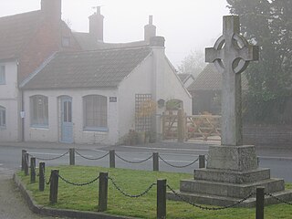
Newton Tony is a rural English village and civil parish in the county of Wiltshire, close to the border with Hampshire. Situated in the Bourne Valley, Newton Tony is about 9 miles (14 km) north-east of its post town, Salisbury. Wilbury House, a Grade I listed 17th-century mansion, stands in parkland in the north of the parish.

The Church of St. Thomas à Becket is the Church of England parish church of Box, Wiltshire, in south-west England. It is one of a number of churches named after Thomas Becket following his martyrdom. The church has 12th-century origins and was substantially remodelled in the 14th, 15th, 18th and 19th centuries. It is a Grade I listed building.

