Bradarac (Požarevac)

Last updated
Bradarac
Брадарац
Village
Serbia adm location map.svg
Red pog.svg
Bradarac
Coordinates: 44°41′12″N21°13′36″E / 44.68667°N 21.22667°E / 44.68667; 21.22667
CountryFlag of Serbia.svg  Serbia
District Braničevo District
Municipality Požarevac
Population (2002)
  Total 874
Time zone CET (UTC+1)
  Summer (DST) CEST (UTC+2)

Bradarac (Serbian Cyrillic: Брадарац) is a village in the municipality of Požarevac, Serbia. According to the 2002 census, the village has a population of 874 people. [1]

The Serbian Cyrillic alphabet is an adaptation of the Cyrillic script for the Serbian language, developed in 1818 by Serbian linguist Vuk Karadžić. It is one of the two alphabets used to write standard modern Serbian, Bosnian and Montenegrin, the other being Latin.

Village Small clustered human settlement smaller than a town

A village is a clustered human settlement or community, larger than a hamlet but smaller than a town, with a population ranging from a few hundred to a few thousand. Though villages are often located in rural areas, the term urban village is also applied to certain urban neighborhoods. Villages are normally permanent, with fixed dwellings; however, transient villages can occur. Further, the dwellings of a village are fairly close to one another, not scattered broadly over the landscape, as a dispersed settlement.

Požarevac City in Southern and Eastern Serbia, Serbia

Požarevac is a city and the administrative center of the Braničevo District in eastern Serbia. It is located between three rivers: Danube, Great Morava and Mlava. As of 2011, the city has a population of 44,183 inhabitants, while the city administrative area has 75,334 inhabitants.

Related Research Articles

Jasenička river in Serbia

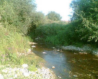
The Jasenička river is a river in eastern Serbia, a 55 km-long right tributary to the Danube.

Dębowa Góra, Kutno County Village in Łódź, Poland

Dębowa Góra is a village in the administrative district of Gmina Bedlno, within Kutno County, Łódź Voivodeship, in central Poland. It lies approximately 24 kilometres (15 mi) south-east of Kutno and 44 km (27 mi) north of the regional capital Łódź.

Qaraqoyunlu, Qubadli Place in Qubadli

Qaraqoyunlu is a village in the Qubadli Rayon of Azerbaijan.

Gorzków, Staszów County Village in Świętokrzyskie, Poland

Gorzków is a village in the administrative district of Gmina Bogoria, within Staszów County, Świętokrzyskie Voivodeship, in south-central Poland. It lies approximately 5 kilometres (3 mi) north of Bogoria, 16 km (10 mi) north of Staszów, and 50 km (31 mi) south-east of the regional capital Kielce.

Sopieszyno Village in Pomeranian, Poland

Sopieszyno is a village in the administrative district of Gmina Wejherowo, within Wejherowo County, Pomeranian Voivodeship, in northern Poland. It lies approximately 7 kilometres (4 mi) south of Wejherowo and 34 km (21 mi) north-west of the regional capital Gdańsk.

Janówko is a village in the administrative district of Gmina Węgorzewo, within Węgorzewo County, Warmian-Masurian Voivodeship, in northern Poland, close to the border with the Kaliningrad Oblast of Russia.

Samarinovac (Žitorađa) Village in Toplica District, Serbia

Samarinovac is a village in the municipality of Žitorađa, Serbia. According to the 2002 census, the village has a population of 756 people.

Batovac Village in Braničevo District, Serbia

Batovac is a village in the municipality of Požarevac, Serbia. According to the 2002 census, the village has a population of 596 people.

Beranje Village in Braničevo District, Serbia

Beranje is a village in the municipality of Požarevac, Serbia. According to the 2002 census, the village has a population of 491 people.

Bratinac Village in Braničevo District, Serbia

Bratinac is a village in the municipality of Požarevac, Serbia. According to the 2002 census, the village has a population of 629 people.

Dragovac, Požarevac Village in Braničevo District, Serbia

Dragovac is a village in the municipality of Požarevac, Serbia. According to the 2002 census, the village has a population of 910 people.

Drmno Village in Braničevo District, Serbia

Drmno is a village in the municipality of Požarevac, Serbia. According to the 2002 census, the village has a population of 1046 people.

Dubravica, Požarevac Village in Braničevo District, Serbia

Dubravica is a village in the municipality of Požarevac, Serbia.

Selo Kostolac or Stari Kostolac, is a village in the municipality of Kostolac, city of Požarevac, Serbia. According to the 2002 census, the village has a population of 1,313 people.

Nabrđe Village in Braničevo District, Serbia

Nabrđe is a village in the municipality of Požarevac, Serbia. According to the 2002 census, the village has a population of 346 people.

Prugovo Village in Braničevo District, Serbia

Prugovo is a village in the municipality of Požarevac, Serbia. According to the 2002 census, the village has a population of 774 people.

Rečica, Požarevac Village in Braničevo District, Serbia

Rečica is a village in the municipality of Požarevac, Serbia. According to the 2002 census, the village has a population of 518 people.

Trnjane (Požarevac) Village in Braničevo District, Serbia

Trnjane is a village in the municipality of Požarevac, Serbia. According to the 2002 census, the village has a population of 915 people.

Živica (Požarevac) Village in Braničevo District, Serbia

Živica is a village in the municipality of Požarevac, Serbia. According to the 2002 census, the village has a population of 728 people.

Mislođin Village in Serbia

Mislođin is a village situated in Obrenovac municipality in Serbia.

References

  1. Popis stanovništva, domaćinstava i Stanova 2002. Knjiga 1: Nacionalna ili etnička pripadnost po naseljima. Republika Srbija, Republički zavod za statistiku Beograd 2003. ISBN   86-84433-00-9

Coordinates: 44°41′12″N21°13′36″E / 44.68667°N 21.22667°E / 44.68667; 21.22667

Geographic coordinate system Coordinate system

A geographic coordinate system is a coordinate system that enables every location on Earth to be specified by a set of numbers, letters or symbols. The coordinates are often chosen such that one of the numbers represents a vertical position and two or three of the numbers represent a horizontal position; alternatively, a geographic position may be expressed in a combined three-dimensional Cartesian vector. A common choice of coordinates is latitude, longitude and elevation. To specify a location on a plane requires a map projection.