Beckenham is a town in Greater London, England, within the London Borough of Bromley. Prior to 1965, it was part of Kent. It is situated north of Elmers End and Eden Park, east of Penge, south of Lower Sydenham and Bellingham, and west of Bromley and Shortlands, and 8.4 miles (13.5 km) south-east of Charing Cross. Its population at the 2011 Census was 46,844.

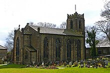
Haworth is a village in West Yorkshire, England, in the Pennines 3 miles (5 km) south-west of Keighley, 8 miles (13 km) north of Halifax, 10 miles (16 km) west of Bradford and 10 miles (16 km) east of Colne in Lancashire. The surrounding areas include Oakworth and Oxenhope. Nearby villages include Cross Roads, Stanbury and Lumbfoot.

Rastrick is a village in the county of West Yorkshire, England, between Halifax, 5 miles (8 km) north-west and Huddersfield, 4 miles (7 km) south.
Garsington is a village and civil parish about 8 kilometres (5 mi) southeast of Oxford in Oxfordshire. "A History of the County of Oxfordshire" provides a detailed history of the parish from 1082. The 2011 census recorded the parish's population as 1,689. The village is known for the artistic colony and flamboyant social life of the Bloomsbury Group at Garsington Manor when it was the home from 1914 to 1928 of Philip and Ottoline Morrell, and for the Garsington Opera which was staged there from 1989 to 2010.

Hathersage is a village and civil parish in the Peak District in Derbyshire, England. It lies slightly to the north of the River Derwent, approximately 10 miles (16.1 km) south-west of Sheffield.

Cuddington is a village and civil parish within the Buckinghamshire district in the ceremonial county of Buckinghamshire, England. It is near the Oxfordshire border, about six miles west of Aylesbury.

Melksham is a town and civil parish on the River Avon in Wiltshire, England, about 4.5 miles (7 km) northeast of Trowbridge and 6 miles (10 km) south of Chippenham. At the 2021 census, the parish had a population of 18,113.

Grappenhall is a village within the civil parish of Grappenhall and Thelwall in the Borough of Warrington in Cheshire, England. The parish had a population of 9,377 at the 2001 census, 9,687 at the 2011 census, and 9,651 at the 2021 census.

Ifield is a former village and now one of 14 neighbourhoods within the town of Crawley in West Sussex, England. Ifield is in the west of the town and is bordered by Ifield West, Horsham, Langley Green to the north east, West Green to the east across the ring road and Gossops Green and Bewbush to the south across the Arun Valley railway line.

Hambledon is a small village and civil parish in the county of Hampshire in England, situated about 10 miles (16 km) north of Portsmouth within the South Downs National Park.
Clayton, or Clayton Village, is a civil parish in the City of Bradford metropolitan borough in West Yorkshire, England, situated 3 miles (4.8 km) to the west of Bradford city centre. It is listed in the Domesday Book, meaning it dates back to at least the 11th century and was privately owned from 1160 to 1866. It was noted for its clay. More recently, Clayton was a key location in the British and international wool trade, being the home of the British Wool Marketing Board headquarters. The old building was demolished and converted into housing in the late 1990s. The village re-acquired civil parish status with a parish council in 2004.

Middleton St George is a large village and civil parish in the borough of Darlington and the ceremonial county of County Durham, England. It is situated approximately 3.5 miles (5.6 km) east of Darlington.

Hook Norton is a village and civil parish in Oxfordshire, England. It lies 4+1⁄2 miles (7 km) northeast of Chipping Norton, close to the Cotswold Hills. The 2011 Census recorded the parish's population as 2,117. The village is formed of four neighbourhoods: East End, Scotland End, Down End and Southrop.

Lenham is a market village and civil parish in the Maidstone district, in Kent, England, situated on the southern edge of the North Downs, 9 miles (14 km) east of Maidstone. The picturesque square in the village has two public houses, a couple of restaurants, and a tea-room. The parish has a population of 3,370 according to the 2011 Census.

Shenfield is a suburb of Brentwood in the Borough of Brentwood, Essex, England. In 2020, it was estimated to have a population of 5,396.

Ticknall is a small village and civil parish in South Derbyshire, England. The population of the civil parish at the 2011 Census was 642. Situated on the A514 road, close to Melbourne, it has three pubs, several small businesses, and a primary school. Two hundred years ago it was considerably larger and noisier with lime quarries, tramways and potteries. Coal was also dug close to the village. Close to the village is Calke Abbey, now a National Trust property.

Bodicote is a village and civil parish in North Oxfordshire, approximately 2 miles (3 km) south of the centre of Banbury. The 2011 Census recorded the parish's population as 2,126. The Church of England parish church of Saint John the Baptist is a Grade II* listed building, with the chancel arch dating back to the 13th century.

Widford is a village and civil parish between Ware and Much Hadham in the East Hertfordshire district of Hertfordshire in England. It covers an area of approximately 1,167 acres and contains 220 houses. The River Ash flows through the north of the parish. Widford had a population of 534 people in the 2011 census.

Kingsley is a civil parish and a village in the unitary authority of Cheshire West and Chester and the ceremonial county of Cheshire, England. It is approximately 5 miles south east of the town of Frodsham.

Peover Superior is a former civil parish, now in the parish of Peover Superior and Snelson, in the unitary authority area of Cheshire East and the ceremonial county of Cheshire, England. It is described by the Office for National Statistics as a village surrounded by inhabited countryside. The civil parish included the village of Over Peover and the hamlet of Peover Heath. In 2011 the parish had a population of 666.