
Mountain View is a city in Santa Clara County, California, United States. Named for its views of the Santa Cruz Mountains, it has a population of 82,376.

Cascade Mountain is in Essex County of New York. It is one of the 46 Adirondack High Peaks (36th) and is located in the Adirondack Park. Its name comes from a series of waterfalls on a brook near the mountain's base. The lake it flows into and the pass between Cascade and Pitchoff mountains are also named Cascade.

In these lists of mountains in Ireland, those within Northern Ireland, or on the Republic of Ireland – United Kingdom border, are marked with an asterisk, while the rest are within the Republic of Ireland. Where mountains are ranked by height, the definition of the topographical prominence used to classify the mountain, is noted. In British definitions, a height of 600 metres (1,969 ft) is required for a mountain, whereas in Ireland, a lower threshold of 500 metres (1,640 ft) is sometimes advocated.

Cerro de Punta or just Cerro Punta is the highest peak in Puerto Rico, rising to 1,338 meters (4,390 ft) above sea level. The mountain is part of the Cordillera Central and is located in the municipality of Ponce.

Mweelrea at 814 metres (2,671 ft), is the 26th-highest peak in Ireland on the Arderin scale, and the 34th-highest peak on the Vandeleur-Lynam scale. Mweelrea is situated near the apex of a "horseshoe-shaped" massif that includes the peaks of Ben Lugmore and Ben Bury, and which is located between Killary Harbour and Doo Lough, in Mayo, Ireland. Mweelrea is the provincial top for Connacht, and is noted for its southeastern cliff lined corries, and its views. The massif is called the Mweelrea Mountains or the Mweelrea Range.

The Tenmile Range is a mountain range in U.S. state of Colorado. The range is an extension of the Mosquito Range which is part of the Rocky Mountains. The two ranges are effectively the same range. They are split only by the Continental Divide and name. The Tenmile Range is on the north side of the divide, and the Mosquito on the south. The range is often referred to as the Tenmile-Mosquito Range.

The mountains and hills of the British Isles are categorised into various lists based on different combinations of elevation, prominence, and other criteria such as isolation. These lists are used for peak bagging, whereby hillwalkers attempt to reach all the summits on a given list, the oldest being the 282 Munros in Scotland, created in 1891.

Rocky Peak Ridge is the twentieth highest peak in the High Peaks Region of the Adirondack Park of New York, United States. The name of the mountain is due to its geology, a rocky ridge to the east of the better known Giant Mountain. The long, bare ridge is unusual in the Adirondacks; it resulted from the last great forest fire in the region, in 1913.

Mullaghcleevaun at 849 metres (2,785 ft), is the 15th–highest peak in Ireland on the Arderin scale, and the 20th–highest peak on the Vandeleur-Lynam scale. Mullaghcleevaun is in the central sector of the Wicklow Mountains range, in Wicklow, Ireland; it is the 2nd highest peak in Wicklow after Lugnaquilla. Mullaghcleevaun lies on the main "central spine" of the whole range that runs from Kippure in the north, to Lugnaquillia in the south; and in particular, it lies on the continuous "central boggy ridge" that runs from the Sally Gap to Tonelagee.

Tonelagee at 817 metres (2,680 ft), is the 25th–highest peak in Ireland on the Arderin scale, and the 33rd–highest peak on the Vandeleur-Lynam scale. Tonelagee is situated in the central sector of the Wicklow Mountains range, and sits on the main "central spine" of the range that runs from Kippure in the north, to Lugnaquillia in the south; and in particular, the continuous "central boggy ridge" that runs from the Sally Gap in the north, via Mullaghcleevaun, to Tonelagee. Tonelagee is the third highest peak in Wicklow after Lugnaquilla and Mullaghcleevaun.

Baurtregaum at 851 metres (2,792 ft), is the 13th–highest peak in Ireland on the Arderin scale, and the 18th–highest peak on the Vandeleur-Lynam scale. Baurtregaum is situated at the centre of the massif of the Slieve Mish Mountains in the Dingle Peninsula in Kerry, Ireland, and is the tallest mountain of the Slieve Mish range, with a number of major subsidiary summits.

Eldorado Mountain is a mountain summit on the eastern flank of the Front Range of the Rocky Mountains of North America. The 8,344-foot (2,543 m) peak is located 8.1 miles (13.1 km) south by west of downtown Boulder, Colorado, United States. The mountain is largely in Boulder County but it straddles the border and its southern flanks are located in Jefferson County. Its name was probably borrowed from the nearby community of Eldorado Springs.

Phelps Mountain is a mountain located in Essex County, New York. The mountain is named after Orson Schofield "Old Mountain" Phelps (1817–1905), who cut the first trail up Mount Marcy and named several of the Adirondack peaks. It is the 32nd highest peak in New York. Phelps Mountain is flanked to the southeast by Table Top Mountain.

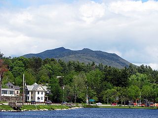
Hurricane Mountain is a 3,688-foot-tall (1,124 m) mountain near Keene in the north of the High Peaks region of the Adirondacks in New York, United States. It is considered to boast some of the most impressive views of any of the lesser peaks; this is due to its prominence, and because its summit was cleared by Verplanck Colvin in the course of his early survey of the Adirondacks. On a clear day, the length of Lake Champlain and the Green Mountains of Vermont are visible to the east, and many of the High Peaks can be seen to the south through the northwest. There is a disused fire tower on the top.

Mount Banks, a mountain within the Explorers Range of the Blue Mountains Range that is a spur off the Great Dividing Range, is located within the Blue Mountains National Park, approximately 100 kilometres (62 mi) west of Sydney in New South Wales, Australia. Mount Banks is located 8 kilometres (5.0 mi) from the nearest residential area, Mount Tomah, has an elevation of 1,049 metres (3,442 ft) AMSL, and can be accessed relatively easily via the Bells Line of Road.

Mount Hay, a mountain that is part of the Mt Hay Range of the Blue Mountains Range which is a spur off the Great Dividing Range, is located in the Blue Mountains National Park, New South Wales, Australia. It is located approximately 100 kilometres (62 mi) west of Sydney and 10 kilometres (6.2 mi) north of the nearest town, Wentworth Falls. Mount Hay is approximately 944 metres (3,097 ft) AMSL and is one of several basalt caps located within the UNESCO World Heritage Greater Blue Mountains Area.
McKenzie Mountain is a 3,861-foot (1,177 m) mountain in western Essex County in the towns of St. Armand and North Elba in the Adirondack Park, a unit of the Forest Preserve.

Spruce Mountain is a mountain in the Kayaderosseras Range in the town of Corinth in Saratoga County, New York. The 2,005 foot (611 m) summit is accessible via a 1.3-mile (2.1 km) trail and is topped with a 73 foot (22 m) fire tower affording a more than 120-mile (190 km) panoramic view from the Adirondacks to the Catskills, and east to Vermont. The tower, built in 1928 and refurbished in 2015, is one of only 23 remaining in the Adirondack Mountains.


 View from the top
 Cows being brought down from the mountains
