
The Port Authority of New York and New Jersey, is a joint venture between the U.S. states of New York and New Jersey, established in 1921 through an interstate compact authorized by the United States Congress. The Port Authority oversees much of the regional transportation infrastructure, including bridges, tunnels, airports, and seaports, within the geographical jurisdiction of the Port of New York and New Jersey. This 1,500-square-mile (3,900 km2) port district is generally encompassed within a 25-mile (40 km) radius of the Statue of Liberty National Monument. The Port Authority is headquartered at 4 World Trade Center.

The New Jersey Turnpike (NJTP) is a system of controlled-access highways in the U.S. state of New Jersey. The turnpike is maintained by the New Jersey Turnpike Authority (NJTA). The 117.20-mile (188.62 km) mainline's southern terminus is at Interstate 295 (I-295) and U.S. Route 40 (US 40) in Pennsville Township in Salem County, near the Delaware Memorial Bridge. Its northern terminus is at the approach to the George Washington Bridge in Fort Lee in Bergen County; originally it was at an interchange with I-80 and US 46 in Ridgefield Park. Construction of the mainline from concept to completion took 22 months, from 1950 to 1951. It was opened to traffic on November 5, 1951, between its southern terminus and exit 10.
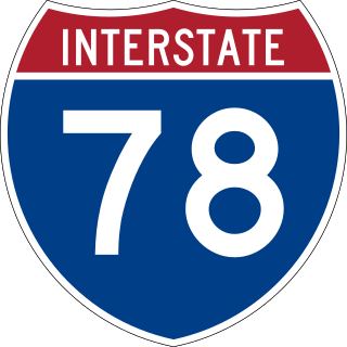
Interstate 78 (I-78) is an east–west Interstate Highway in the Northeastern United States that runs 144 miles (232 km) from I-81 northeast of Harrisburg, Pennsylvania through Allentown to western and North Jersey, terminating at the Holland Tunnel entrance to Lower Manhattan in New York City. Major metropolitan areas along I-78 route include the Lehigh Valley in Pennsylvania, the Gateway Region in New Jersey, and the New York metropolitan area.

Route 21 is a state highway in northern New Jersey, running 14.35 mi (23.09 km) from the Newark Airport Interchange with U.S. Route 1/9 (US 1-9) and US 22 in Newark, Essex County to an interchange with US 46 in Clifton, Passaic County. The route is a four- to six-lane divided highway known as McCarter Highway on its southern portion in Newark that serves as a connector between the Newark and Paterson areas, following the west bank of the Passaic River for much of its length. It also serves as the main north–south highway through the central part of Newark, connecting attractions in Downtown Newark with Newark Airport. The portion of Route 21 through Newark is a surface arterial that runs alongside the elevated Northeast Corridor rail line through the southern part of the city and continues north through Downtown Newark while the portion north of Downtown Newark is a freeway. Route 21 intersects many major roads including Interstate 78 (I-78), Route 27, and I-280 in Newark, Route 7 in Belleville, and Route 3 in Clifton.

Essex County is located in the northeastern part of the U.S. state of New Jersey, and is one of the centrally located counties in the New York metropolitan area. As of the 2020 census, the county was the state's second-most populous county, with a population of 863,728, its highest decennial count since the 1970 census and an increase of 79,759 (+10.2%) from the 2010 census count of 783,969. The county is part of the North Jersey region of the state.

Route 81 is a state highway in the U.S. state of New Jersey. The route is a freeway connector between exit 13A of the New Jersey Turnpike and U.S. Route 1/9 near Newark Liberty International Airport. It runs for 1.18 miles (1.90 km), entirely within the city of Elizabeth in Union County. A freeway called Route S100 was initially proposed on the current alignment of Route 81 in 1938; it, along with its parent Route 100, was never built. The current route was conceived in the 1960s as a freeway replacement for Route 164, which followed Humboldt Avenue, a surface road. It was to be designated Route 76, but was renumbered to Route 81 when Interstate 76 was created in New Jersey.

Newark Liberty International Airport, originally Newark Metropolitan Airport and later Newark International Airport, is an international airport straddling the boundary between the cities of Newark in Essex County and Elizabeth in Union County, New Jersey, in the United States. Located about 4.5 miles (7.2 km) south of downtown Newark and 9 miles (14 km) west-southwest of Manhattan in New York City, it is a major gateway to points in Europe, South America, Asia, and Oceania. It is jointly owned by the cities and leased to its operator, the Port Authority of New York and New Jersey. It is the second-busiest airport in the New York airport system behind John F. Kennedy International Airport but far ahead of LaGuardia Airport.
E-ZPass is an electronic toll collection system used on toll roads, toll bridges, and toll tunnels in the Eastern United States, Midwestern United States, and Southern United States. The E-ZPass Interagency Group (IAG) consists of member agencies in several states, which use the same technology and allow travelers to use the same transponder on toll roads throughout the network.

U.S. Route 1/9 Truck is a U.S. Route in the northern part of New Jersey that stretches 4.11 miles (6.61 km) from the eastern edge of Newark to the Tonnele Circle in Jersey City. It is the alternate road for US 1/9 that trucks must use because they are prohibited from using the Pulaski Skyway, which carries the main routes of US 1/9. It also serves traffic accessing the New Jersey Turnpike, Route 440, and Route 7. The route is a four- to six-lane road its entire length, with portions of it being a divided highway that runs through urban areas. From its south end to about halfway through Kearny, US 1/9 Truck is freeway-standard, with access to other roads controlled by interchanges.

Newark Liberty International Airport Station is a railroad station on the Northeast Corridor (NEC) in Newark, New Jersey. The station provides access to Newark Liberty International Airport (EWR) via the AirTrain monorail which connects the station to the airport's terminals and parking areas.

Atlantic City International Airport is a shared civil-military airport 9 miles (14 km) northwest of central Atlantic City, New Jersey, in Egg Harbor Township, the Pomona section of Galloway Township and in Hamilton Township. The airport is accessible via Exit 9 on the Atlantic City Expressway. The facility is operated by the South Jersey Transportation Authority (SJTA) and the Port Authority of New York and New Jersey, which performs select management functions. Most of the land is owned by the Federal Aviation Administration and leased to the SJTA, while the SJTA owns the terminal building.

Interstate 95 (I-95) is a major Interstate Highway that runs along the East Coast of the United States from Miami, Florida, north to the Canada–United States border at Houlton, Maine. In New Jersey, it runs along much of the mainline of the New Jersey Turnpike, as well as the Pearl Harbor Memorial Turnpike Extension, and the New Jersey Turnpike's I-95 Extension to the George Washington Bridge for a total of 77.96 miles (125.46 km). Located in the northeastern part of the state near New York City, the 11.03-mile (17.75 km) Western Spur of the New Jersey Turnpike, considered to be Route 95W by the New Jersey Department of Transportation (NJDOT), is also part of I-95.

Interstate 78 (I-78) is an east–west route stretching from Union Township, Lebanon County, Pennsylvania, to New York City. In New Jersey, I-78 is called the Phillipsburg–Newark Expressway and the Newark Bay–Hudson County Extension of the New Jersey Turnpike. The highway runs for 67.83 miles (109.16 km) in the northern part of the state of New Jersey from the I-78 Toll Bridge over the Delaware River at the Pennsylvania state line in Phillipsburg, Warren County, east to the Holland Tunnel under the Hudson River at the New York state line in Jersey City, Hudson County. The Phillipsburg–Newark Expressway portion of I-78, formally called the Lightning Division Memorial Highway, runs from the Phillipsburg area east across rural areas of western New Jersey before entering suburban areas in Somerset County. The road crosses the Watchung Mountains, widening into a local–express lane configuration at Route 24 as it continues through urban areas to Newark. Here, I-78 intersects the mainline of the New Jersey Turnpike (I-95) and becomes the Newark Bay Extension, crossing the Newark Bay Bridge and continuing to Jersey City. The route, along with Route 139, follows a one-way pair of surface streets to the Holland Tunnel.

U.S. Route 9 (US 9) is a United States Numbered Highway in the Mid-Atlantic United States, running from Laurel, Delaware, north to Champlain, New York. In New Jersey, the route runs 166.80 miles (268.44 km) from the Cape May–Lewes Ferry terminal in North Cape May, Cape May County, where the ferry carries US 9 across the Delaware Bay to Lewes, Delaware, north to the George Washington Bridge in Fort Lee, Bergen County, where the route along with Interstate 95 (I-95) and US 1 continue into New York City. US 9 is the longest U.S. Highway in the state. From North Cape May north to Toms River in Ocean County, US 9 is mostly a two-lane undivided road that closely parallels the Garden State Parkway and runs near the Jersey Shore. Along this stretch, it passes through the communities of Rio Grande, Cape May Court House, Somers Point, Pleasantville, Absecon, Tuckerton, Manahawkin, Beachwood, and Berkeley Township. In the Toms River area, US 9 runs along the Garden State Parkway for a short distance before heading northwest away from it and the Jersey Shore into Lakewood Township. Upon entering Monmouth County, the route transitions into a multilane suburban divided highway and continues through Howell Township, Freehold Township, Manalapan Township, Marlboro Township, Old Bridge Township, Sayreville, and South Amboy. In Woodbridge Township, US 9 merges with US 1 and the two routes continue through northern New Jersey as US 1/9 to the George Washington Bridge.

Interstate 95 (I-95) is a major north–south Interstate Highway that runs along the East Coast of the United States from Miami, Florida, north to the Canada–United States border at Houlton, Maine. In the state of Pennsylvania, it runs 44.25 miles (71.21 km) from the Delaware state line near Marcus Hook in Delaware County in the southeastern part of the state northeast to the Delaware River–Turnpike Toll Bridge at the New Jersey state line near Bristol in Bucks County, closely paralleling the New Jersey state line for its entire length through Pennsylvania.
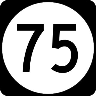
Route 75 was a proposed freeway in the U.S. State of New Jersey in the Newark area in the 1960s and 1970s. It was designed to connect the existing Route 21 freeway north of Newark with Interstate 78 (I-78), U.S. Route 1-9 (US 1–9), and Newark Airport. The state of New Jersey applied for interstate status for the route in 1970, but construction of the road remained stalled in courts throughout the 1970s. In 1973, the state of New Jersey and the Federal Highway Administration shelved plans for the route in April 1972, and in 1997, the state of New Jersey officially removed the route from its route logs. Despite its removal, vestiges of Route 75 still remain. The first example is Exit 13 on Interstate 280 eastbound in Newark. The exit is an enormous three lane ramp, while through traffic on I-280 has only two lanes. The ramp comes to a stop at a traffic light on First Street, just south of Orange Street. Also, at Exit 56 off Interstate 78, large flyover ramps meant for a freeway diverge from the roadway, but terminate at city streets.

U.S. Route 1 (US 1) is a U.S. Route which parallels the East Coast of the United States, running from Key West, Florida, in the south to Fort Kent, Maine, at the Canadian border in the north. Of the entire length of the route, 66.06 miles (106.31 km) of it runs through New Jersey. It enters the state from Pennsylvania on the Trenton–Morrisville Toll Bridge over the Delaware River in the state capital of Trenton, running through the city on the Trenton Freeway. From here, US 1 continues northeast as a surface divided highway through suburban areas, heading into Middlesex County and passing through New Brunswick and Edison. US 1 merges with US 9 in Woodbridge, and the two routes continue through northern New Jersey as US 1/9 to the George Washington Bridge over the Hudson River in Fort Lee. At this point, the road continues into New York City along with I-95.
U.S. Route 1/9 is the 31.01-mile (49.91 km) long concurrency of US 1 and US 9 from their junction in Woodbridge Township in Middlesex County, New Jersey, north to New York City. The route is a multilane road with some freeway portions that runs through urbanized areas of North Jersey adjacent to New York City. Throughout most of its length in New Jersey, the road runs near the New Jersey Turnpike/Interstate 95 (I-95). In Fort Lee, US 1/9 merges onto I-95 and crosses the Hudson River on the George Washington Bridge, where the two U.S. Routes split a short distance into New York. US 1/9 intersects several major roads, including I-278 in Linden, Route 81 in Elizabeth, I-78 and US 22 in Newark, Route 139 in Jersey City, Route 3 and Route 495 in North Bergen, and US 46 in Palisades Park. US 1/9 also serves as the primary access point to Newark Airport. Between Newark and Jersey City, US 1/9 runs along the Pulaski Skyway. Trucks are banned from this section of road and must use US 1/9 Truck. The concurrency between US 1 and US 9 is commonly referred to as "1 and 9". Some signage for the concurrency, as well as the truck route, combines the two roads into one shield, separated by a hyphen (1-9) or an ampersand (1&9).

U.S. Route 22 (US 22) is a United States Numbered Highway stretching from Cincinnati, Ohio, in the west to Newark, New Jersey, in the east. In New Jersey, the route runs for 60.53 miles (97.41 km) from the Easton–Phillipsburg Toll Bridge over the Delaware River in Phillipsburg, Warren County, to Interstate 78 (I-78), US 1/9, and Route 21 at the Newark Airport Interchange in Newark, Essex County. The road first heads through the Phillipsburg–Alpha area as a surface divided highway before running concurrent with I-78 through mountainous and agricultural sections of western New Jersey between Alpha and east of Clinton in Hunterdon County. For the remainder of the route, US 22 runs to the south of I-78 through mostly suburban areas as a four- to six-lane surface divided highway, passing through Hunterdon, Somerset, Union, and Essex counties. Along this portion, it intersects US 202 and US 206 in Somerville, I-287 in Bridgewater Township, and the Garden State Parkway in Union.

Transportation in New Jersey utilizes a combination of road, rail, air, and water modes. New Jersey is situated between Philadelphia and New York City, two major metropolitan centers of the Boston-Washington megalopolis, making it a regional corridor for transportation. As a result, New Jersey's freeways carry high volumes of interstate traffic and products. The main thoroughfare for long distance travel is the New Jersey Turnpike, the nation's fifth-busiest toll road. The Garden State Parkway connects the state's densely populated north to its southern shore region. New Jersey has the 4th smallest area of U.S. states, but its population density of 1,196 persons per sq. mi causes congestion to be a major issue for motorists.
