Related Research Articles

100 Mile House is a town and district municipality located in the South Cariboo region of central British Columbia, Canada.
Highway 97 is the longest continuously numbered route in the Canadian province of British Columbia, running 2,081 km (1,293 mi) from the Canada–United States border near Osoyoos in the south to the British Columbia/Yukon boundary in the north at Watson Lake, Yukon. The route takes its number from U.S. Route 97, with which it connects at the international border. The highway was initially designated '97' in 1953.

The Cariboo is an intermontane region of British Columbia, Canada, centered on a plateau stretching from Fraser Canyon to the Cariboo Mountains. The name is a reference to the caribou that were once abundant in the region.

Canim Beach Provincial Park is a provincial park in British Columbia, Canada, located at the southwest end of Canim Lake in the Interlakes District of the South Cariboo region, adjacent to the Secwepemc Indian reserve community of Canim Lake, British Columbia just northeast of 100 Mile House. The park was established by Order-in-Council in 1956 and expanded by later legislation in 2000 and 2004 to total a current approximate of 8.2 hectares, 3.6 hectares of upland and 4.6 hectares of foreshore.

The Clearwater River is the largest tributary of the North Thompson River, joining it at the community of Clearwater, British Columbia. The Clearwater rises from glaciers in the Cariboo Mountains and flows in a mostly southerly direction for 201 km (125 mi) to the North Thompson. Its entire course, except the last 5 km (3 mi), is within Wells Gray Provincial Park. Its confluence with the North Thompson is protected by North Thompson River Provincial Park.
The Stone First Nation or Yunesit'in First Nation is a band government of the Yunesit'in subgroup of the Tsilhqot'in people, whose territory is the Chilcotin District in the western Central Interior region of the Canadian province of British Columbia. It is a member of the Tsilhqot'in Tribal Council. The people of the Stone First Nation are known as the Yunesit'in in the Chilcotin language.

The Robson Valley is a geographic region of the Canadian province of British Columbia, comprising the section of the Rocky Mountain Trench that lies southeast of the city of Prince George following the Fraser River to the Yellowhead Pass. The name is derived from Mount Robson, which stands near the entrance to the Yellowhead Pass. Communities in the Robson Valley include the settlements of Dome Creek, Crescent Spur, Dunster, and Tête Jaune Cache, with larger population concentrations in the villages of McBride and Valemount. On a map, the Robson Valley is located immediately south of the elbow in the boundary between Alberta and British Columbia. Transportation corridors through the Robson Valley include the Canadian National Railway lines, and Highways 16 and 5.
Canim Lake is an unincorporated settlement with a pop. of 228 and First Nations Indian reserve community in British Columbia, Canada. It is located east of 100 Mile House in the Cariboo Region.

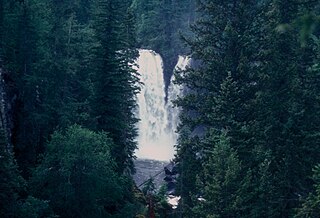
Canim Falls is a 23 metre high waterfall on the Canim River between Canim Lake and Mahood Lake in Wells Grey Provincial Park in the Cariboo region of the Central Interior of British Columbia, Canada. The waterfall has eroded steadily upstream and created a 4 km (2.5 mi) long canyon cut into a lava plateau associated with the Wells Gray-Clearwater volcanic field.

The Interlakes, also known as the Interlakes District, is a geographic region of the Interior of British Columbia, Canada, located along and around the Interlakes Highway between 100 Mile House on BC Highway 97 and Little Fort on the North Thompson River. The area is a subregion of the Cariboo and includes the communities of Bridge Lake and Lac des Roches.

Mahood Falls is a waterfall in Wells Gray Provincial Park located on the Canim River between Canim Lake and Mahood Lake and northeast of 100 Mile House, British Columbia, Canada. The waterfall is 20 m (66 ft) high.

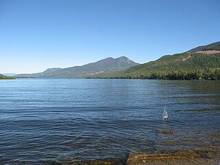
Mahood Lake is a lake in the South Cariboo region of the Interior of British Columbia in Wells Gray Provincial Park. It is drained by the Mahood River, a tributary of the Clearwater River which has cut a deep canyon into Cambrian rocks and Pleistocene glacial moraines. Mahood Lake is fed by the short Canim River, which drains nearby Canim Lake to the west via Canim Falls and Mahood Falls.

The Canim River is a river in the South Cariboo region of the Interior of British Columbia, Canada. It begins at the outlet of Canim Lake and runs approximately 1.8 km to Canim Falls, the river then continues approximately 9 kilometres via a canyon cut into a lava plateau, to Mahood Lake.

The Mahood River is a river in the northern Shuswap Highland of the Central Interior of British Columbia in Wells Gray Provincial Park. It is 7 kilometres (4.3 mi) long from its source at Mahood Lake to its confluence with the Clearwater River, a tributary of the North Thompson River. The Mahood River has cut a deep canyon into Cambrian rocks and Pleistocene glacial moraines.

Bridge Lake is a lake in the Interlakes District of the South Cariboo region of the Interior of British Columbia, Canada. It is the source of Bridge Creek which runs in a curving course west and then northeast to Canim Lake via the town of 100 Mile House. The lake is approximately 16 km2 in area (including the area of several islands and rocks in the lake, the largest of which is named Long Island and is 1136 m in elevation. It is located 560 km north of Vancouver and around 140 km northwest of Kamloops in the Interlakes District close to the Little Fort Highway. It and its neighbours Sheridan Lake and Lac des Roches are the largest lakes along the Interlakes Highway.

The Murtle River is a river in east-central British Columbia, Canada. It rises from a large unnamed glacier in the Cariboo Mountains at an elevation of 2,300 metres (7,500 ft) and flows southwest for 18 kilometres (11 mi) to the head of gigantic Murtle Lake. The river also drains Murtle Lake then flows southwest for 36 kilometres (22 mi) into the Clearwater River. The Murtle River is the longest and largest tributary to the Clearwater.

Wells Gray Provincial Park is a large wilderness park located in east-central British Columbia, Canada. The park protects most of the southern, and highest, regions of the Cariboo Mountains and covers 5,250 square kilometres. It is British Columbia's fourth largest park, after Tatshenshini, Spatsizi and Tweedsmuir.
Vidette is an unincorporated locality in the Deadman River Valley in the Thompson-Bonaparte Country region of the Central Interior of British Columbia, Canada. It is just north of Vidette Lake, which has become famous for being declared the "Centre of the Universe" by Tibetan Buddhist monks. The locality's name derives from the French spoken by fur trades, when a roadhouse here was on the Hudson's Bay Brigade Trail connecting Fort Kamloops to Fort Alexandria via the Bonaparte Plateau, and which became part of the Gold Rush Trail from the United States to the Cariboo Gold Rush.
The Lillooet Land District is one of the 59 cadastral subdivisions of British Columbia, which were created by the Lands Act of the Colony of British Columbia in 1859, defined as "a territorial division with legally defined boundaries for administrative purposes". The land district's boundaries came to be used as the boundary of the initial Lillooet riding for the provincial Legislature from 1871, when the colony became a province. In addition to use in descriptions of land titles and lot surveys, the Land District was also the basis of the Lillooet Mining District.
References
Coordinates: 51°46′00″N120°54′00″W / 51.76667°N 120.90000°W