Related Research Articles

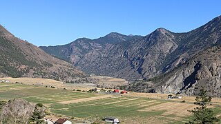
Lillooet is a district municipality in the Squamish-Lillooet region of southwestern British Columbia. The town is on the west shore of the Fraser River immediately north of the Seton River mouth. On BC Highway 99, the locality is by road about 100 kilometres (62 mi) northeast of Pemberton, 64 kilometres (40 mi) northwest of Lytton, and 172 kilometres (107 mi) west of Kamloops.
The Stʼatʼimc, also known as the Lillooet, St̓át̓imc, or Stl'atl'imx, are an Interior Salish people located in the southern Coast Mountains and Fraser Canyon region of the Interior of the Canadian province of British Columbia.
Yale-Lillooet was a provincial electoral district for the Legislative Assembly of British Columbia, Canada.

The Fraser Canyon is a major landform of the Fraser River where it descends rapidly through narrow rock gorges in the Coast Mountains en route from the Interior Plateau of British Columbia to the Fraser Valley. Colloquially, the term "Fraser Canyon" is often used to include the Thompson Canyon from Lytton to Ashcroft, since they form the same highway route which most people are familiar with, although it is actually reckoned to begin above Williams Lake at Soda Creek Canyon near the town of the same name.
Shalalth and South Shalalth are unincorporated communities on the northern shore near the western end of Seton Lake in the Squamish-Lillooet region of southwestern British Columbia. The localities are by road about 63 kilometres (39 mi) northwest of Lillooet, but only 24 kilometres (15 mi) by rail.

The Bridge River is an approximately 120 kilometres (75 mi) long river in southern British Columbia. It flows south-east from the Coast Mountains. Until 1961, it was a major tributary of the Fraser River, entering that stream about six miles upstream from the town of Lillooet; its flow, however, was near-completely diverted into Seton Lake with the completion of the Bridge River Power Project, with the water now entering the Fraser just south of Lillooet as a result.
The Skatin First Nations, aka the Skatin Nations, are a band government of the In-SHUCK-ch Nation, a small group of the larger St'at'imc people who are also referred to as Lower Stl'atl'imx. The Town of Skatin - the St'at'imcets version of the Chinook Jargon Skookumchuck- is located 4 km south of T'sek Hot Spring- alt. spelling T'sek Hot Spring - commonly & formerly named both St. Agnes' Well & Skookumchuck Hot Springs The community is 28 km south of the outlet of Lillooet Lake on the east side of the Lillooet River. It is approximately 75 km south of the town of Pemberton and the large reserve of the Lil'wat branch of the St'at'imc at Mount Currie. Other bands nearby are Samahquam at Baptiste Smith IR on the west side of the Lillooet River at 30 km. and Xa'xtsa First Nations; the latter is located at Port Douglas, near the mouth of the Lillooet River where it enters the head of Harrison Lake. The N'Quatqua First Nation on Anderson Lake, between Mount Currie and Lillooet, was at one time involved in joint treaty negotiations with the In-SHUCK-ch but its members have voted to withdraw, though a tribal council including the In-SHUCK-ch bands and N'Quatqua remains, the Lower Stl'atl'imx Tribal Council.

The Camelsfoot Range is a sub-range of the Chilcotin Ranges subdivision of the Pacific Ranges of the Coast Mountains in British Columbia. The Fraser River forms its eastern boundary. The range is approximately 90 km at its maximum length and less than 30 km wide at its widest.
N'Quatqua, variously spelled Nequatque, N'quat'qua, is the proper historic name in the St'at'imcets language for the First Nations village of the Stl'atl'imx people of the community of D'Arcy, which is at the upper end of Anderson Lake about 35 miles southeast of Lillooet and about the same distance from Pemberton. The usage is synonymous with Nequatque Indian Reserve No. 1, which is 177 ha. in size and located adjacent to the mouth of the Gates River.
The Lillooet Tribal Council is the official English name of the largest tribal council of what is also known as the St'at'imc Nation, though not including all governments of St'at'imc peoples - the term St'at'imc Nation has another context of all St'at'imc peoples, not just those within this tribal council or the tribal council itself, as the term can be used for. The Lillooet Tribal Council a.k.a. the St'at'imc Nation is the largest tribal council of the St'at'imc people, though a pan-St'at'imc organization, the St'át'timc Chiefs Council includes all St'at'imc bands.
The Bridge River Indian Band(Lillooet: nx̌ʷístǝnǝmx) also known as the Nxwísten First Nation, the Xwisten First Nation, and the Bridge River Band, is a First Nations government located in the Central Interior-Fraser Canyon region of the Canadian province of British Columbia. It is a member of the Lillooet Tribal Council, which is the largest grouping of band governments of the St'at'imc people.
D'Arcy is an unincorporated community in the Canadian province of British Columbia, approximately 150 kilometres northeast of the city of Vancouver. Located at the head of Anderson Lake, D'Arcy, also known as Nequatque or N'Quatqua in the St'at'imcets (Lillooet) language, is partly a recreational and resource community and also the territory and residential area of the N'Quatqua First Nation.

The Seton Lake First Nation, a.k.a. the Seton Lake Indian Band, is a First Nations government located in the Central Interior-Fraser Canyon region of the Canadian province of British Columbia. It is a member of the Lillooet Tribal Council, which is the largest grouping of band governments of the St'at'imc people. Other St'at'imc governments include the smaller In-SHUCK-ch Nation on the lower Lillooet River to the southwest, and the independent N'quatqua First Nation at the farther end of Anderson Lake from Seton Portage, which is the location of three of the band's reserve communities.
The T'it'q'et also known as the T'it'k'it, the Tl'itl'kit and as the Lillooet Indian Band, is a First Nations government located in the Central Interior-Fraser Canyon region of the Canadian province of British Columbia.
The N'Quatqua First Nation, also known as the N'quatqua Nation, the N'Quatqua Nation, the Nequatque First Nation, the Anderson Lake Indian Band, the Anderson Lake First Nation and the Anderson Lake Band, is a First Nations government of the St'at'imc people, located in the southern Coast Mountains region of the Canadian province of British Columbia at the community of D'Arcy, where the British Columbia Railway meets the head of Anderson Lake, about midway between the towns of Pemberton and Lillooet.
Bridge River was used to describe three separate towns or localities in the Lillooet Country of the Interior of British Columbia connected with the river and valley of the same name.
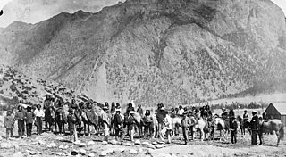
The Lillooet Country, also referred to as the Lillooet District, is a region spanning from the central Fraser Canyon town of Lillooet west to the valley of the Lillooet River, and including the valleys in between, in the Southern Interior of British Columbia. Like other historical BC regions, it is sometimes referred to simply as The Lillooet or even Lillooet,.
Fountain is an unincorporated rural area and Indian reserve community in the Fraser Canyon region of British Columbia, Canada, located at the ten-mile (16 km) mark from the town of Lillooet on BC Highway 99, which in that area is also on the route of the Old Cariboo Road and is located at the junction of that route with the old gold rush-era trail via Fountain Valley and the Fountain Lakes.

Cayoosh Creek is a northeast-flowing tributary of the Seton River in the Canadian province of British Columbia. The name Cayoosh Creek remains on the bridge-sign crossing the stream on BC Highway 99 and continues in use locally to refer to the final reaches of the Seton River, formerly Seton Creek, which prior to the renaming ending at the confluence with Cayoosh Creek. The creek is the namesake of Cayoosh Creek Indian Reserve No. 1, one of the main Indian reserves of the Cayoose Creek Indian Band, which lies adjacent to what was renamed the Seton River without local consultation.
Mission Ridge, also known as Mission Mountain, is a ridge in the Bridge River-Lillooet Country of the South-Central Interior of British Columbia, Canada, extending westward from the town of Lillooet along the north side of Seton Lake to Mission Pass, which is immediately above and to the north of the lakeside community of Shalalth. The road over the pass is also known as Mission Mountain, which is short for "Mission Mountain Road". Mission Creek lies on the north side of the pass, and is a tributary of the Bridge River, the lower reaches of which lie on the north side of the ridge, and which was the only road access into the upper Bridge River Country before the construction of a road through the Bridge River Canyon in the mid-1950s opened that region up to road access from the lower Bridge River valley and the town of Lillooet via the community of Moha. Most, or virtually all, of the ridge, is Indian Reserves, notably Slosh 1, under the administration of the Seton Lake Indian Band, and Bridge River 1, which is under the administration of the Bridge River Indian Band. Parts of the ridge's eastern end are in reserves controlled by the Lillooet Indian Band, including its final spires above Lillooet, which were dubbed St. Mary's Mount by the Reverend Lundin Brown in the 1860s, though that name never stuck and is ungazetted.
References
- ↑ "Bridge River Rapids". BC Geographical Names .
- ↑ Tales from Seton Portage, Irene Edwards, self-publ. Lillooet, BC, 1976
- ↑ Halfway to the Goldfields, a History of Lillooet, Lorraine Harris, J.J. Douglas, North Vancouver (1977), ISBN 978-0-88894-062-9 ISBN 0-88894-062-9
- ↑ Tales from Seton Portage, Irene Edwards, self-publ. Lillooet, BC, 1976
- ↑
- A complex culture of the British Columbia Plateau: Traditional Stl'atl'imx resource use, Brian Hayden (editor). University of British Columbia Press. Vancouver.
- ↑ Same as yesterday: the Lillooet chronicle, the theft of their lands and resources, Joanne Drake-Terry, publ. Lillooet Tribal Council, Lillooet, B.C. (1989)
- ↑ A complex culture of the British Columbia Plateau: Traditional Stl'atl'imx resource use, Brian Hayden (editor). University of British Columbia Press. Vancouver.
- ↑ Same as yesterday: the Lillooet chronicle, the theft of their lands and resources, Joanne Drake-Terry, publ. Lillooet Tribal Council, Lillooet, B.C. (1989)
- ↑ Notes of the Jesup North Pacific Expedition, Vol. The Shuswap, James Teit, section History of the Chiefs of the Okanagan
- ↑ The Thompson Country, Mark Sweeten Wade
- ↑ Tales from Seton Portage, Irene Edwards, self-publ. Lillooet, BC, 1976
- ↑ Water Powers of British Columbia, British Columbia government, 1956
- ↑ Same as yesterday: the Lillooet chronicle, the theft of their lands and resources, Joanne Drake-Terry, publ. Lillooet Tribal Council, Lillooet, B.C. (1989)