Bristol, Ohio

Last updated

Location of Bristol, Ohio OHMap-doton-Bristol.png
Location of Bristol, Ohio

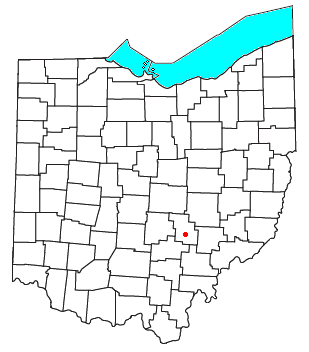
Bristol is an unincorporated community in southern Pike Township, Perry County, Ohio, United States. [1] It lies along State Route 93 at its intersection with Marietta Road and Township Road 223. It is located 4 miles (6 kilometers) south of New Lexington, the county seat of Perry County. [2]

Bristol was originally called Burlington, and under the latter name was laid out in 1816. [3] A post office called Britol was established in 1820. [3]

Related Research Articles

<span class="mw-page-title-main">Moxahala Creek</span> River

Moxahala Creek is a tributary of the Muskingum River, 29.2 miles (47.0 km) long, in southeastern Ohio in the United States. Via the Muskingum and Ohio Rivers, it is part of the watershed of the Mississippi River, draining an area of 301 square miles (780 km2)

<span class="mw-page-title-main">Wakatomika Creek</span>

Wakatomika Creek is a tributary of the Muskingum River, 42.6 mi (68.6 km) long, in central Ohio in the United States. Via the Muskingum and Ohio Rivers, it is part of the watershed of the Mississippi River, draining an area of 234 mi² (606 km²)

<span class="mw-page-title-main">Lees Creek, Ohio</span>

Lees Creek, also known as Centerville, is an unincorporated community in central Wayne Township, Clinton County, Ohio, United States. It lies at the intersection of State Route 729 with Cox Road, 6 miles south of Sabina and 12 miles (19 km) southeast of Wilmington, the county seat of Clinton County. It lies between the headwaters of the Middle Fork of Lees Creek, to the southeast, and the Anderson Fork of Caesar Creek. it had a post office, with the ZIP code 45138. The Post Office closed in 2012 and the town, including East Clinton High School, now carries a Sabina mailing address.

<span class="mw-page-title-main">Pricetown, Highland County, Ohio</span>

Pricetown is an unincorporated community in eastern Salem Township, Highland County, Ohio, United States.

<span class="mw-page-title-main">Monroe Township, Perry County, Ohio</span> Township in Ohio, United States

Monroe Township is one of the fourteen townships of Perry County, Ohio, United States. The 2000 census found 1,565 people in the township, 926 of whom lived in the unincorporated portions of the township.

<span class="mw-page-title-main">Reno, Ohio</span> Census-designated place in Ohio, US

Reno is a census-designated place in southern Marietta Township, Washington County, Ohio, United States. It has a post office with the ZIP code 45773. It is located on the Ohio River a short distance below the county seat of Marietta. State Route 7 forms its main street.

<span class="mw-page-title-main">Little Hocking, Ohio</span> Census-designated place in Ohio, US

Little Hocking is a census-designated place in southern Belpre Township, Washington County, Ohio, United States. It has a post office with the ZIP code 45742.

<span class="mw-page-title-main">Cutler, Ohio</span>

Cutler is an unincorporated community in southwestern Fairfield Township, Washington County, Ohio, United States. It has a post office with the ZIP code 45724. It lies at the intersection of State Route 555 and County Road 59 near Gilbert Run, a subsidiary of the Little Hocking River, which meets the Ohio River at Little Hocking to the southeast.

<span class="mw-page-title-main">White Cottage, Ohio</span>

White Cottage is an unincorporated community in central Newton Township, Muskingum County, Ohio, United States. It has a post office with the ZIP code 43791. It lies along U.S. Route 22 between Zanesville and Lancaster.

<span class="mw-page-title-main">Byer, Ohio</span> Unincorporated community in Ohio, United States

Byer is an unincorporated community in northwestern Washington Township, Jackson County, Ohio, United States. It lies along State Route 327 between Wellston and Londonderry, at 39°10′53″N82°37′53″W.

<span class="mw-page-title-main">Rose Farm, Ohio</span>

Rose Farm is an unincorporated community and census-designated place (CDP) in southwestern York Township, Morgan County, and southeastern Harrison Township, Perry County, Ohio, United States. It lies along State Route 669 at its intersection with McKinley Street. Ogg Creek, which meets the Moxahala Creek just north of Rose Farm, runs through the community. It is located 13 miles northwest of McConnelsville, the county seat of Morgan County, and a much shorter distance southeast of Crooksville in nearby Perry County.

<span class="mw-page-title-main">Pyrmont, Ohio</span>

Pyrmont is an unincorporated community in northwestern Perry Township, Montgomery County, Ohio, United States. It centers at the intersection of Brookville–Pyrmont Pike and Sulphur Springs Road, extending to the intersection of Brookville–Pyrmont Pike and Providence Pike. Located in the far west of the county, it lies several miles from the city of Dayton; the nearest city is Brookville, three miles to the northeast. Pyrmont is a part of the Brookville Local School District. Pyrmont, which was on a stagecoach route, was a busy town before Interstate 70 was built near Brookville.

<span class="mw-page-title-main">Royalton, Ohio</span>

Royalton is an unincorporated community in northern Amanda Township, Fairfield County, Ohio, United States.

<span class="mw-page-title-main">Clarksfield, Ohio</span>

Clarksfield is an unincorporated community in the northwestern portion of Clarksfield Township, Huron County, Ohio, United States. It lies along State Route 18 midway between Norwalk and Wellington, and along State Route 60 between New London and Wakeman. The Vermilion River flows northward through Clarksfield.

<span class="mw-page-title-main">Byron, Ohio</span>

Byron is a small unincorporated community in southeastern Bath Township, Greene County, Ohio, United States. It sits at the intersection of Linebaugh and Dayton-Yellow Springs Roads, between Fairborn and Xenia. Byron is located at 39°47′10″N83°58′51″W, at an elevation of 915 feet (279 m).

<span class="mw-page-title-main">Etna, Lawrence County, Ohio</span>

Etna is an unincorporated community in eastern Elizabeth Township, Lawrence County, Ohio, United States. It lies at an elevation of 620 feet.

<span class="mw-page-title-main">Melbern, Ohio</span>

Melbern is a small unincorporated community in western Center Township, Williams County, Ohio, United States. It is situated on County Road 9 south of County Road D.

<span class="mw-page-title-main">Derby, Indiana</span> Unincorporated community in Indiana, United States

Derby is an unincorporated community along the Ohio River in far southern Union Township, Perry County, in the U.S. state of Indiana. It lies at the intersection of State Roads 66 and 70 above the city of Tell City, the county seat of Perry County. Its elevation is 453 feet (138 m), and it is located at 38°1′49″N86°31′38″W. Although Derby is unincorporated, it has a post office, with the ZIP code of 47525.

<span class="mw-page-title-main">Hunts Corners, Ohio</span> Historic district in Ohio, United States

Hunts Corners is an unincorporated community in southeastern Lyme Township, Huron County, Ohio, United States. It lies at the intersection of State Route 547 and Sand Hill Road, southeast of Bellevue and southwest of the city of Norwalk, the county seat of Huron County. Its elevation is 768 feet (234 m), and it is located at 41°13′39″N82°45′27″W.

Carpenter is an unincorporated community in Meigs County, Ohio, United States, along Leading Creek.

References

  1. U.S. Geological Survey Geographic Names Information System: Bristol, Ohio
  2. DeLorme. Ohio Atlas & Gazetteer. 7th ed. Yarmouth: DeLorme, 2004, p. 70. ISBN   0-89933-281-1.
  3. 1 2 Colborn, Ephraim S. (1883). History of Fairfield and Perry Counties, Ohio: Their Past and Present. Brookhaven Press. p. 248.

39°44′09″N82°04′41″W / 39.73583°N 82.07806°W / 39.73583; -82.07806