Physical geography is one of the three main branches of geography. Physical geography is the branch of natural science which deals with the processes and patterns in the natural environment such as the atmosphere, hydrosphere, biosphere, and geosphere. This focus is in contrast with the branch of human geography, which focuses on the built environment, and technical geography, which focuses on using, studying, and creating tools to obtain, analyze, interpret, and understand spatial information. The three branches have significant overlap, however.

Geomorphology is the scientific study of the origin and evolution of topographic and bathymetric features generated by physical, chemical or biological processes operating at or near Earth's surface. Geomorphologists seek to understand why landscapes look the way they do, to understand landform and terrain history and dynamics and to predict changes through a combination of field observations, physical experiments and numerical modeling. Geomorphologists work within disciplines such as physical geography, geology, geodesy, engineering geology, archaeology, climatology, and geotechnical engineering. This broad base of interests contributes to many research styles and interests within the field.

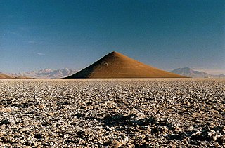
A landform is a natural or anthropogenic land feature on the solid surface of the Earth or other planetary body. Landforms together make up a given terrain, and their arrangement in the landscape is known as topography. Landforms include hills, mountains, canyons, and valleys, as well as shoreline features such as bays, peninsulas, and seas, including submerged features such as mid-ocean ridges, volcanoes, and the great ocean basins.

Richard John Chorley was an English geographer, and Professor of Geography at Cambridge University, known as leading figure in quantitative geography in the late 20th century, who played an instrumental role in bringing in the use of systems theory to geography.
The geographic cycle, or cycle of erosion, is an idealized model that explains the development of relief in landscapes. The model starts with the erosion that follows uplift of land above a base level and ends, if conditions allow, in the formation of a peneplain. Landscapes that show evidence of more than one cycle of erosion are termed "polycyclical". The cycle of erosion and some of its associated concepts have, despite their popularity, been a subject of much criticism.
David S. G. Thomas is a British scientist and geographer. He was born at his parents' home in River, near Dover, Kent, UK, in October 1958. He is Professor of geography at the University of Oxford, the fifth person to hold the Statuary Chair, and a Professorial Fellow of Hertford College, Oxford.
Andrew Shaw Goudie is a geographer at the University of Oxford specialising in desert geomorphology, dust storms, weathering, and climatic change in the tropics. He is also known for his teaching and best-selling textbooks on human impacts on the environment. He is the author, co-author, editor, or co-editor of forty-one books and more than two hundred papers published in learned journals. He combines research and some teaching with administrative roles.

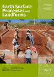
Earth Surface Processes and Landforms is a peer-reviewed scientific journal published by John Wiley & Sons on behalf of the British Society for Geomorphology. It covers geomorphology and more in general all aspects of Earth sciences dealing with the Earth surface. The journal was established in 1976 as Earth Surface Processes, obtaining its current name in 1981. The journal primarily publishes original research papers. It also publishes Earth Surface Exchanges which include commentaries on issues of particular geomorphological interest, discussions of published papers, shorter journal articles suitable for rapid publication, and commissioned reviews on key aspects of geomorphological science. Foci include the physical geography of rivers, valleys, glaciers, mountains, hills, slopes, coasts, deserts, and estuary environments, along with research into Holocene, Pleistocene, or Quaternary science. The editor-in-chief is Stuart Lane.
Physiographic regions are a means of defining Earth's landforms into independently distinct, mutually exclusive areas, independent of political boundaries. It is based upon the classic three-tiered approach by Nevin M. Fenneman in 1916, that separates landforms into physiographic divisions, physiographic provinces, and physiographic sections.
David Leslie Linton was a British geographer and geomorphologist, was professor of geography at Sheffield and Birmingham, best remembered for his work on the landscape development of south-east England with S. W. Wooldridge, and on the development of tors.

Marjorie Mary Sweeting, was a British geomorphologist specializing in karst phenomena. Sweeting had gained extensive knowledge on various topographies and landscapes by travelling around the world to places such as Greece, Australia, Czechoslovakia, United States, Canada, South Africa, Belize, and most notably China. She published Karst Landforms, and Karst in China: its Geomorphology and Environment. The latter is the first comprehensive Western account of China's karst, and one of the first western published works on the karst found within China, despite being a male dominated field.
Professor Bernard John Smith was an English geomorphologist and a physical geographer. He was born in the English village of Beer in Dorset where he attended school until the family's relocation to London.
Clifford Embleton was a British geomorphologist. He was born in Bromborough at that time in Cheshire. He was the son of Arthur Thomas Embleton (1895-1954), a shipping clerk, and Constance Fitzgerald (1896–1948). He was educated at Birkenhead School and won an open exhibition at St John's College, Cambridge to read geography. He graduated in 1953 having won the Philip Lake Prize. His doctoral thesis in 1956 was on the glacial landforms of north Wales.

Hydrogeomorphology has been defined as “an interdisciplinary science that focuses on the interaction and linkage of hydrologic processes with landforms or earth materials and the interaction of geomorphic processes with surface and subsurface water in temporal and spatial dimensions.” The term 'hydro-geomorphology’ designates the study of landforms caused by the action of water. By this definition hydro-geomorphology is inseparable part of geomorphology moreover fluvial geomorphology, because water is one of the most important agents in forming and shaping of landforms. From the groundwater point of view integration of geological, structural and hydrological data with hydro-geomorphologic data is very much useful in finding out the groundwater potential zones with fruitful results. The science relating to the geographical, geological, and hydrological aspects of water bodies and to changes to these aspects in response to low variations and to natural and human caused events, such as heavy rainfall or channel straightening is the hydro-geomorphology.
Julius Büdel was a German geomorphologist noted for his work on the influence of climate in shaping landscapes and landforms. In his work Büdel stressed the importance of inherited landforms in present-day landscapes and argued that many landforms are the result of a combination of processes, and not of a single process. Büdel estimated that 95% of mid-latitude landforms are relict. Büdel studied both cold-climate processes in Svalbard and "tropical" weathering processes in India to understand the origin of the relief of Central Europe, which he argued was a palimpsest of landforms formed at different times and under different climates. For Central Europe Büdel concluded that in Late Cretaceous to Early Pliocene times etchplains formed. Then in Late Pliocene to Early Pleistocene times a transition period occurred in landscape forming processes. Finally in the Late Pleistocene periglaciation and deep permafrost made Central Europe a place of "excessive valley cutting". Holocene developments would not have affected much of the landscape other than adding a deep soil cover.
In geology and geomorphology a paleosurface is a surface made by erosion of considerable antiquity. Paleosurfaces might be flat or uneven in some cases having considerable relief. Flat and large paleosurfaces —that is planation surfaces— have higher potential to be preserved than small and irregular surfaces and are thus the most studied kind of paleosurfaces. Irregular paleosurfaces, albeit usually smaller than flat ones, occur across the globe, one example being the Sudetes etchsurfaces. In the case of peneplains it is argued that they become paleosurfaces once they are detached from the base level they grade to.

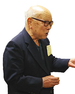
Eiju Yatsu was a Japanese geomorphologist who taught in Japan, US and Canada. He is best known for his contributions to weathering and 'rock control' in geomorphology.

Climatic geomorphology is the study of the role of climate in shaping landforms and the earth-surface processes. An approach used in climatic geomorphology is to study relict landforms to infer ancient climates. Being often concerned about past climates climatic geomorphology considered sometimes to be an aspect of historical geology. Since landscape features in one region might have evolved under climates different from those of the present, studying climatically disparate regions might help understand present-day landscapes. For example, Julius Büdel studied both cold-climate processes in Svalbard and weathering processes in tropical India to understand the origin of the relief of Central Europe, which he argued was a palimpsest of landforms formed at different times and under different climates.
Heather Viles is a professor of biogeomorphology and heritage conservation in the school of geography and the environment at Oxford University, senior research fellow at Worcester College, and honorary professor at the Institute of Sustainable Heritage, University College London. She is a Fellow of the British Society for Geomorphology.
Colin Kerr Ballantyne is a Scottish geomorphologist, geologist, and physical geographer.


