
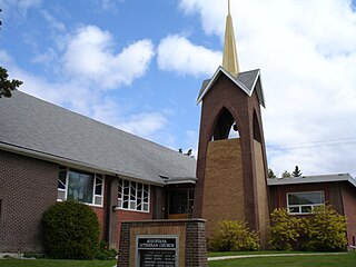
Sutherland is a mostly residential neighbourhood located in east-central Saskatoon, Saskatchewan, Canada. It is an older suburban subdivision, composed of a near-even mix of single-family detached houses and multiple-unit apartment and semi-detached dwellings. As of 2006, the area was home to 5,206 residents. The neighbourhood is a middle-income area, with an average family income of $51,857, an average dwelling value of $204,213 and a home ownership rate of 43.8%. According to MLS data, the average sale price of a home as of 2013 was $288,651. Sutherland was administered as a separate town outside of Saskatoon before being annexed by the city in 1956.

Nutana is a primarily residential neighbourhood located near the centre of Saskatoon, Saskatchewan, Canada. It includes the business district of Broadway Avenue. It comprises a nearly even mixture of low-density, single detached dwellings and apartment-style multiple unit dwellings. As of 2009, the area is home to 6,261 residents. The neighbourhood is considered a middle to upper-income area, with an average family income of $67,657, an average dwelling value of $206,830 and a home ownership rate of 51.3%. According to MLS data, the average sale price of a home as of 2013 was $409,891. First established in 1883, Nutana was the original settlement of what now makes up the city of Saskatoon.

Nutana Suburban Centre is a mixed-development neighbourhood located in south-central Saskatoon, Saskatchewan, Canada. It is a classified as a "suburban centre" subdivision, composed of medium to high-density multiple-unit dwellings, commercial areas and civic facilities. As of 2009, the area is home to 2,962 residents. Housing in the neighbourhood consists of high-density apartment-style dwellings and row houses. The neighbourhood is considered a lower-income area, with an average family income of $34,474, an average dwelling value of $266,311 and a home ownership rate of 29.3%. The low average income but comparatively high dwelling value is due to the number of senior citizens residing in the neighbourhood. The age distribution of Nutana SC's population is skewed very highly toward residents age 65 and older. According to MLS data, the average sale price of a home as of 2013 was $296,114.

Varsity View is a mostly residential neighbourhood located near central Saskatoon, Saskatchewan, Canada. It is immediately south of the University of Saskatchewan campus. It is an older suburban subdivision, comprising a mixture of low-density, single detached dwellings, detached duplexes and apartment-style units. As of 2007, the area is home to 3,611 residents. The neighbourhood is considered a middle-income area, with an average family income of $50,587, an average dwelling value of $284,710 and a home ownership rate of 38.7%. Its proximity to the university gives this area its relatively high student population, almost 25% in 2005. According to MLS data, the average sale price of a home as of 2013 was $402,332.

Buena Vista is a residential neighbourhood located near the centre of Saskatoon, Saskatchewan, Canada. It is an older suburban subdivision, including mostly low-density, single detached dwellings. As of 2011, the area is home to 3,271 residents. The neighbourhood is considered a middle-income area, with an average family income of $67,170, an average dwelling value of $251,560 and a home ownership rate of 77.7%.

The Central Business District is one of seven development districts in Saskatoon, Saskatchewan, Canada. The central business district is Ward 6 of a Mayor-Council government represented by councillor Cynthia Block. Formerly called West Saskatoon, this area arose when the steam engines built their pumping stations on the lower west bank of the South Saskatchewan River. Retail enterprises sprang up around the newly created train station and rail yards. The city of Saskatoon's Central Business District has shopping malls and boutiques.

College Park is a primarily residential neighbourhood located in the east-central part of Saskatoon, Saskatchewan, Canada. The majority of its residents live in single-family detached dwellings, with a sizable minority of high-density, multiple-unit dwellings. As of 2011, the area is home to 5,470 residents. The neighbourhood is considered a middle-income area, with an average family income of $65,133, an average dwelling value of $232,228 and a home ownership rate of 58.9%. According to MLS data, the average sale price of a home as of 2013 was $299,844.

Grosvenor Park is a mostly residential neighbourhood located in east-central Saskatoon, Saskatchewan, Canada. It is a suburban subdivision, composed of a near-even mix of low-density, single detached dwellings and apartment-style units. As of 2006, the area is home to 1,645 residents. The neighbourhood is considered an upper-income area, with an average family income of $67,544, an average dwelling value of $329,988 and a home ownership rate of 44.8%. According to MLS data, the average sale price of a home as of 2013 was $493,174.

Wildwood is a primarily residential neighbourhood located in the southeast part of Saskatoon, Saskatchewan, Canada. It includes part of the 8th Street business district. The majority of its residents live in a townhouse or apartment-style multiple unit dwellings, with a sizeable minority of low-density, single detached dwellings. As of 2016, the area is home to 7,645 residents. The neighbourhood has an average family income of $37,770, a homeownership rate of 67.0% and an average home sale price of $300,327.

Eastview is a mostly residential neighbourhood located in south-central Saskatoon, Saskatchewan, Canada. It is a suburban subdivision, consisting of low-density, single detached dwellings, low-rise apartment buildings and semi-detached houses. As of 2007, the area is home to 3,566 residents. The neighbourhood is considered a middle-income area, with an average family income of $58,703, an average dwelling value of $260,050 and a home ownership rate of 51.6%. According to MLS data, the average sale price of a home as of 2013 was $318,449.
Haultain is a mostly residential neighbourhood located in south-central Saskatoon, Saskatchewan, Canada. It is a suburban subdivision, consisting mostly of low-density, single detached dwellings. As of 2007, the area is home to 2,742 residents. The neighbourhood is considered a middle-income area, with an average family income of $47,890, an average dwelling value of $201,503 and a home ownership rate of 59.3%. According to MLS data, the average sale price of a home as of 2013 was $316,411.

Queen Elizabeth is a mostly residential neighbourhood located in south-central Saskatoon, Saskatchewan, Canada. It is a suburban subdivision, consisting mostly of low-density, single detached dwellings. As of 2007, the area is home to 2,491 residents. The neighbourhood is considered a middle-income area, with an average family income of $61,904, an average dwelling value of $280,970 and a home ownership rate of 66.9%. According to MLS data, the average sale price of a home as of 2013 was $343,459.

The Exhibition subdivision of Saskatoon, Saskatchewan, Canada, is located on the banks of the South Saskatchewan River and was developed between the two major World Wars. To the west is the Diefenbaker Management Area which boasts the Diefenbaker park and Pioneer Cemetery. The park includes a medium-sized hill which is used for tobogganing and snowboarding, and the park itself is a frequently-used venue for picnics and public events and performances. The Exhibition community is also known as Thornton, after a (now-demolished) public elementary school that formerly served the area and early in its history also went by the name Bellevue.
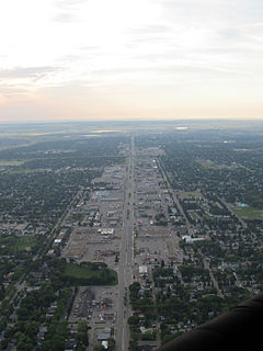
8th Street East is an arterial road serving the city of Saskatoon, Saskatchewan. It begins as a continuation of a minor residential street at Lorne Avenue in Saskatoon, and runs through the eastern part of city, eventually exiting the city limits as a country road.

Adelaide/Churchill is a mostly residential neighbourhood located in south-central Saskatoon, Saskatchewan, Canada. It is a suburban subdivision, consisting mostly of low-density, single detached dwellings. As of 2009, the area is home to 3,445 residents. The neighbourhood is considered a middle-income area, with an average family income of $78,438, an average dwelling value of $287,976 and a home ownership rate of 90.3%. According to MLS data, the average sale price of a home as of 2013 was $350,096.

Avalon is a mostly residential neighbourhood located in south-central Saskatoon, Saskatchewan, Canada. It is a suburban subdivision, consisting mostly of low-density, single detached dwellings. As of 2007, the area is home to 3,214 residents. The neighbourhood is considered a middle-income area, with an average family income of $65,000, an average dwelling value of $168,444 and a home ownership rate of 77.3%. According to MLS data, the average sale price of a home as of 2013 was $352,359.

Nutana Park is a mostly residential neighbourhood located in south-central Saskatoon, Saskatchewan, Canada. It is a suburban subdivision, consisting mostly of low-density, single detached dwellings. As of 2007, the area is home to 2,748 residents. The neighbourhood is considered a middle-income area, with an average family income of $66,555, an average dwelling value of $257,789 and a home ownership rate of 85.1%. According to MLS data, the average sale price of a home as of 2013 was $356,116.

Sutherland Industrial is an industrial subdivision located in east-central Saskatoon, Saskatchewan, Canada. It was originally part of Sutherland, a town outside of Saskatoon before being annexed by the city in 1956. The subdivision also contains the first urban reserve in Saskatchewan, the Muskeg Lake Cree Nation.

The CN Industrial Area is the industrial subdivision located in southern Saskatoon. It is also known as South Saskatoon, after the CN rail siding located in the area. It is a part of the Nutana Suburban Development Area. This industrial park was established with the Grand Trunk Pacific Railway crossing the South Saskatchewan River.

