
Whitby is a town in Durham Region. Whitby is located in Southern Ontario east of Ajax and west of Oshawa, on the north shore of Lake Ontario and is home to the headquarters of Durham Region. It had a population of 138,501 at the 2021 census. It is approximately 45 km (28 mi) east of Toronto, and it is known as a commuter suburb in the Durham Region, a part of the Greater Toronto Area. While the southern portion of Whitby is predominantly urban and an economic hub, the northern part of the municipality is more rural and includes the communities of Ashburn, Brooklin, Myrtle, Myrtle Station, and Macedonian Village.

Pickering is a city located in Southern Ontario, Canada, immediately east of Toronto in Durham Region.

The Regional Municipality of Durham, informally referred to as Durham Region, is a regional municipality in Southern Ontario, Canada. Located east of Toronto and the Regional Municipality of York, Durham forms the east-end of the Greater Toronto Area and part of the Golden Horseshoe region. It has an area of approximately 2,500 km2 (970 sq mi). The regional government is headquartered in Whitby.

Brock is a township in the Regional Municipality of Durham, Ontario, Canada. Brock Township is also a former municipality and geographic township prior to the amalgamation that formed the current municipality.
Beaverton is a community in Brock Township in the Regional Municipality of Durham, Ontario, Canada.

Bowmanville is a town of approximately 40,000 people located in the Municipality of Clarington, Durham Region, Ontario, Canada. It is approximately 75 km (47 mi) east of Toronto, and 15 km (9.3 mi) east of Oshawa along Highway 2. Bowmanville was first incorporated as a town in 1858, but later incorporated with the neighbouring townships of Clarke and Darlington in 1974 forming the Town of Newcastle, which was renamed in 1994 to the Municipality of Clarington. Bowmanville is part of the Greater Toronto Area.
Ontario County was the name of two historic counties in the Canadian province of Ontario. Both counties were located in approximately the same area and existed on-and-off between 1792 and 1974. Their primary modern successor is the Regional Municipality of Durham, though certain parts of them were transferred to other surrounding regions.
King's Highway 48, also known as Highway 48, is a provincially maintained highway in southern Ontario that extends from Major Mackenzie Drive in Markham, through Whitchurch-Stouffville and East Gwillimbury, to Highway 12 south-east of Beaverton. The route is generally rural and straight, passing near several communities within the Regional Municipality of York. The route is 65.2 kilometres (40.5 mi) long. Most part of the road has a speed limit of 80 km/h (50 mph), except within town limits, where the speed limit is reduced to 60 km/h (37 mph) or 50 km/h (31 mph).
Ontario North was a federal electoral district represented in the House of Commons of Canada from 1867 to 1925. It was located in the province of Ontario. It was created by the British North America Act of 1867.
Cannington is a community in Brock Township, Durham Region, Ontario, Canada. The town is on the Beaver River.
Sunderland is a community located approximately 100 km (62 mi) northeast of Toronto, Ontario, Canada in Brock Township, in the Regional Municipality of Durham. This is currently one of the very few populated areas of the Greater Toronto Area where the Trans-Canada Highway passes near, thus also making this the closest point from the highway to the City of Toronto at 100 km (62 mi) apart.

The Durham District School Board(DDSB), known as English/French language Public District School Board No. 13 prior to 1999, is an English-language public-secular school board in the province of Ontario. The Board serves most of Durham Region, except for Clarington, which is a part of the Kawartha Pine Ridge District School Board.
Eastdale Collegiate and Vocational Institute is located in Oshawa, Ontario within the Durham District School Board. The school has students in grades 9-12 and offers a wide range of academic and extracurricular activities. Eastdale offers courses in construction, communications, and manufacturing technology, as well as technical design.

The Greater Essex County District School Board was created on January 1, 1998, with the amalgamation of the Windsor Board of Education and the Essex County Board of Education. The school board services families in both Windsor, Ontario and Essex County, Ontario in Canada.
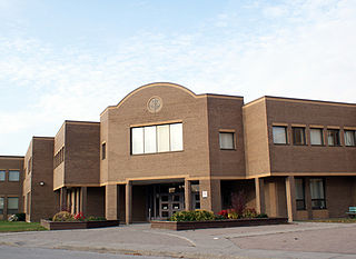
Archbishop Denis O'Connor Catholic High School is a Roman Catholic high school located in Ajax, Ontario, Canada, within the Durham Catholic District School Board. It is named for Archbishop Denis T. O'Connor, a priest who was born in Pickering in 1841, and who became the third Archbishop of Toronto, Ontario, Canada in 1899. The school has students in grades 9–12 and offers a wide range of academic and extracurricular activities. The current enrolment is approximately 600 students. The school colours are green and yellow, and its motto is Nil sine fide et labore, which is Latin for "Nothing without faith and work."
Niagara District Secondary School (NDSS) was a public secondary school located in Niagara-on-the-Lake, Ontario, Canada.

The Durham Catholic District School Board is a Catholic school board located in Durham Region, east of Toronto, Ontario. It currently runs 39 elementary schools and 7 secondary schools. The board also runs one Adult Education Centre in Ajax and one Continuing Education Centre in Oshawa.

The Almaguin Highlands Region in Ontario, Canada, covers approximately 5,200 km2 (2,000 sq mi) comprising the eastern half of Parry Sound District. It is bounded by Muskoka in the south, and by Lake Nipissing and Nipissing District in the north. The eastern edge abuts the western boundary of Algonquin Provincial Park, whereas the western boundary of the Almaguin Highlands is generally regarded to be the mid east-west point of Parry Sound District. Originally derived from the words Algonquin, Magnetawan, and Seguin. the name Almaguin is now used to describe the marketing region of East Parry Sound.
Built 1954, Centre Dufferin District High School is the public high school for Shelburne, Ontario. With a student population of approximately 850, the school serves the towns and townships of Grand Valley, Amaranth, Melancthon, Mulmur, and Mono. It is part of the Upper Grand District School Board.
Bervie is an unincorporated place and Compact Rural Community in the municipality of Kincardine, Bruce County in southwestern Ontario, Canada. It is located on Ontario Highway 9, and is on the Penetangore River, which flows to Lake Huron at the town centre of Kincardine.

