
Fluvanna County is a county located in the Piedmont region of the Commonwealth of Virginia, United States. As of the 2020 census, the population was 27,249. Its county seat is Palmyra, while the most populous community is the census designated place of Lake Monticello.

The James River is a river in Virginia that begins in the Appalachian Mountains and flows from the confluence of the Cowpasture and Jackson Rivers in Botetourt County 348 miles (560 km) to the Chesapeake Bay. The river length extends to 444 miles (715 km) if the Jackson River, the longer of its two headwaters, is included. It is the longest river in Virginia. Jamestown and Williamsburg, Virginia's first colonial capitals, and Richmond, Virginia's current capital, lie on the James River.
The Black Warrior River is a waterway in west-central Alabama in the southeastern United States. The river rises in the extreme southern edges of the Appalachian Highlands and flows 178 miles (286 km) to the Tombigbee River, of which the Black Warrior is the primary tributary. The river is named after the Mississippian paramount chief Tuskaloosa, whose name was Muskogean for 'Black Warrior'. The Black Warrior is impounded along nearly its entire course by a series of locks and dams to form a chain of reservoirs that not only provide a path for an inland waterway, but also yield hydroelectric power, drinking water, and industrial water.

The James River and Kanawha Canal was a partially built canal in Virginia intended to facilitate shipments of passengers and freight by water between the western counties of Virginia and the coast. Ultimately its towpath became the roadbed for a rail line following the same course.
Lake Anna is one of the largest freshwater inland reservoirs in Virginia, covering an area of 13,000 acres (53 km2), and located 72 miles (116 km) south of Washington, D.C., in Louisa and Spotsylvania counties. The lake is easily accessible from Fredericksburg, Richmond, Charlottesville, Northern Virginia, and Washington, D.C., and is one of the most popular recreational lakes in the state.

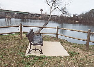
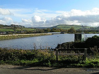
Bremo Bluff is an unincorporated community located on the northern bank of the James River in Fluvanna County, Virginia, United States. The locale was established by the Cocke family in 1636. During the American Civil War, the family of General Robert E. Lee sought refuge in the community. It is home to Bremo Power Station, which, at one point, generated 3 percent of the total electricity delivered by utility company Dominion Energy.
Virginia Air Line Railroad (VAL) was a short-line railroad that operated from 1908 to 1975 in Central Virginia. It was built by the Virginia Air Line Railway Company to connect the Chesapeake and Ohio Railway's (C&O) Piedmont Subdivision at Lindsay, Virginia, to the Rivanna Subdivision of C&O's James River Line at Strathmore Yard, near Bremo Bluff, Virginia.

The Rivanna River is a 42.1-mile-long (67.8 km) tributary of the James River in central Virginia in the United States. The Rivanna's tributaries originate in the Blue Ridge Mountains; via the James River, it is part of the watershed of Chesapeake Bay.
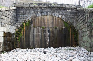
Church Hill Tunnel is an old Chesapeake and Ohio Railway (C&O) tunnel, built in the early 1870s, which extends approximately 4,000 feet under the Church Hill district of Richmond, Virginia, United States. On October 2, 1925, the tunnel collapsed on a work train, killing four men and trapping a steam locomotive and ten flat cars. Rescue efforts only resulted in further collapse, and the tunnel was eventually sealed for safety reasons.

The Triple Crossing in Richmond, Virginia is one of two places in North America where three railroad lines cross at different levels at the same spot, the other being the BNSF operated Santa Fe Junction in Kansas City. Santa Fe Junction became a triple crossing after the Argentine Connection was completed in 2004.
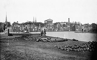
Richmond, Virginia, served as the capital of the Confederate States of America during the American Civil War from May 1861 to April 1865. Besides its political status, it was a vital source of weapons and supplies for the war effort, as well as the terminus of five railroads; as such, it would have been defended by the Confederate States Army at all costs.
Toddbrook Reservoir, a feeder for the Peak Forest Canal, opened in 1838. It is above the town of Whaley Bridge in the High Peak area of Derbyshire, England. The reservoir is a Site of Special Scientific Interest (SSSI) providing habitats for herons, ducks and other animals and fish, while rare mosses and liverworts grow on its shores, particularly short-lived species that grow on seasonally exposed mud. The reservoir is used for sailing and angling. The Peak District Boundary Walk runs around the eastern end of the reservoir. The reservoir is owned by the Canal & River Trust and, like the nearby Combs Reservoir, is a feeder reservoir for the Peak Forest Canal. The feeder runs through Whaley Bridge, and with the Combs feed enters the canal system in a pool close to the transhipment shed at the Whaley Bridge canal basin.

The Peninsula Subdivision Trestle is a railroad trestle in Richmond, Virginia on the Peninsula Subdivision of CSX Transportation.

The Rivanna Subdivision Trestle is a trestle in Richmond, Virginia at the end of the Rivanna Subdivision. The bridge is the upper level of Triple Crossing, and also crosses United States Route 360. It parallels the James River, and actually "steps" into it at one section. The bridge connects to the Peninsula Subdivision Trestle.

Bosher's Dam is a historic low head dam built upon the James River just west of Richmond, Virginia. It is a 12-foot-high stone structure which interrupts the natural flow of Virginia's largest self-contained river by spanning the waterway between suburban Tuckahoe in Henrico County and the western part of Richmond just west of the Edward E. Willey Bridge. Such dams are often referred to as "drowning machines" by paddlers due to their dangerous nature. Bosher's Dam is not an exception and has caused a number of deaths.

The T. Tyler Potterfield Memorial Bridge, also known as the VEPCO Levee Dam, and formerly the Brown's Island Dam Walk, crosses the James River in Richmond, Virginia connecting Brown's Island to the James River Parks System on the Manchester side of the river.
The Cushaw Hydroelectric Project is a 7.5 megawatt (MW) dam and power house facility owned and operated by Cushaw Hydro LLC.

