Related Research Articles

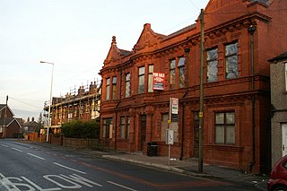
Ashton-in-Makerfield is a market town in Greater Manchester, England. It is part of the Metropolitan Borough of Wigan and is 4.2 miles (6.8 km) south of the town of Wigan. In 2001 it had a population of 28,505, increasing to 28,762 at the 2011 Census.
Abram is a village and electoral ward in the Metropolitan Borough of Wigan, Greater Manchester, England. It lies on flat land on the northeast bank of the Leeds and Liverpool Canal, 2 miles (3.2 km) west of Leigh, 3 miles (4.8 km) southeast of Wigan, and 14.5 miles (23 km) west of Manchester. Abram is a dormitory village with a population of 9,855.
Agecroft Colliery was a coal mine on the Manchester Coalfield that opened in 1844 in the Agecroft district of Pendlebury, Lancashire, England. It exploited the coal seams of the Middle Coal Measures of the Lancashire Coalfield. The colliery had two spells of use; the first between 1844 and 1932, when the most accessible coal seams were exploited, and a second lease of life after extensive development in the late 1950s to access the deepest seams.
Edward Frederick Crippin was an English businessman.

Bryn Hall, also called Brynne Hall, is situated in Bryn Park, Ashton-in-Makerfield, Greater Manchester.

The Lancashire Coalfield in North West England was an important British coalfield. Its coal seams were formed from the vegetation of tropical swampy forests in the Carboniferous period over 300 million years ago.
Tyldesley Coal Company was a coal mining company formed in 1870 in Tyldesley, on the Manchester Coalfield in the historic county of Lancashire, England that had its origins in Yew Tree Colliery, the location for a mining disaster that killed 25 men and boys in 1858.
Ramsden's Shakerley Collieries was a coal mining company operating the Nelson and Wellington Pits from the mid 19th century in Shakerley, Tyldesley in the historic county of Lancashire, England.
Bedford Colliery, also known as Wood End Pit, was a coal mine on the Manchester Coalfield in Bedford, Leigh, Lancashire, England. The colliery was owned by John Speakman, who started sinking two shafts on land at Wood End Farm in the northeast part of Bedford, south of the London and North Western Railway's Tyldesley Loopline in about 1874. Speakman's father owned Priestners, Bankfield, and Broadoak collieries in Westleigh. Bedford Colliery remained in the possession of the Speakman family until it was amalgamated with Manchester Collieries in 1929.
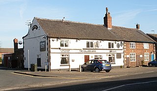
Great Boys Colliery was a coal mine operating on the Manchester Coalfield in the second half of the 19th century in Tyldesley, then in the historic county of Lancashire, England. It was sunk on Great Boys farm, which in 1778 was described as a "messuage with eight Cheshire acres of land" on the north side of Sale Lane west of the Colliers Arms public house. It was owned by William Atkin and sold in 1855 to mineowners, John Fletcher of Bolton and Samuel Scowcroft. By 1869 their partnership was dissolved and the company became John Fletcher and Sons in 1877. Shafts were sunk for a colliery on Pear Tree Farm on the corner of Mort Lane and Sale Lane which appear in the 1867 Mines Lists and became part of Great Boys Colliery. Fletcher and Schofield were granted permission to construct a mineral railway to join the London and North Western Railway's Tyldesley Loopline in 1868 but there is no evidence that it was built. The colliery closed before 1885. The colliery accessed the Brassey mine at about 170 yards and the Six Foot mine at 182 yards. The deeper coal seams were accessed by New Lester Colliery.
Manchester Collieries was a coal mining company with headquarters in Walkden formed from a group of independent companies operating on the Manchester Coalfield in 1929. The Mining Industry Act of 1926 attempted to stem the post-war decline in coal mining and encourage independent companies to merge in order to modernise and better survive the economic conditions of the day. Robert Burrows of the Atherton company Fletcher Burrows proposed a merger of several independent companies operating to the west of Manchester. The merger was agreed and took place in March 1929.
New Lester Colliery was a coal mine operating on the Manchester Coalfield from the second half of the 19th century to the first half of the 20th century in Tyldesley, then in the historic county of Lancashire, England. It was owned by James Roscoe and two shafts were sunk in about 1865 on the east side of Mort Lane on the road to Little Hulton where Roscoe had sunk the Peel Hall and New Watergate pits.
New Manchester or The City was an isolated mining community on the Manchester Coalfield north of Mosley Common in the Tyldesley township, England. It lies west of a boundary stone at Ellenbrook which marks the ancient boundary of the Hundreds of Salford and West Derby, the boundary of Eccles and Leigh ecclesiastical parishes, Tyldesley, Worsley and Little Hulton townships and the metropolitan districts of Wigan and Salford. The route of the Roman road from Manchester to Wigan and the Tyldesley Loopline passed south of the village. The Lancashire and Yorkshire Railway's Manchester to Southport line passed to the north.

Astley Green Colliery was a coal mine in Astley, Greater Manchester, then in the historic county of Lancashire, England. It was the last colliery to be sunk in Astley. Sinking commenced in 1908 by the Pilkington Colliery Company, a subsidiary of the Clifton and Kersley Coal Company, at the southern edge of the Manchester Coalfield, working the Middle Coal Measures where they dipped under the Permian age rocks under Chat Moss. The colliery was north of the Bridgewater Canal. In 1929 it became part of Manchester Collieries, and in 1947 was nationalised and integrated into the National Coal Board. It closed in 1970, and is now Astley Green Colliery Museum.
Gin Pit was a coal mine operating on the Lancashire Coalfield from the 1840s in Tyldesley, Greater Manchester then in the historic county of Lancashire, England. It exploited the Middle Coal Measures of the Manchester Coalfield and was situated to the south of the Tyldesley Loopline.
Peelwood Colliery was a coal mine operating on the Manchester Coalfield after 1883 in Shakerley, Tyldesley, Greater Manchester, then in the historic county of Lancashire, England.
Nelson Pit was a coal mine operating on the Manchester Coalfield from the 1830s or 1840s in Shakerley, Tyldesley, Greater Manchester, then in the historic county of Lancashire, England.

The Maypole Colliery disaster was a mining accident on 18 August 1908, when an underground explosion occurred at the Maypole Colliery, in Abram, near Wigan, then in the historic county of Lancashire, in North West England. The final death toll was 76.
References
Notes
- ↑ Townley, Smith & Peden 1991, p. 202
- ↑ Bryn Hall Colliery - Raleys - Maps, Poems and Searchable Databases for Mining in the UK, Cmhrc.co.uk, archived from the original on 17 February 2012, retrieved 29 March 2013
- ↑ Orwells tracks, archived from the original on 3 December 2013, retrieved 29 March 2013
- ↑ Disasters - Names, Durham Mining Museum, retrieved 30 March 2013
- ↑ Bryn Hall. Ashton-in-Makerfield, Lancashire. 2nd. June. 1873. (PDF), The Coalmining History Research Centre, p. 4, archived from the original (PDF) on 22 March 2013, retrieved 29 March 2013
Bibliography
- Townley, C. H. A.; Smith, F. D.; Peden, J. A. (1991), The Industrial railways of the Wigan Coalfield, Part One, West and South of Wigan Coalfield, Runpast, ISBN 1-870754-18-2