
The geography of France consists of a terrain that is mostly flat plains or gently rolling hills in the north and west and mountainous in the south and the east.
Democratic capitalism, also known as capitalist democracy, is a political, economic and social ideology that involves the combination of a liberal democratic political system with a capitalist economic system. It is based on a tripartite arrangement of a private sector-driven market economy based predominantly on a liberal democratic policy, economic incentives through free markets, fiscal responsibility and a liberal moral-cultural system which encourages pluralism. This ideology supports a capitalist economy subject to control by a democratic political system that is supported by the majority. It stands in contrast to corporatism by limiting the influence of special interest groups, including corporate lobbyists, on politics.

Mynydd Bodafon is a small collection of peaks including the Arwydd which is the highest point on the island of Anglesey. It lies about 2½ miles west of the coastal town of Moelfre and ⅔ of a mile south-west of the hamlet of Brynrefail. The meaning of Bodafon is obscure. Bod is a common placename element meaning 'dwelling' and afon here is probably a corruption of the personal name A(e)ddan.
Jimsmith Lake Provincial Park is a provincial park in British Columbia, Canada. The small park has Jimsmith Lake surrounded by mixed forest. It is located just south of Cranbrook.

The Delimara Transmitter was a relay station of Deutsche Welle near Cyclops on Malta. It was used as short- and medium wave transmission site. For the medium wave transmissions, which took place on 1557 kHz with a transmission power of 600 kW, it had two guyed masts, insulated against ground, which were guyed with polymeric guyes. The short wave antennas were mounted on free-standing lattice towers.

Advanced Landing Grounds (ALGs) were temporary advance airfields constructed by the Allies during World War II during the liberation of Europe. They were built in the UK prior to the invasion and thereafter in northwest Europe from 6 June 1944 to V-E Day, 7 May 1945.

In enzymology, a NADPH—hemoprotein reductase (EC 1.6.2.4) is an enzyme that catalyzes the chemical reaction
The Roman Catholic Diocese of Livramento de Nossa Senhora is a diocese located in the city of Livramento de Nossa Senhora in the Ecclesiastical province of Vitória da Conquista in Brazil.
Killydrum is a townland in County Fermanagh, Northern Ireland. It has previously been referred to as Kildrome (1659) and Killdrum (1695). This townland belongs to the land division of Old Barr in the area of Boho.
Rátka is a village in Borsod-Abaúj-Zemplén County in northeastern Hungary.
Newtown Road is a Tide Light Rail station in Norfolk, Virginia. It opened in August 2011 and is situated on Curlew Drive at the city line between Norfolk and Virginia Beach. It is currently the eastern terminus of the line. The station is adjacent to the Interstate Corporate Center and the Sentara Leigh Hospital.
Rumah District is a district of the Mahrah Governorate, Yemen. As of 2003, the district had a population of 6,357 inhabitants.

The Château de Bouxwiller was a moated castle situated in the département of Bas-Rhin, Alsace, France, constructed in the 15th century under its lords, the von Lichtenberg family. Remodeled many times, the château served more as a residence than a military post. In the 18th century, its attractive and terraced French-styled gardens were very well known.

Perceptions is a composition for trumpet soloist and large jazz orchestra composed and arranged by J. J. Johnson. The piece was commissioned by Dizzy Gillespie and recorded in 1961 for the Verve label. The instrumentation of the orchestra is unusual in that no saxophones or woodwinds are used.
Afşar is a village in the District of Bolu, Bolu Province, Turkey. As of 2010, it had a population of 216 people.

The Grottes de Presque or Presque Caves are a group of caves in Saint-Médard-de-Presque, in the Lot department of France.
Bogaje, formerly known as Bogaji (Богаји) is a settlement in Rožaje, Montenegro. According to the 2003 census, it had 222 inhabitants, who identified as a majority of Serbs (59,45%) and minorities of Bosniaks (23,42%), Montenegrins (13,96%) and Muslims (3,15%).
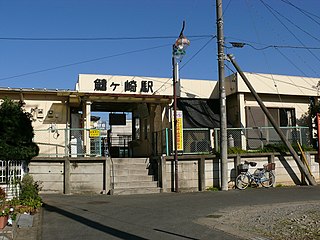
Hiregasaki Station is a train station in Nagareyama, Chiba, Japan.
Sniachiv is a commune (selsoviet) in Storozhynets Raion, Chernivtsi Oblast, Ukraine. It is composed of two villages, Hlybochok and Sniachiv.
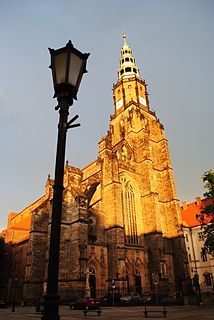
The St. Stanislaus and St. Wenceslaus Cathedral, also called Świdnica Cathedral, is a historical monument and a main Catholic building in Świdnica, Poland.


