Buckwha Creek

Last updated

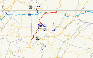
Buckwha Creek is a 12.6-mile-long (20.3 km) [1] tributary of Aquashicola Creek in the Poconos of eastern Pennsylvania in the United States. [2]

Tributary stream or river that flows into a main stem river or lake

A tributary or affluent is a stream or river that flows into a larger stream or main stem river or a lake. A tributary does not flow directly into a sea or ocean. Tributaries and the main stem river drain the surrounding drainage basin of its surface water and groundwater, leading the water out into an ocean.

Aquashicola Creek, also known as Aquanchicola Creek, or Aquanshicola Creek, is a 20.8-mile-long (33.5 km) tributary of the Lehigh River in the Poconos of eastern Pennsylvania in the United States.

Pocono Mountains geographical, geological, and cultural region located in northeastern Pennsylvania, United States

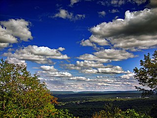
The Pocono Mountains, commonly referred to as The Poconos, are a geographical, geological, and cultural region in Northeastern Pennsylvania, United States. The Poconos are an upland of the larger Allegheny Plateau. Forming a 2,400-square-mile (6,200 km2) escarpment overlooking the Delaware River and Delaware Water Gap to the east, the mountains are bordered on the north by Lake Wallenpaupack, on the west by the Wyoming Valley and the Coal Region, and to the south by the Lehigh Valley. The name comes from the Munsee word Pokawachne, which means "Creek Between Two Hills." Much of the Poconos region lies within the Greater New York-Newark, NY-NJ-CT-PA Combined Statistical Area. The wooded hills and valleys have long been a popular recreation area, accessible within a two-hour drive to millions of metropolitan area residents, with many communities having resort hotels with fishing, hunting, skiing, and other sports facilities.

Contents

The creek originates in a swamp to the southwest of Saylorsburg, flowing southwest along the northwest side of Chestnut Ridge. About five miles below its source, it is dammed to form Princess Lake, about a mile above Kunkletown.

Saylorsburg, Pennsylvania Census-designated place in Pennsylvania, United States

Saylorsburg is a census-designated place and unincorporated community in Monroe County, Pennsylvania, United States. Saylorsburg is located off Pennsylvania Route 33, 5 miles (8.0 km) northwest of Wind Gap. As of the 2010 census, its population was 1,126. The village is located in both Ross Township and Hamilton Township.

Chestnut Ridge, Bedford County

Chestnut Ridge is an elongate hill trending northeast-southwest in west-central Bedford County, Pennsylvania. It is partially forested with rural homes, farms, and notably apple orchards. Four small towns surround it: Schellsburg, New Paris, Fishertown, and Pleasantville. Shawnee State Park and Shawnee Lake lie immediately to the south of the ridge.

Kunkletown, Pennsylvania Unincorporated community in Pennsylvania, United States

Kunkletown is an unincorporated community in Eldred Township, Monroe County, Pennsylvania, United States. It is located at an elevation of 531 feet. It is at ZIP Code 18058.

Buckwha Creek cuts south through Chestnut Ridge at Little Gap and joins Aquashicola Creek approximately 1.2 miles (1.9 km) downstream. [2]

Little Gap, Pennsylvania Unincorporated community in Pennsylvania, United States

Little Gap is a village in eastern Lower Towamensing Township, Carbon County, Pennsylvania on the Aquashicola Creek, which is crossed by a covered bridge, open to vehicular traffic. Blue Mountain Ski Area is located just to the south of the village, which is split between the Danielsville, Kunkletown, and Palmerton ZIP codes of 18038, 18058, and 18071, respectively.

Tributaries

See also

Related Research Articles

Chest Township, Cambria County, Pennsylvania Township in Pennsylvania, United States

Chest Township is a township in Cambria County, Pennsylvania, United States. The population was 349 at the 2010 census. It is part of the Johnstown, Pennsylvania Metropolitan Statistical Area.

Sandy Ridge, Pennsylvania Census-designated place in Pennsylvania, United States

Sandy Ridge is an unincorporated community and census-designated place (CDP) in Centre County, Pennsylvania, United States. It is part of the State College, Pennsylvania Metropolitan Statistical Area. The population was 407 at the 2010 census. It was also known as Retort.

Bullskin Township, Fayette County, Pennsylvania Township in Pennsylvania, United States

Bullskin Township is a township in Fayette County, Pennsylvania, United States. The population was 6,966 at the 2010 census, down from 7,782 at the 2000 census. It is served by the Connellsville Area School District.

Saltlick Township, Fayette County, Pennsylvania Township in Pennsylvania, United States

Saltlick Township is a township in Fayette County, Pennsylvania, United States. The population was 3,461 at the 2010 census, down from 3,715 at the 2000 census. It is served by the Connellsville Area School District.

Springfield Township, Fayette County, Pennsylvania Township in Pennsylvania, United States

Springfield Township is a township in Fayette County, Pennsylvania, United States. The population was 3,043 at the 2010 census. The Connellsville Area School District serves the township.

Tuscarora Township, Juniata County, Pennsylvania Township in Pennsylvania, United States

Tuscarora Township is a township in southwest Juniata County, Pennsylvania, United States. The population was 1,240 at the 2010 census.

Pine Creek is an 18.4-mile-long (29.6 km) tributary of Penns Creek in central Pennsylvania in the United States. Via Penns Creek, it is part of the Susquehanna River watershed.

Bald Eagle Creek is a 9.4-mile-long (15.1 km) tributary of the Little Juniata River in Blair County, Pennsylvania, in the United States. It runs southwest through the Bald Eagle Valley at the foot of the Bald Eagle Mountain ridge to Tyrone.

Meshoppen Creek is a tributary of the Susquehanna River in Susquehanna and Wyoming counties, Pennsylvania, in the United States. It is approximately 30.6 miles (49.2 km) long and flows through Bridgewater Township, Dimock Township, and Springville Township in Susquehanna County and Lemon Township, Washington Township, Meshoppen Township, and Meshoppen in Wyoming County. The watershed of the creek has an area of 114 square miles (300 km2). It is possible to canoe on 17.0 miles (27.4 km) of Meshoppen Creek.

Little Lehigh Creek river in the United States of America

The Little Lehigh Creek is approximately 24.0 miles (38.6 km) long, in eastern Pennsylvania, in the United States. It is also sometimes referred to as the Little Lehigh River. It is called the Little Lehigh because it is the largest tributary of the Lehigh River.

Mason-Dixon Trail

The Mason-Dixon Trail is a 195.9-mile (315.3 km), blue-blazed footpath that connects the Appalachian Trail with the Brandywine Trail, passing through Gifford Pinchot State Park and White Clay Creek Preserve in Pennsylvania and White Clay Creek State Park in Delaware. About 30 per cent of the "trail" is a route marked along public roads; the remainder is actual trail.

Little Swatara Creek is a 26.0-mile-long (41.8 km) tributary of Swatara Creek in southeast Pennsylvania in the United States.

Powell Creek is a 16.5-mile-long (26.6 km) tributary of the Susquehanna River in Dauphin County, Pennsylvania in the United States.

North East River tributary of the Cheasapeake Bay in Cecil Co. MD

The Northeast River is a tributary of the Chesapeake Bay in Maryland. Entirely tidal, it extends for about 5.0 miles (8.0 km) from the town of North East southwest past Charlestown to the main body of Chesapeake Bay between Carpenter's Point and Red Point. The river is fed by North East Creek and its tributaries, which reach as far north as just east of Nottingham, Pennsylvania. The Northeast River is entirely within Cecil County, Maryland, though its watershed extends into Chester County, Pennsylvania. Its watershed area in MD is 63 square miles (160 km2), with 6% impervious surface in 1994. On the 1612 John Smith map, it was referred to as Gunter's Harbour.

U.S. Route 219 in Maryland highway in Maryland

U.S. Route 219 (US 219) is a part of the U.S. Highway System that runs from Rich Creek, Virginia to West Seneca, New York. In the U.S. state of Maryland, the U.S. Highway runs 48.40 miles (77.89 km) from the West Virginia state line near Red House to the Pennsylvania state line near Grantsville. Known as Garrett Highway for much of its length in Maryland, US 219 is the primary north–south route in Garrett County, connecting Interstate 68 (I-68) and Oakland. The highway also provides the main access to the resort area of Deep Creek Lake, which includes Maryland's only ski area, Wisp Ski Resort.

Cresheim Creek

Cresheim Creek is a creek in southeastern Pennsylvania. Rising at Wyndmoor in Springfield Township, it runs about 2.7 miles (4.3 km) southwest, passing through part of Northwest Philadelphia and forming the boundary between Mount Airy and Chestnut Hill, before emptying into the Wissahickon Creek at Devil's Pool not far south of the Valley Green Inn.

Rocky Mountain is a peak of the Blue Ridge Mountains in Virginia. It is located about 2 miles (3.5 km) east of Irish Gap, on the border of Rockbridge County and Amherst County; it is the highest point of both counties. Rocky Mountain is flanked to the northeast by Elk Pond Mountain, to the southwest by Grapevine Ridge, and to the south by Tar Jacket Ridge.

Hensingersville, also known as New Hensingersville, is an unincorporated community located mostly in southwestern Lower Macungie Township, Lehigh County but also in Longswamp Township, Berks County, Pennsylvania, near the intersections of Pennsylvania Route 2018, Pennsylvania Route 3001, Chestnut Road, and Reservoir Hill Road. It is located in the Lehigh Valley, just south of the Borough of Alburtis and Lock Ridge, at the confluence of the west and east branches of Swabia Creek. Its elevation is 489 feet. Hensingersville appears on the East Greenville U.S. Geological Survey Map and is designated by the USGS as a Populated Place. It is split between the Alburtis zip code of 18011 and the Macungie zip code of 18062.

Chestnut Ridge (Laurel Highlands)

Chestnut Ridge is the westernmost ridge of the Allegheny Mountains in Pennsylvania. It is located primarily within the Laurel Highlands region of southwestern Pennsylvania, extending into northern West Virginia.

References

  1. U.S. Geological Survey. National Hydrography Dataset high-resolution flowline data. The National Map Archived 2012-04-05 at WebCite , accessed April 1, 2011
  2. 1 2 Gertler, Edward. Keystone Canoeing, Seneca Press, 2004. ISBN   0-9749692-0-6

Coordinates: 40°51′07″N75°26′12″W / 40.85197°N 75.43664°W / 40.85197; -75.43664

Geographic coordinate system Coordinate system

A geographic coordinate system is a coordinate system that enables every location on Earth to be specified by a set of numbers, letters or symbols. The coordinates are often chosen such that one of the numbers represents a vertical position and two or three of the numbers represent a horizontal position; alternatively, a geographic position may be expressed in a combined three-dimensional Cartesian vector. A common choice of coordinates is latitude, longitude and elevation. To specify a location on a plane requires a map projection.