Related Research Articles

The South Platte River is one of the two principal tributaries of the Platte River. Flowing through the U.S. states of Colorado and Nebraska, it is itself a major river of the American Midwest and the American Southwest/Mountain West. Its drainage basin includes much of the eastern flank of the Rocky Mountains in Colorado, much of the populated region known as the Colorado Front Range and Eastern Plains, and a portion of southeastern Wyoming in the vicinity of the city of Cheyenne. It joins the North Platte River in western Nebraska to form the Platte, which then flows across Nebraska to the Missouri. The river serves as the principal source of water for eastern Colorado. In its valley along the foothills in Colorado, it has permitted agriculture in an area of the Colorado Piedmont and Great Plains that is otherwise arid.

South Africa occupies the southern tip of Africa, its coastline stretching more than 2,850 kilometres from the desert border with Namibia on the Atlantic (western) coast southwards around the tip of Africa and then northeast to the border with Mozambique on the Indian Ocean. The low-lying coastal zone is narrow for much of that distance, soon giving way to a mountainous escarpment that separates the coast from the high inland plateau. In some places, notably the province of KwaZulu-Natal in the east, a greater distance separates the coast from the escarpment. Although much of the country is classified as semi-arid, it has considerable variation in climate as well as topography. The total land area is 1,220,813 km2 (471,359 sq mi). It has the 23rd largest Exclusive Economic Zone of 1,535,538 km2 (592,875 sq mi).

The Berg River is a river located just north of Cape Town in the Western Cape Province of South Africa. It is approximately 294 km (183 mi) long with a catchment area of 7,715 km² (2979 mi²) and debouches into the Atlantic Ocean. About 65% of the Berg River area is under agriculture. The major towns in the Berg River area are Velddrif and Laaiplek near the coast, Piketberg, Hopefield, Moorreesburg and Darling further inland.

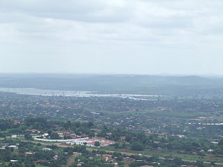
Hartbeespoort Dam is an arch type dam situated in the North West Province of South Africa. It lies in a valley to the south of the Magaliesberg mountain range and north of the Witwatersberg mountain range, about 35 kilometres north west of Johannesburg and 20 kilometres west of Pretoria. The name of the dam means "gorge of the hartebeest" in Afrikaans. This "poort" in the Magaliesberg was a popular spot for hunters, where they cornered and shot the hartebeest. The dam was originally designed for irrigation, which is currently its primary use, as well as for domestic and industrial use. The dam has suffered from a hypertrophic state since the early 1970s. Mismanagement of waste water treatment from urban zones within the Hartbeespoort Dam catchment area is largely to blame, having distorted the food web with over 280 tons of phosphate and nitrate deposits.

The Crooked River is a tributary, 125 miles (201 km) long, of the Deschutes River in the U.S. state of Oregon. The river begins at the confluence of the South Fork Crooked River and Beaver Creek. Of the two tributaries, the South Fork Crooked River is the larger and is sometimes considered part of the Crooked River proper. A variant name of the South Fork Crooked River is simply "Crooked River". The Deschutes River flows north into the Columbia River.

The Pongola or Phongolo River is a river in South Africa. It is a tributary of the Maputo River. It rises near Utrecht in northern KwaZulu-Natal, flows east through Pongola, is dammed at Pongolapoort, and crosses the Ubombo Mountains; then it flows north towards Mozambique, joining the Maputo River.
Nandoni Dam, previously known as the Mutoti Dam, is an earth-fill/concrete type dam in Limpopo province, South Africa. It is located on the Luvuvhu River near the villages of ha-Mutoti and ha-Budeli and ha-Mphego just a few kilometres from Thohoyandou in the district of Vhembe. The dam serves primarily for water supply and its hazard potential has been ranked high (3).

The Tumut River, a perennial stream that is part of the Murrumbidgee catchment within the Murray–Darling basin, is located in the Snowy Mountains and South West Slopes districts of New South Wales, Australia.

The Yarrangobilly River is a perennial river of the Murrumbidgee River catchment within the Murray–Darling basin, located in the Snowy Mountains region of New South Wales, Australia.

Bloemhof Dam is a dam in South Africa. It was originally known as the Oppermansdrif Dam when under construction during the late 1960s. It is located at the confluence of the Vaal River and the Vet River, on the border between the provinces North West and Free State. The dam wall has a total length of 4,270 metres (14,010 ft) The reservoir is very shallow, and therefore needs a large area to mean anything for water storage. The area around the reservoir (dam), has been a protected area, but because it lies on the border between provinces, these became two separate nature reserves. On the North West Province side lies the Bloemhof Dam Nature Reserve, on the Free State side is the Sandveld Nature Reserve.
Boskop Dam is an earth-fill type dam on the Mooi River, near Potchefstroom, North West Province, South Africa. It was constructed in 1959. The main purpose of the dam is for irrigation and domestic usage. Its hazard potential is ranked as high, due to poor maintenance and the development of sink holes.
Pongolapoort Dam, commonly referred to as Lake Jozini, is an arch type dam in northern KwaZulu-Natal, South Africa located on the Phongolo River. The dam is situated 280 km north-east of the port city of Durban. The dam was constructed in 1973 at the eastern end of the narrow gorge separating the Lebombo and Ubombo ranges. The dam mainly serves for irrigation purposes and its hazard potential has been ranked high (3). The Phongolo River is the dams largest feeder as well as the dams only perennial feeder.

The Bushman's River is an east to north-easterly flowing tributary of the Tugela River, in the KwaZulu-Natal province of South Africa. It rises in the Drakensberg Mountain range, with its upper catchment in the Giant's Castle Game Reserve, north of the Giant's Castle promontory. It feeds the Wagendrift Dam and then flows past the town of Estcourt to join the Tugela River near the town of Weenen.

The Eerste River, located in the Western Cape, South Africa, rises on Dwarsberg 60 km east of Cape Town at the head of Jonkershoek. The Eerste River catchment covers the eastern part of the Cape Flats lying to the west of the Hottentots Holland Mountains and south of the Tygerberg where the Kuils River tributary rises east of Kanonkop. The Eerste River is a short river; its length has been given as 40 km. The major tributary, Kuils River, is approximately 30 km long to its point of confluence with the Eerste River.
Disaneng Dam, is an earth-fill type dam on the Molopo River in the Ratlou Local Municipality, near to the border of the Mahikeng Local Municipality and not far from Mmabatho, North West, South Africa. It was established in 1980 and its primary purpose is for irrigation.

Klipvoor Dam is a concrete gravity type dam located on the Moretele River, 55 km north of Brits, North West, South Africa. It was established in 1970. The main purpose of the dam is to serve for irrigation and its hazard potential has been ranked as high (3).

Ångardsvatnet is a lake in the municipality of Oppdal in Trøndelag county, Norway. The 3.24-square-kilometre (1.25 sq mi) lake lies in the Storlidalen valley, about 13 kilometres (8.1 mi) northwest of the village of Lønset and about 35 kilometres (22 mi) west of the village of Oppdal. The lake is about 4.8 kilometres (3.0 mi) long and about 950 metres (3,120 ft) wide. It is surrounded by the Trollheimen mountain range including the mountains Gråfjellet, Kråkvasstind, and Lorthøa to the south and Bårdsgardskammen and Okla to the north. The lake Gjevillvatnet lies in the next valley to the north of Ångardsvatnet.

Buffelspoort is the westernmost of five defiles that cut through the Swartberg Mountain range, situated in the Western Cape province of South Africa. The others are the Seweweekspoort, Die Poort, where the Gamka River transects Die Hel, Meiringspoort, and Snykloof at its eastern extremity.
References
- ↑ List of South African Dams from the Department of Water Affairs
- ↑ Fishing on the Buffelspoort Dam in the North West
This article about a dam or floodgate in South Africa is a stub. You can help Wikipedia by expanding it. |