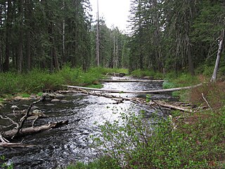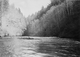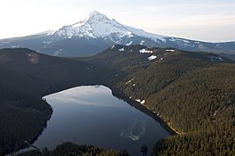
The Willamette River is a major tributary of the Columbia River, accounting for 12 to 15 percent of the Columbia's flow. The Willamette's main stem is 187 miles (301 km) long, lying entirely in northwestern Oregon in the United States. Flowing northward between the Oregon Coast Range and the Cascade Range, the river and its tributaries form the Willamette Valley, a basin that contains two-thirds of Oregon's population, including the state capital, Salem, and the state's largest city, Portland, which surrounds the Willamette's mouth at the Columbia.

The Deschutes River in central Oregon is a major tributary of the Columbia River. The river provides much of the drainage on the eastern side of the Cascade Range in Oregon, gathering many of the tributaries that descend from the drier, eastern flank of the mountains. The Deschutes provided an important route to and from the Columbia for Native Americans for thousands of years, and then in the 19th century for pioneers on the Oregon Trail. The river flows mostly through rugged and arid country, and its valley provides a cultural heart for central Oregon. Today the river supplies water for irrigation and is popular in the summer for whitewater rafting and fishing.

The Sandy River is a 56-mile (90 km) tributary of the Columbia River in northwestern Oregon in the United States. The Sandy joins the Columbia about 14 miles (23 km) upstream of Portland.

The McKenzie River is a 90-mile (145 km) tributary of the Willamette River in western Oregon in the United States. It drains part of the Cascade Range east of Eugene and flows westward into the southernmost end of the Willamette Valley. It is named for Donald McKenzie, a Scottish Canadian fur trader who explored parts of the Pacific Northwest for the Pacific Fur Company in the early 19th century. As of the 21st century, six large dams have been built on the McKenzie and its tributaries.

Mount Tabor is a neighborhood in Southeast Portland that takes its name from the volcanic cinder cone and city park on the volcano that it surrounds, in the U.S. state of Oregon. The name refers to Mount Tabor, Israel. It was named by Plympton Kelly, son of Oregon City pioneer resident Clinton Kelly.

The Bull Run Hydroelectric Project was a Portland General Electric (PGE) development in the Sandy River basin in the U.S. state of Oregon. Originally built between 1908 and 1912 near the town of Bull Run, it supplied hydroelectric power for the Portland area for nearly a century, until it was removed in 2007 and 2008. The project used a system of canals, tunnels, wood box flumes and diversion dams to feed a remote storage reservoir and powerhouse. The entire project was removed because of rising environmental costs. Marmot Dam on the Sandy River was demolished in 2007, and the Little Sandy Dam on the Little Sandy River was taken down in 2008.

The Bull Run River is a 21.9-mile (35.2 km) tributary of the Sandy River in the U.S. state of Oregon. Beginning at the lower end of Bull Run Lake in the Cascade Range, it flows generally west through the Bull Run Watershed Management Unit (BRWMU), a restricted area meant to protect the river and its tributaries from contamination. The river, impounded by two artificial storage reservoirs as well as the lake, is the primary source of drinking water for the city of Portland, Oregon.

Lake Needwood is a 75-acre (300,000 m2) reservoir in Derwood, Maryland, United States. Located east of Rockville, in the eastern part of Montgomery County, it is situated on Rock Creek. The lake was created by damming Rock Creek in 1965 with the goal of providing flood control and reducing soil erosion. Lake Needwood also protects the water quality of the creek by functioning as a retention basin to trap sediment from storm-water runoff.

Mount Tabor is an extinct volcanic vent with a city park on the volcano, located in Portland, Oregon's neighborhood of the same name. The name refers to Mount Tabor, Israel. It was named by Plympton Kelly, son of Oregon City pioneer resident Clinton Kelly.

Applegate Lake is a 988-acre (400 ha) reservoir located in the Rogue River–Siskiyou National Forest about 27 miles (43 km) southwest of Medford in the U.S. state of Oregon. It is 16 miles (26 km) south of Oregon Route 238 along Applegate River Road and slightly north of the Oregon–California border. The lake is an impoundment of the Applegate River about 46 miles (74 km) from its confluence with the Rogue River.

Cougar Dam is a 519-foot (158 m) tall rockfill hydroelectric dam in the U.S. state of Oregon. It has a gated concrete spillway and a powerhouse with two turbines totaling 25 megawatts of electric power.

Blue Lake Regional Park is a public park in Fairview, in the U.S. state of Oregon. The 101-acre (41 ha) park, near the south shore of the Columbia River in Multnomah County, includes many covered and uncovered picnic areas, playing fields for sports such as softball, a cross country course and infrastructure related to lake recreation including swimming, boating, and fishing. Encompassing wooded areas, three ponds, and a wetland in addition to the lake, the park is frequented by migrating birds and other wildlife. Paved paths run through the park, which is near the 40-Mile Loop hiking and biking trail. Park vegetation includes cottonwoods, willows, and other trees and shrubs as well as wetland plants such as cattails.
The Portland Water Bureau is the municipal water department for the city of Portland in the U.S. state of Oregon. The bureau manages a water supply that comes mainly from the Bull Run River in the foothills of the Cascade Range east of the city and secondarily from the Columbia South Shore Well Field near the Columbia River. As of 2023, Mingus Mapps was the city commissioner in charge of the bureau, and the chief administrator is Michael Stuhr. Budgeted departmental revenues for fiscal year 2015–16 included about $157 million for charges for services.

Little Butte Creek is a 17-mile-long (27 km) tributary of the Rogue River in the U.S. state of Oregon. Its drainage basin consists of approximately 354 square miles (917 km2) of Jackson County and another 19 square miles (49 km2) of Klamath County. Its two forks, the North Fork and the South Fork, both begin high in the Cascade Range near Mount McLoughlin and Brown Mountain. They both flow generally west until they meet near Lake Creek. The main stem continues west, flowing through the communities of Brownsboro, Eagle Point, and White City, before finally emptying into the Rogue River about 3 miles (5 km) southwest of Eagle Point.

The Little Sandy River is a tributary, roughly 15 miles (24 km) long, of the Bull Run River in the U.S. state of Oregon. Forming west of Mount Hood in the Mount Hood National Forest, it flows generally west, roughly parallel to the Sandy River to the south. Its entire course lies in Clackamas County, and most of its main stem and tributaries are within the Bull Run Watershed Management Unit (BRWMU), a restricted zone that protects Portland's main water supply.

The South Fork Bull Run River is a tributary, about 6 miles (9.7 km) long, of the Bull Run River in the U.S. state of Oregon. Part of the system that provides drinking water to the city of Portland, it flows generally west through a protected part of the Mount Hood National Forest in Clackamas County. It joins the Bull Run River at Bull Run Reservoir 2, about 8 miles (13 km) from the larger stream's confluence with the Sandy River.

The North Fork Bull Run River is a tributary, about 6 miles (10 km) long, of the Bull Run River in the U.S. state of Oregon. Part of the system that provides drinking water to the city of Portland, it flows generally south through a protected part of the Mount Hood National Forest in Multnomah County. It joins the Bull Run River at Bull Run Reservoir 1.

The Goose Lake Valley is located in south-central Oregon and northeastern California in the United States. It is a high valley at the northwestern corner of North America's Great Basin. Much of the valley floor is covered by Goose Lake, a large endorheic lake that straddles the Oregon–California border. Native Americans inhabited the Goose Lake Valley for thousands of years before explorers arrived in the 19th century. The pioneer wagon route known as the Applegate Trail crossed the Goose Lake Valley on its way to southern Oregon. At the south end of Goose Lake, the Lassen Cutoff separated from the Applegate Trail and headed south toward the Sacramento Valley. Today, Lakeview, Oregon, is the largest settlement in the valley. Livestock ranching and lumber mills are the valley's main commercial activity. The Goose Lake Valley offers a number of recreational opportunities including hang-gliding, hunting, fishing, and birdwatching.
Blazed Alder Creek is a tributary, about 4 miles (6 km) long, of the Bull Run River in the U.S. state of Oregon. Part of the system that provides drinking water to the city of Portland, it flows generally north through a protected part of the Mount Hood National Forest in Clackamas and Multnomah counties. The creek is named after a 24-inch (61 cm) blazed (marked) alder tree that was used as a benchmark during early watershed surveys.

Hills Creek Reservoir, also known as Hills Creek Lake, is an artificial impoundment behind Hills Creek Dam on the Middle Fork Willamette River in the U.S. state of Oregon. The lake is near Oakridge in Lane County about 40 miles (64 km) southeast of Eugene, at the confluence of Hills Creek with the Middle Fork. The reservoir and its watershed lie within the Willamette National Forest.


