Bullion Mountains

Last updated
Bullion Mountains
Relief map of California.png
Red triangle with thick white border.svg
Location of the Bullion Mountains in California [1]
Highest point
Elevation 815 m (2,674 ft)
Geography
Country United States
State California
Region Mojave Desert
District San Bernardino County
Range coordinates 34°22′45.988″N115°56′26.003″W / 34.37944111°N 115.94055639°W / 34.37944111; -115.94055639 Coordinates: 34°22′45.988″N115°56′26.003″W / 34.37944111°N 115.94055639°W / 34.37944111; -115.94055639
Topo map USGS  Lead Mountain

The Bullion Mountains are located in the Mojave Desert of California southeast of the city of Barstow. The mountain range stretches for approximately 50 miles in a northwest-southeasterly direction north of Joshua Tree and Twentynine Palms.

Mojave Desert desert in southwestern United States

The Mojave Desert is an arid rain-shadow desert and the driest desert in North America. It is in the southwestern United States, primarily within southeastern California and southern Nevada, and it occupies 47,877 sq mi (124,000 km2). Very small areas also extend into Utah and Arizona. Its boundaries are generally noted by the presence of Joshua trees, which are native only to the Mojave Desert and are considered an indicator species, and it is believed to support an additional 1,750 to 2,000 species of plants. The central part of the desert is sparsely populated, while its peripheries support large communities such as Las Vegas, Barstow, Lancaster, Palmdale, Victorville, and St. George.

California State of the United States of America

California is a state in the Pacific Region of the United States. With 39.6 million residents, California is the most populous U.S. state and the third-largest by area. The state capital is Sacramento. The Greater Los Angeles Area and the San Francisco Bay Area are the nation's second and fifth most populous urban regions, with 18.7 million and 8.8 million residents respectively. Los Angeles is California's most populous city, and the country's second most populous, after New York City. California also has the nation's most populous county, Los Angeles County, and its largest county by area, San Bernardino County. The City and County of San Francisco is both the country's second-most densely populated major city after New York City and the fifth-most densely populated county, behind only four of the five New York City boroughs.

Barstow, California City in California, United States

Barstow is a city in San Bernardino County, California, United States. The population was 22,639 at the 2010 census. Barstow is located 67 miles (108 km) north of San Bernardino.

Since most of the range lies in the Marine Corps Air Ground Combat Center Twentynine Palms, where live ammunition practices occur, almost the entire mountain range is off-limits to the public. The highest point of the range in the northwestern region is 4,669 feet (1,423) meters.

Marine Corps Air Ground Combat Center Twentynine Palms United States Marine Corps base

The Marine Corps Air Ground Combat Center (MCAGCC), also known as 29 Palms, is the largest United States Marine Corps base. It was a census-designated place (CDP) officially known as Twentynine Palms Base located adjacent to the city of Twentynine Palms in southern San Bernardino County, California. As of the 2000 census, the base had a total population of 8,413. The zip code of the base is 92278; base housing's zip code is 92277. The base covers a total area of 596,288 acres.

Related Research Articles

Twentynine Palms, California City in California, United States

Twentynine Palms is a city in San Bernardino County, California, United States. It was previously called Twenty-Nine Palms.

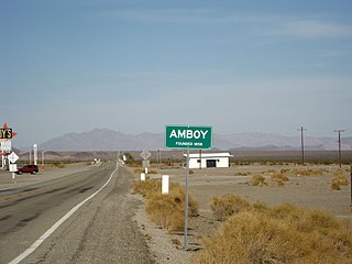
Amboy, California Unincorporated community in California, United States

Amboy is an unincorporated community in San Bernardino County, in California's Mojave Desert, west of Needles and east of Ludlow on historic Route 66. It is roughly 60 miles (97 km) northeast of Twentynine Palms. Prior to 2015, the town's business district contained a post office, a historic restaurant-motel, and a Route 66 tourist shop.

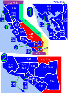
Area codes 760 and 442 area codes for Mono County, California

Area code 760 is a California telephone area code that was split from area code 619 on March 22, 1997. Area code 442 is an overlay of 760 that became effective on November 21, 2009. It encompasses much of the southeastern and southernmost portions of California. The area includes Imperial, Inyo, and Mono counties, as well as portions of San Diego, Riverside, San Bernardino, Los Angeles and Kern counties.

California State Route 62 highway in California

State Route 62 is a state highway in the U.S. state of California.

Coxcomb Mountains mountain range of southern California

The Coxcomb Mountains are a mountain range located in eastern Riverside County, Southern California.

Pinto Mountains

The Pinto Mountains are found in southern California, USA, at the north-central part of Joshua Tree National Park. The range reaches an elevation of 1,390 meters (4,560 ft) southeast of the city of Twentynine Palms. The range is made up of dark gneiss, and the creosote bush is the dominant plant in the area.

Lava Bed Mountains

The Lava Bed Mountains are located in the Mojave Desert in southeastern California, United States. The mountains lie in a northwest-southeasterly direction, and are located almost entirely within the Marine Corps Air Ground Combat Center Twentynine Palms, which is a restricted area. The mountains reach a height of 4,488 feet (1,368 m) above sea level at Argos Mountain, and are found at the northwestern end of the Bullion Mountains. Gays Pass is located at the southern end of the chain, with the Rodman Mountains to the northwest. The Lava Bed Mountains are approximately 11 miles (18 km), and lie in the arid climate zone, characterized by little rainfall.

Turtle Mountains (California)

The Turtle Mountains, are located in northeastern San Bernardino County, in the southeastern part of California.

Morongo Basin region of the inland empire in Mojave Desert, San Bernardino

The Morongo Basin is an endorheic basin and valley region located in eastern San Bernardino County, in Southern California.

Morongo Unified School District school district in California, United States

The Morongo Unified School District (MUSD) is a public education governing body in the Mojave high desert of Southern California. MUSD has more than 1,100 employees who provide educational services to 9,301 students.

Marble Mountains (San Bernardino County) mountain range in California in United States of America

The Marble Mountains are a mountain range in the Eastern Mojave Desert and within Mojave Trails National Monument, in San Bernardino County, California.

Kilbeck Hills

The Kilbeck Hills are a low mountain range in the eastern Mojave Desert, in San Bernardino County, southern California.

Morongo Basin Transit Authority

Morongo Basin Transit Authority is the transit agency that serves the Morongo Basin in San Bernardino County, California. It is a joint powers authority between Yucca Valley, Twentynine Palms, and San Bernardino County

Cleghorn Lakes Wilderness

The Cleghorn Lakes Wilderness is a 33,475-acre (135.47 km2) wilderness area in the southern Mojave Desert. It is located 16 miles (26 km) northeast of Twentynine Palms, California, and 20 miles (32 km) north of Joshua Tree National Park. It is managed by the Bureau of Land Management.

KCLZ is a radio station broadcasting a mainstream rock music format, simulcasting KCLB 93.7 FM Coachella, California. Licensed to Twentynine Palms, California, United States, the station is currently owned by Alpha Media LLC, through licensee Alpha Media Licensee LLC.

The Twenty-Nine Palms Band of Mission Indians of California is a federally recognized tribe of Mission Indians with two reservations, one located near the cities of Indio and Coachella in Riverside County, and the other in the city of Twentynine Palms in San Bernardino County, California. While many scholars regard the tribe as being Luiseño, the tribe itself identifies as being Chemehuevi.

Elizabeth Campbell (1893–1971) was an American archeologist, notable for proposing a much earlier date for the presence of man in the desert Southwest than was generally accepted. She worked with her husband William (Bill) Campbell and first proposed that artifacts found along the shores of Lake Mojave and other Pleistocene lakes and rivers of the desert West were contemporaneous with the presence of water. They showed that there were virtually no sites that were not associated with archaic water sources. They hypothesized that the geologic features associated with the artifacts could be used to date the period of human habitation. This is the first use of what has become known as environmental archaeology.

Wonder Valley, California Unincorporated Community in California, United States

Wonder Valley is a sparsely populated unincorporated community in the Morongo Basin of Southern California's High Desert region, straddling Amboy Road and State Route 62 in San Bernardino County, California, United States, approximately 10 miles (16 km) east of the city of Twentynine Palms.

References