
Brierley Hill is a town and electoral ward in the Metropolitan Borough of Dudley, West Midlands, England, 3 miles (4.8 km) south of Dudley and 1 mile (1.6 km) north of Stourbridge. Part of the Black Country and in a heavily industrialised area, it has a population of 13,935 at the 2011 census. It is best known for glass and steel manufacturing, although the industry has declined considerably since the 1970s. One of the largest factories in the area was the Round Oak Steelworks, which closed down and was redeveloped in the 1980s to become the Merry Hill Shopping Centre. Brierley Hill was originally in Staffordshire.
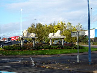
Great Bridge is a historic village and district of Tipton in the Metropolitan Borough of Sandwell in the metropolitan county of the West Midlands, England. It is situated near the towns of Dudley, West Bromwich and Wednesbury.
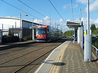
Wednesbury Great Western Street tram stop is a tram stop in Wednesbury, Sandwell, England. It was opened on 31 May 1999 and is situated on West Midlands Metro Line 1. The stop is next to the West Midlands Metro tram depot.

Dudley Port railway station serves the Dudley Port and Great Bridge areas of Tipton, West Midlands, England. Situated on both the Stour Valley Line and Rugby–Birmingham–Stafford line, the station is operated by West Midlands Railway.

Netherton is a town of the Metropolitan Borough of Dudley, 2 miles (3 km) south of Dudley in the West Midlands of England. It was historically part of Worcestershire. The town is part of the Black Country, Netherton is bounded by nature reserves to the east and west, and an industrial area and the Dudley Southern By-Pass to the north.

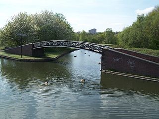
Netherton Tunnel Branch Canal, in the West Midlands county, England, is part of the Birmingham Canal Navigations, (BCN). It was constructed at a 453–foot elevation, the Wednesbury or Birmingham level; it has no locks. The total length of the branch canal is 2.4 miles (3.9 km) and the canal tunnel is 9,081 feet (2,768 m) long.
Dudley Freightliner Terminal was opened on the site of Dudley railway station in November 1967, as one of Freightliner's first rail terminals. It was an instant financial success and by 1981 was one of the most profitable Freightliner terminals in Britain, but Freightliner announced plans to close it and transfer the staff to the less successful Birmingham terminal. These plans were shelved in 1983 but resurfaced in 1986, with the terminal finally closing in September 1989. Trains continued to pass the site of the Freightliner terminal until the Wednesbury to Round Oak section of the South Staffordshire Line and Oxford, Worcester & Wolverhampton line closed in March 1993.

The Dudley Canal is a canal passing through Dudley in the West Midlands of England. The canal is part of the English and Welsh network of connected navigable inland waterways and forms part of the popular Stourport Ring narrowboat cruising route.

Dudley railway station was a railway station in Dudley, Worcestershire, England, built where the Oxford-Worcester-Wolverhampton Line and the South Staffordshire Line diverged to Wolverhampton and Walsall and Lichfield respectively.

Brettell Lane railway station was a station on the Oxford-Worcester-Wolverhampton Line which served the town of Brierley Hill in England.

Brierley Hill railway station was a station on the Oxford-Worcester-Wolverhampton Line serving the town of Brierley Hill in England.
Great Bridge North railway station was a station on the South Staffordshire Line that served the village of Great Bridge and town of Tipton in Staffordshire, England.

Wednesbury Town railway station was a station on the South Staffordshire Line.

Windmill End railway station was a station on the former Great Western Railway's Bumble Hole Line between Blowers Green and Old Hill.
The present day Bumble Hole Branch Canal and Boshboil Branch surround Bumble Hole, a water-filled clay pit, in Bumble Hole and Warren's Hall Nature Reserve, Rowley Regis, West Midlands, England. They formed a looped part of the original Dudley No. 2 Canal until the opening of the Netherton Tunnel in 1858 when the loop was bypassed by a new cut, in line with the new tunnel. Part of the bypassed canal loop, which surrounds Bumble Hole, is now in-filled giving access to the pool of Bumble Hole. An area next to the Bumble Hole and Dudley canals is the Bumble Hole Local Nature Reserve.

Baptist End railway station was a halt on the former Great Western Railway's Bumble Hole Line between Blowers Green and Old Hill.

The Pensnett Canal, also called Lord Ward's Canal was a private 1.25 miles (2 km) long canal near Brierley Hill, West Midlands, England, which opened in 1840 and served the industrial enterprises of Lord Dudley's Estate. The engineer was Mathew Frost. Since its closure to navigation in 1950, much of it has been lost by overbuilding, but a small section at its junction with the Dudley Canal was restored in 1995, and the section through Brierley Hill remains in water, although it is polluted and not navigable.

Bumble Hole Local Nature Reserve is situated in the Netherton area of Dudley Metropolitan Borough in the county of West Midlands, England. This former industrial area now features canals, ponds, grassland and wooded areas. The reserve lies adjacent to the Warren's Hall Local Nature Reserve. It was declared a local nature reserve in 1996.

Warren's Hall Country Park is a local nature reserve situated in Sandwell Metropolitan Borough in the West Midlands of England. It lies next to Bumble Hole Local Nature Reserve. It includes ponds, canals, grassland, small wooded areas and the entrance to Netherton Canal Tunnel.
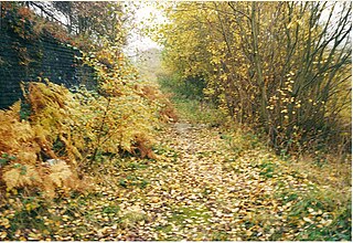
Netherton railway station served the town of Netherton, Dudley, England, from 1852 to 1878 on the Oxford, Worcester and Wolverhampton Railway.
