
The Unadilla River is a 71-mile-long (114 km) river in the Central New York Region of New York State. The river begins northeast of the hamlet of Millers Mills and flows generally south to the village of Sidney, where it converges with the Susquehanna River, which drains into the Chesapeake Bay, a bay of the Atlantic Ocean.

Canadarago Lake is a 1,917-acre (7.76 km2) lake located in Otsego County, New York and is the source of Oaks Creek. The Village of Richfield Springs is located at the lake's northern end. It is the second largest lake in Otsego County, lying to the west of and parallel to the larger Otsego Lake. The lake's name is also spelled "Candajarago Lake" or "Caniadaraga Lake".

Oriskany Creek is a 33-mile-long (53 km) river in New York, United States. It rises in Madison County and flows northeastward, primarily through Oneida County. Oriskany Creek is a tributary of the Mohawk River and therefore part of the Hudson River watershed.

The West Canada Creek is a 76-mile-long (122 km) river in upstate New York, United States. West Canada Creek is an important water way in Hamilton, Oneida, and Herkimer counties, draining the south part of the Adirondack Mountains before emptying into the Mohawk River near the Village of Herkimer. The name "Canada" is derived from an Iroquoian word for "village" (Kanata).

East Canada Creek is a 34.6-mile-long (55.7 km) river in upstate New York, United States. It is a tributary of the Mohawk River and flows southward from New York's Adirondack Park. The name "Canada" may be derived from the St. Lawrence Iroquoian word Kanata, meaning "village"; the name may also refer to the creek's importance as a trail to Canada in colonial times.
Cripple Creek is a river in southern Herkimer County and northern Otsego County in the state of New York. It begins northeast of Warren and flows through Weaver Lake then Young Lake before flowing into Otsego Lake south of Springfield Center. Was formally referred to as Lawyers Creek.
Herkimer Creek is a river in Otsego County in the state of New York. It begins west-southwest of the Hamlet of Richfield and northwest of the Hamlet of Dogtown and begins flowing mostly southeast before flowing into Canadarago Lake northeast of the Hamlet of Schuyler Lake.

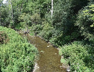
Nowadaga Creek is a river in Herkimer County in the state of New York. The basin drains portions of the towns of Danube, Stark, and Little Falls, as well as a small portion of the town of Warren, in southern Herkimer County before converging with the Erie Canal in Indian Castle, New York. The drainage basin is approximately 49 percent forested. The creek has an average slope of 1.7 percent over its entire stream length of 10.0 miles. On a 1790 land patent map it is spelled "Inchanando Creek".
Fulmer Creek is an 11.5-mile-long (18.5 km) river that flows into the Mohawk River in Mohawk, New York. The creek derives its name from the "Fulmer" family, who bought land through the Burnetsfield patent of 1725, in which lands on the present village site were granted out.

Steele Creek is a river in Herkimer County in the state of New York. The creek begins in an unnamed swamp south of Cedarville, and flows in a northeast direction before emptying into the Mohawk River in the village of Ilion. Steele Creek travels through the Ilion Gorge and alongside NY-51 for most of its length. Steele Creek derives its name from Rudolph Stahl, who built the first grist mill in Ilion along the creek.
Sterling Creek is a river located in Herkimer County in the U.S. State of New York. It flows into the Mohawk River east-southeast of the Hamlet of West Schuyler.
Pratt Creek is a river in Herkimer County in the state of New York. It flows into the Mohawk River near Frankfort.
Crum Creek, also known as Cathatachua Creek, is a river in Herkimer County in the state of New York. It begins north of Little Falls and flows in a generally southeast direction before flowing into the Mohawk River in the hamlet of East Creek.

Sprite Creek is a river in Fulton County and Herkimer County in the U.S. State of New York. It begins at Canada Lake northwest of the Hamlet of Caroga Lake, and flows through Lily Lake before converging with the East Canada Creek northeast of the Village of Dolgeville.
Ohisa Creek is a river in Herkimer County in the state of New York. The creek begins southeast of Paines Hollow and flows southeast then curves north and eventually converges with Nowadaga Creek in Newville.

North Lake is a lake located by Atwell, New York and is the source of the Black River. North Lake is one of several lakes in Herkimer County that has a medium acid content, and is therefore not a big fish producer. The fish species present are tiger muskie, white sucker, perch, and bullhead. Boating is permitted, limited to a small gravel based boat launch in Atwell.
Otsquene Creek is a river in Herkimer County and Montgomery County in the U.S. State of New York. It enters Otsquago Creek by Valley Brook, New York. On the 1905 Fulton and Montgomery County Atlas it is referred to as Crab-skill Creek.
Bridenbecker Creek is a river in Herkimer County in the state of New York. It flows into the Mohawk River by Frankfort. Bridenbecker Creek is named after the Bridenbecker family who had a farm in the area in the 1800s.
Knapp Brook is a river that flows into the Mohawk River by West Schuyler, New York.
East Herkimer is a hamlet and census-designated place (CDP) in the town of Herkimer in Herkimer County, New York, United States. It was first listed as a CDP prior to the 2020 census.

