
Vilshofen an der Donau is a town in the German district of Passau.

Neufahrn bei Freising is a municipality in the district of Freising, in Bavaria, Germany. It has about 20,000 inhabitants and is located near the river Isar, 12 km southwest of Freising and 20 km northeast of Munich.
Gefrees is a town in the district of Bayreuth, in Bavaria, Germany. It is situated in the Fichtelgebirge, 21 km northeast of Bayreuth. It was the site of a battle during the Napoleonic Wars.

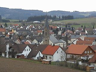
Herrieden is a town in the district of Ansbach and situated in the Middle Franconia region of Bavaria, Germany. It lies along the upper Altmühl river, about 9 km (6 mi) southwest of the city of Ansbach, 47 km southwest of the city of Nürnberg, 95 km east of Heilbronn and 144 km northwest of Munich.

Wassertrüdingen is a town in the district of Ansbach, Middle Franconia, Bavaria, Germany. It is between the Hesselberg, the only Franconian mountain with a view on the Alps, the wooded heights of the Oettinger Forest and the foothills of the Hahnenkamm. The Fränkisches Seenland recreation area is 15 kilometers away. Altentrüdingen, Fürnheim, Geilsheim, Obermögersheim, Reichenbach und Schobdach are part of Wassertrüdingen

Rottenburg an der Laaber is a town in the district of Landshut, in Bavaria, Germany. It is situated on the river Große Laber, 21 km northwest of Landshut.

Bruckberg is a municipality in the district of Ansbach in Bavaria in Germany.

Dombühl is a municipality in the district of Ansbach in Bavaria in Germany.

Heroldsbach is a municipality in the district of Forchheim in Bavaria in Germany.
Langensendelbach is a municipality in the district of Forchheim in Bavaria in Germany with a population of over 3100. The village Bräuningshof is a part of Langensendelbach.
Bad Bayersoien is a German municipality in the district of Garmisch-Partenkirchen, in Bavaria.

Mainleus is a municipality in the district of Kulmbach in Bavaria in Germany, the site of a post World War II American sector displaced person camp.

Waakirchen is a municipality in the district of Miesbach in Bavaria in Germany. At the end of World War II, Japanese American soldiers rescued concentration camp victims on a death march at this village.

Breitenbrunn is a municipality in the district of Neumarkt in Bavaria in Germany.

Mühlhausen is a municipality in the district of Neumarkt in Bavaria in Germany. It lies in the Sulz River valley.

Leuchtenberg is a municipality in the district of Neustadt an der Waldnaab in Bavaria, Germany, essentially a suburb of nearby Weiden in der Oberpfalz, and a larger historical region in the Holy Roman Empire governed by the Landgraves of Leuchtenberg.

Brannenburg is a municipality in the district of Rosenheim in Bavaria in Germany. There is a train station is located in Brannenburg.

Thiersheim is a municipality in the district of Wunsiedel in Bavaria in Germany.

Stammham is a municipality in the district of Eichstätt in Bavaria in Germany.

Staudach-Egerndach is a municipality in the district of Traunstein in Bavaria, Germany.


