Dietenhofen

Last updated
Dietenhofen
Schlossstrasse 5 (Dietenhofen) 003.jpg
Dietenhofen Palace, seat of the local history museum
Wappen Dietenhofen.svg
Location of Dietenhofen within Ansbach district
Dietenhofen in AN.svgUnterer WaldAdelshofenBruckbergBurkEhingenLichtenauMerkendorfSchopflochWeidenbachWettringenAurach
Germany adm location map.svg
Red pog.svg
Dietenhofen
Bavaria location map.svg
Red pog.svg
Dietenhofen
Coordinates: 49°24′10″N10°41′10″E / 49.40278°N 10.68611°E / 49.40278; 10.68611
Country Germany
State Bavaria
Admin. region Mittelfranken
District Ansbach
Government
   Mayor (202026) Rainer Erdel [1]
Area
  Total63.96 km2 (24.70 sq mi)
Elevation
353 m (1,158 ft)
Population
 (2022-12-31) [2]
  Total5,716
  Density89/km2 (230/sq mi)
Time zone UTC+01:00 (CET)
  Summer (DST) UTC+02:00 (CEST)
Postal codes
90599
Dialling codes 09824
Vehicle registration AN
Website www.dietenhofen.de

Dietenhofen is a municipality in the district of Ansbach in Bavaria, Germany.

Contents

Geography

This small village is located in the Franconian Heights about 28 km west of Nuremberg, 14 km north east of Ansbach and 38 km east of Rothenburg o.d. Tauber.
The river Bibert flows through the valley community and gives its name to the Bibert walking and bicycle path. Apart from the main village, there are 27 subdivisions which also belong to Dietenhofen.

These are:

  • Adelmannsdorf
  • Andorf
  • Dietenholz
  • Ebersdorf
  • Frickendorf
  • Götteldorf
  • Haunoldshofen
  • Herpersdorf
  • Höfen
  • Hörleinsdorf
  • Kehlmünz
  • Kleinhabersdorf
  • Kleinhaslach
  • Lentersdorf
  • Leonrod
  • Methlach
  • Moosmühle
  • Münchzell
  • Neudietenholz
  • Neudorf
  • Oberschlauersbach
  • Rothleiten
  • Rüdern
  • Seubersdorf
  • Stolzmühle
  • Walburgswinden
  • Warzfelden


History

The Doodleman's Fountain with a half-timbered house in the background Dietenhofen Tutemann Brunnen.jpg
The Doodleman’s Fountain with a half-timbered house in the background

It’s a good idea to start the history of Dietenhofen with the legend behind its name.
Many years ago three noble maidens who had got lost in the area were saved by following the sound of a shepherd’s horn. They were so grateful that they had a chapel built where they met him, and called the place Dudenhofen. This later became “Dietenhofen”.
One of the most important monuments in Dietenhofen is the St. Andreas Church, which was built about 1000 AD. The church tower was added in the year 1468. There are some interesting old graves in the church and the magnificent old baroque altar is certainly worth seeing.
A few hundred metres away from the church you can find the local history museum which has also played an important role in Dietenhofen’s history. It was built in 1235 and was surrounded by a moat. It was home to Rüdiger von Dietenhofen. In 1523 the building was totally destroyed by fire. In 1822 it was rebuilt, bought by the local government and used as the village school.
The history would not be complete without mentioning the ruins in Leonrod (a nearby sleepy hamlet). The original building was constructed in 1218 and was also surrounded by a moat. It was home to the Baron of Leonrod and his family until it was accidentally burned down by their own servants in 1651.

Dietenhofen is mentioned in History of the Lombards by Paul the Deacon in AD 785, who also calls the place Villa Totonis.

Economy

Dietenhofen enjoys a healthy economic situation and has as many jobs to offer, as it has inhabitants. The Dietenhofen firms Playmobil/Lechuza (Geobra Brandstätter GmbH), Herpa and Branofilter are global players.

Politics

The local council includes 20 voluntary members.

Dietenhofen has two twin towns:

  • Flavignac in France
  • Zschorlau in Saxony/Germany

Exchanges take place regularly and lasting friendships have been established.

Leisure and culture

Dietenhofen has a recently renovated indoor swimming pool and a sports hall. There are also some playing fields.
The numerous clubs and music groups on offer make sure that there is something for everybody. Cultural events take place regularly.

Related Research Articles

<span class="mw-page-title-main">Buchbrunn</span> Municipality in Bavaria, Germany

Buchbrunn is a municipality in the district of Kitzingen, Lower Franconia, Bavaria, Germany. It is placed in the Bayrische Planungsregion 2.

<span class="mw-page-title-main">Roth, Bavaria</span> Town in Bavaria, Germany

Roth is a town in Bavaria, Germany, the capital of the Roth District. It is located about 25 km south of Nuremberg.

<span class="mw-page-title-main">Roßtal</span> Municipality in Bavaria, Germany

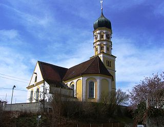
Roßtal is a market town in the district of Fürth, Bavaria, Germany. As of 2020 it had a population of 10,127. It has a primary school and a secondary school. The church is named St. Laurentius and was built from 1025 to 1042.

<span class="mw-page-title-main">Waldkirchen</span> Town in Bavaria, Germany

Waldkirchen is the biggest town in the district of Freyung-Grafenau in Germany.

<span class="mw-page-title-main">Dettelbach</span> Town in Bavaria, Germany

Dettelbach is a town in the district of Kitzingen in the Regierungsbezirk Unterfranken in Bavaria, Germany. It is situated on the right bank of the Main, 20 km east of Würzburg, and 8 km north of Kitzingen. It includes neighboring villages as administrative subdivisions, namely Bibergau, Brück, Dettelbach-Bahnhof, Effeldorf, Euerfeld, Mainsondheim, Neuses am Berg, Neusetz, Schernau und Schnepfenbach.

<span class="mw-page-title-main">Leutershausen</span> Town in Bavaria, Germany

Leutershausen is a municipality in the district of Ansbach, in Bavaria, Germany. It is situated on the river Altmühl, 12 km west of Ansbach.

<span class="mw-page-title-main">Ornbau</span> Town in Bavaria, Germany

Ornbau is a walled town in the district of Ansbach, in Bavaria, Germany. It is situated on the river Altmühl, 15 km southeast of Ansbach.

<span class="mw-page-title-main">Windsbach</span> Town in Bavaria, Germany

Windsbach is a town in the district of Ansbach, in Bavaria, Germany. It is situated 20 km east of Ansbach, and 29 km southwest of Nuremberg.

<span class="mw-page-title-main">Wittelshofen</span> Municipality in Bavaria, Germany

Wittelshofen is a municipality in the district of Ansbach in Bavaria in Germany.

<span class="mw-page-title-main">Petershausen</span> Municipality in Bavaria, Germany

Petershausen is a municipality in the district of Dachau in Bavaria in Germany.

<span class="mw-page-title-main">Vierkirchen</span> Municipality in Bavaria, Germany

Vierkirchen is a municipality in the district of Dachau in Bavaria in Germany.

<span class="mw-page-title-main">Althegnenberg</span> Municipality in Bavaria, Germany

Althegnenberg is a municipality in the district of Fürstenfeldbruck in Bavaria in Germany. The municipality consists of the villages Althegnenberg, Hörbach and Lindenhof.

<span class="mw-page-title-main">Castell, Bavaria</span> Municipality in Bavaria, Germany

Castell is a municipality in the district of Kitzingen in Bavaria in Germany. It was the seat of the Counts of Castell. Today it is part of the municipal association Wiesentheid. It has around 800 inhabitants.

<span class="mw-page-title-main">Roden, Bavaria</span> Municipality in Bavaria, Germany

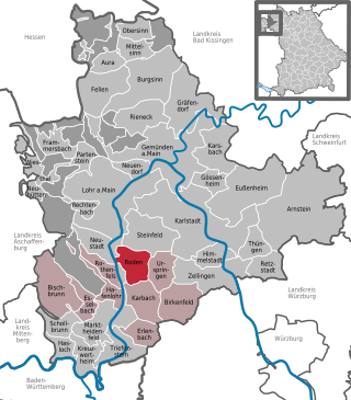
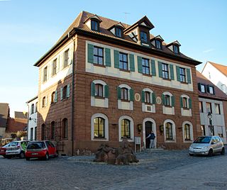
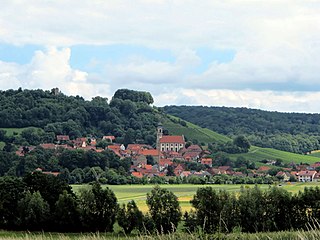
Roden is a community in the Main-Spessart district in the Regierungsbezirk of Lower Franconia (Unterfranken) in Bavaria, Germany and a member of the Verwaltungsgemeinschaft of Marktheidenfeld.

<span class="mw-page-title-main">Kellmünz</span> Municipality in Bavaria, Germany

Kellmünz(official: Kellmünz a.d.Iller) is a municipality in the district of Neu-Ulm in Bavaria in Germany.

<span class="mw-page-title-main">Pleinfeld</span> Municipality in Bavaria, Germany

Pleinfeld is a Franconian municipality and market town in the Weißenburg-Gunzenhausen district, in the German state of Bavaria. It is situated in the Metropolitan Area of Nuremberg and in the Franconian Lake District. Pleinfeld is a nationally recognized recreation area.

<span class="mw-page-title-main">Weichs</span> Municipality in Bavaria, Germany

Weichs is a municipality in the district of Dachau in Bavaria in Germany. There are four main villages in the municipality: Weichs, Aufhausen, Ebersbach, and Fränking. In addition, there are several smaller villages: Albertshof, Biechlhof, Breitenwiesen, Daxberg, Edenholzhausen, Edenpfaffenhofen, Erlbach, Erlhausen, Hölzböck, Jedenhofen, and Zillhofen.

<span class="mw-page-title-main">Leonrod (Dietenhofen)</span> Ortsteil of Dietenhofen in Bavaria, Germany

Leonrod is a village in the borough of the market town of Dietenhofen in the district of Ansbach, Middle Franconia, Germany.

<span class="mw-page-title-main">Leonrod Castle</span>

Leonrod Castle, also called Lewenrode Castle, is a ruined water castle on a manmade lake in the Bibert valley on the edge of the parish of Leonrod in the market town of Dietenhofen in Ansbach county in the German state of Bavaria.

<span class="mw-page-title-main">Weinzierlein</span> Ortsteil of Zirndorf in Bavaria, Germany

Weinzierlein is a village in the town of Zirndorf in the Central Franconian district of Fürth in Bavaria, Germany.

References