
Franconia is a region of Germany, characterised by its culture and East Franconian dialect. Franconia is made up of the three Regierungsbezirke of Lower, Middle and Upper Franconia in Bavaria, the adjacent, Franconian-speaking South Thuringia, south of the Thuringian Forest—which constitutes the language boundary between Franconian and Thuringian—and the eastern parts of Heilbronn-Franconia in Baden-Württemberg.
Ansbach is a Landkreis (district) in Bavaria, Germany. It surrounds – but does not include – the town of Ansbach; nonetheless the administrative seat of the district is located in Ansbach. It is the district with the largest area in Bavaria. At the end of December 2022, the district population was 188,623.

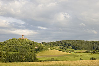
Neustadt an der Aisch is a small town of around 13,000 inhabitants in the northern part of Bavaria (Germany), within the Franconian administrative region Middle Franconia. It is the district town of the district Neustadt (Aisch)-Bad Windsheim.

Dietenhofen is a municipality in the district of Ansbach in Bavaria, Germany.

Neustadt am Main is a community in the Main-Spessart district in the Regierungsbezirk of Lower Franconia (Unterfranken) in Bavaria, Germany and a member of the Verwaltungsgemeinschaft Lohr am Main.

Gerhardshofen is a municipality in the district of Neustadt (Aisch)-Bad Windsheim in the administrative region of Middle Franconia in northern Bavaria in Germany.

Rotenhan Castle is a castle ruin about two kilometres north of the village of Eyrichshof in Lower Franconia in the south German state of Bavaria. Eyrichshof lies within the borough of Ebern in the district of Haßberge. The castle is the ancestral home (Stammsitz) of the House of Rotenhan, a family of imperial knights.

The Nuremberg–Würzburg Railway is a German trunk line railway in northern Bavaria, connecting the city of Nuremberg with Würzburg, the two largest cities in Franconia, and passing through Fürth, Neustadt an der Aisch and Kitzingen. In addition to hourly Regional-Express trains and numerous freight trains, it is served by Intercity-Express trains during the day at half-hourly intervals with some gaps.

The Steigerwald is a hill region up to 498.5 m above sea level (NHN) in the Bavarian-Franconian part of the South German Scarplands between Würzburg and Nuremberg. It is part of the Keuper Uplands, and within it, it is continued to the north-northeast and right of the river Main, by the Haßberge, and to the south-southwest by the Franconian Heights. Part of the region is a designated as the Steigerwald Nature Park.

Hoheneck Castle is a medieval castle above Ipsheim and also a district of the municipality of Ipsheim in the Landkreis Neustadt (Aisch)-Bad Windsheim in Middle Franconia in Bavaria, Germany. Since 1984, the youth castle serves as an educational institution of the Youth Council of the city of Nuremberg.
Tragelhöchstädt is a village in the municipality of Uehlfeld in the district of Neustadt (Aisch)-Bad Windsheim in Bavaria in Germany.
A Ganerbenburg is a castle occupied and managed by several families or family lines at the same time. These families shared common areas of the castle including the courtyard, well, and chapel, whilst maintaining their own private living quarters. They occurred primarily in medieval Germany.

Altenstein Castle is a ruined castle in Altenstein in the district of Haßberge in Lower Franconia, Germany. The family seat of the lords of Stein zu Altenstein, which died out in the 19th century, is located 40 kilometres north of the city of Bamberg and, since the end of the 20th century, has been managed by the district of Haßberge. The castle was renovated around the turn of the millennium.

Leonrod Castle, also called Lewenrode Castle, is a ruined water castle on a manmade lake in the Bibert valley on the edge of the parish of Leonrod in the market town of Dietenhofen in Ansbach county in the German state of Bavaria.

The Franconian Rake is the name given to the coat of arms of the region of Franconia in Germany. It is described heraldically as per fess dancetty of three points gules and argent. The points represent a stylised heraldic rake.
The Franconian Heights are a hill ridge, up to 554 m above sea level (NN), in Bavaria and Baden-Württemberg in South Germany.

Thuisbrunn Castle is located centrally within the parish of Thuisbrunn in the municipality of Gräfenberg in the Bavarian province of Upper Franconia. After having been destroyed and rebuilt several times, the castle is now in private ownership.

The burgstall of Wolkenstein Castle is the site of a late medieval aristocratic castle in the village of Wolkenstein, in the borough of Ebermannstadt in the county of Forchheim in the German state of Bavaria. The burgstall is in private hands and may not be visited.

Schloss Kunreuth is situated on the northwestern edge of the eponymous village of Kunreuth which is part of the collective municipality of Gosberg in the county of Forchheim, in the province of Upper Franconia in the south German state of Bavaria.

Weinzierlein is a village in the town of Zirndorf in the Central Franconian district of Fürth in Bavaria, Germany.


