Red Moor is a nature reserve and Site of Special Scientific Interest (SSSI), noted for its biological characteristics, near Lanlivery in mid Cornwall, England, UK.

Rosenannon Downs is a nature reserve in mid Cornwall, England, UK, being designated Rosenannon Bog and Downs Site of Special Scientific Interest (SSSI), noted for its biological characteristics. The site supports a wide variety of flora and fauna and includes Bronze Age barrows. Conservation work is carried out on the site by the owners, the Cornwall Wildlife Trust.

Bewick and Beanley Moors is the name given to a Site of Special Scientific Interest (SSSI) in north Northumberland, in the north-east of England. The moors are asserted to be of national importance by Natural England for the extent, quality and diversity of upland types including heaths, fens, wet grassland, flushes, mires and blanket bogs, together creating an extensive mosaic habitat supporting an exceptional community of amphibians. The moors are important, too, for their relict juniper woodland and scrub.

Moine Mhòr encompasses a large area of raised bog in the Kilmartin Glen area of Argyll and Bute, Scotland. As well as raised bog there are areas of saltmarsh, brackish grassland, alder carr, fen and woodland, and the variety of habitats at Moine Mhòr provide important habitats for a variety of animal and plant species. The area was declared a national nature reserve (NNR) in 1987, and is now owned and managed by NatureScot. According to NatureScot lowland raised bogs like Moine Mhòr are some of the rarest and most threatened natural wildlife habitats in Europe, due to removal of peat, afforestation and reclamation of farmland.

Whitelee Moor is nature reserve of the Northumberland Wildlife Trust, in Northumberland, England, near Carter Bar. A large part of the moor is blanket bog.
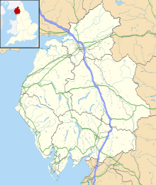
Shap Fells is a Site of Special Scientific Interest part of which is within the Lake District National Park in Cumbria, England. It is located near the eastern boundary of the park, with one section to the west of the A6 road and another section to the east of this road. Throughout the protected area there are areas of blanket bog. Shap Fells was designated as a Site of Special Scientific Interest because of the range of acid grassland types, the diversity of upland birds and also because of geological features. Shap Pink Quarry is included in the western section of this protected area
Bowness Common is a Site of Special Scientific Interest (SSSI) between Cardurnock and Glasson in Cumbria, England. This protected area includes South Solway Mosses National Nature Reserve. Bowness Common SSSI also includes the southern section of Campfield Marsh Nature Reserve, managed by the Royal Society for the Protection of Birds.

Harbottle Moors is a Site of Special Scientific Interest (SSSI) within Northumberland National Park, in Northumberland, England. It is located near the village of Alwinton. The River Coquet forms the northern border of this protected area.
Otterburn Mires is a Site of Special Scientific Interest made up of eight separate patches of land. It is located within Northumberland National Park, in Northumberland, England, 3km east of Byrness,.
Turners Puddle Heath is a Site of Special Scientific Interest north of Wool, near Bovington in Dorset, England. This protected area is located between the River Piddle and the River Frome. This protected area is within the Dorset Heathlands Ramsar site.
Haugh Wood is a Site of Special Scientific Interest near Woolhope in Herefordshire, England. The protected area is recognised for its diversity of its insects. The Forestry Commission has provided waymarked butterfly trails in this protected area.
Holystone Burn Woods is a Site of Special Scientific Interest (SSSI) within Northumberland National Park in Northumberland, England. It is located near the village of Holystone. The protected area includes part of the valley along which flows the stream called Holystone Burn. Part of the protected area is managed by the Northumberland Wildlife Trust.
Lampert Mosses is a Site of Special Scientific Interest within Northumberland National Park, Northumberland, England. It is located 8km north of the town of Haltwistle. The western boundary of this protected area largely follows the valley of the River Irthing. The protected area contains exceptional blanket bog over deep peat.
Whitfield Moor, Plenmeller and Asholme Commons is a Site of Special Scientific Interest in the North Pennines in Northumberland, England. This protected area is located south of Haltwistle and includes part of the Bellister Castle estate and parts of the Williamston estate and Whitfield estate.
Holystone North Wood is a Site of Special Scientific Interest (SSSI) in Northumberland National Park, Northumberland, England. It is located near the village of Holystone. The woodland was historically an oak coppice.
Muckle Moss is a Site of Special Scientific Interest (SSSI) and a National Nature Reserve located near Bardon Mill in Northumberland, England. Muckle Moss is a mire over deep peat, and its boundaries include Blackdyke Plantation.
Irthing Gorge is a Site of Special Scientific Interest on the border between the counties of Northumberland and Cumbria, in England. It is located on the south-western boundary of Northumberland National Park where the River Irthing flows near the village of Gilsland. This protected has an exceptional mixture of habitats, including hillside woodland, seepage areas and bare rock. The gorge here cuts through moorland.
Buttermere Fells is a Site of Special Scientific Interest (SSSI) within Lake District National Park in Cumbria, England. The protected area includes many of the hills and mountains between the Buttermere lake valley near the village of Buttermere and the River Derwent valley near the village of Braithwaite. This protected area includes the mountains of Grasmoor, Crag Hill, Causey Pike and Hindscarth. The protected area includes much of the North Western Fells. This protected area contains exceptional examples of montane dwarf shrub heath communities.
Duddon Valley Woodlands is a Site of Special Scientific Interest within the Lake District National Park in Cumbria, England. This protected area comprises eight large patches of woodland along the valley of the River Duddon. The northernmost part of this protected area is near Seathwaite and southern most at Duddon Bridge. This protected area has an exceptional diversity of moss species and also has a population of the common dormouse.
Greendale Mires is a Site of Special Scientific Interest (SSSI) in the Lake District National Park in Cumbria, England. It is located near the hamlet of Greendale on the western side of Wast Water, beneath Buckbarrow fell. This protected area has exceptional peatland habitat.