Schafstädt was a municipality in the Saalekreis district, in Saxony-Anhalt, Germany. It is situated approximately 17 km southwest of Halle (Saale). Since January 2008, it is part of the town Bad Lauchstädt.

This is a list of the extreme points of Azerbaijan, the points that are farther north, south, east or west than any other location.
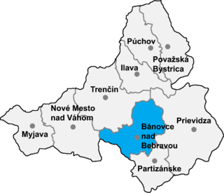
Uhrovské Podhradie is a village and municipality in Bánovce nad Bebravou District in the Trenčín Region of north-western Slovakia. The village is situated close to the ruins of a Roman castle Uhrovec.

Noord-Sleen is a village in the Netherlands and it is part of the Coevorden municipality in Drenthe. It has an altitude of 11 meters (39 feet) and a population of about 460.
La Puebla de los Infantes is a city located in the province of Seville, Spain. According to the 2005 census (INE), the city has a population of 3263 inhabitants.

Ceclavín is a municipality located in the province of Cáceres, Extremadura, Spain. According to the 2005 census (INE), the municipality has a population of 2115 inhabitants.

Bobota is a commune located in Sălaj County, Romania. It is composed of three villages: Bobota, Derșida (Kisderzsida) and Zalnoc (Zálnok).

Sitowiec is a village in the administrative district of Gmina Koronowo, within Bydgoszcz County, Kuyavian-Pomeranian Voivodeship, in north-central Poland. It lies 14 kilometres (9 mi) north-west of Koronowo and 34 km (21 mi) north-west of Bydgoszcz.
Znoski is a village in the administrative district of Gmina Mońki, within Mońki County, Podlaskie Voivodeship, in north-eastern Poland. It lies approximately 3 kilometres (2 mi) south-west of Mońki and 40 km (25 mi) north-west of the regional capital Białystok.
Pasierbiec is a village in the administrative district of Gmina Limanowa, within Limanowa County, Lesser Poland Voivodeship, in southern Poland. It lies approximately 8 kilometres (5 mi) north-west of Limanowa and 46 km (29 mi) south-east of the regional capital Kraków.
Płaciszewo is a village in the administrative district of Gmina Glinojeck, within Ciechanów County, Masovian Voivodeship, in east-central Poland. It lies approximately 9 kilometres (6 mi) south-east of Glinojeck, 21 km (13 mi) south-west of Ciechanów, and 74 km (46 mi) north-west of Warsaw.
Wola Ostaszewska is a village in the administrative district of Gmina Sońsk, within Ciechanów County, Masovian Voivodeship, in east-central Poland. It lies approximately 7 kilometres (4 mi) east of Sońsk, 17 km (11 mi) south-east of Ciechanów, and 63 km (39 mi) north of Warsaw.
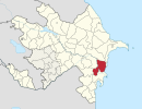
Qırmızı Şəfəq is a village in the municipality of Yenikənd in the Neftchala Rayon of Azerbaijan.
Sankarpur is a village development committee in Kanchanpur District in the Mahakali Zone of south-western Nepal. At the time of the 1991 Nepal census it had a population of 6538.
Muncuqlu is a village in the municipality of Çatax in the Tovuz Rayon of Azerbaijan.

The Pirsaat is a river in Azerbaijan which flows through Ismailli, Shamakhi and Salyan Rayons. Length - 199 km, basin area - 2,280 km2. The river is fed by snow, rain and groundwater. Its largest tributary is Zoghalava.
Oued Cheham is a town and commune in Guelma Province, Algeria. According to the 1998 census it has a population of 11,795.
Shahriston is a town and jamoat in north-west Tajikistan. It is located in Shahriston District in Sughd province. It is the administrative center of Shahriston District, in the central part of Sughd province. The jamoat has a total population of 16,295.