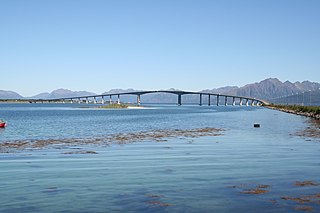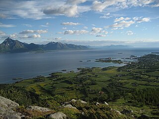
Hadsel is a municipality in Nordland county, Norway. It is part of the traditional district of Vesterålen. The administrative centre of the municipality is the town of Stokmarknes. Other villages in Hadsel include Fiskebøl, Gjerstad, Grønning, Grytting, Hanøyvika, Hennes, Kaljord, Melbu, Sanden, and Sandnes.

Melbu is a village in Hadsel Municipality in Nordland county, Norway. The village is located on the island of Hadseløya on the northern shore of the Hadselfjorden. Melbu is one of two population centres on the island of Hadseløya, and it is called "The Pearl of Vesteraalen". The other being the town of Stokmarknes in the north. Melbu is host to the annual Sommer-Melbu festival. Its economy heavily relies on Fish

is a town and the administrative centre of Hadsel Municipality in Nordland county, Norway. It is located on the northern coast of the island of Hadseløya and on the small, neighboring island of Børøya. In 2000, Stokmarknes received "town status". The 2.47-square-kilometre (610-acre) town has a population (2018) of 3,367 which gives the town a population density of 1,363 inhabitants per square kilometre (3,530/sq mi).

Borøya or Borøy is an island in Tvedestrand municipality in Agder county, Norway. The 3.4-square-kilometre (1.3 sq mi) island lies along the Oksefjorden between the islands of Sandøya and Tverrdalsøya. Some of the villages on the island include Sandvika, Borøkilen, Utgårdstrand, and Snarsund. The island has about 240 residents and it has one bridge connecting it to the mainland.

Vesterålen is a district and archipelago in Nordland county, Norway. It is located just north of Lofoten and west of Harstad. It is the northernmost part of Nordland county. Sortland is the largest town, situated near the center of the archipelago. Vesterålen includes the municipalities of Andøy, Bø, Hadsel, Sortland, and Øksnes.

The Sortland Bridge is a cantilever road bridge that crosses the Sortlandssundet strait between the village of Strand on Hinnøya island and the town of Sortland on Langøya island. It is located within Sortland Municipality in Nordland county, Norway. The bridge is 948 metres (3,110 ft) long, the main span is 150 metres (490 ft), and the maximum clearance to the sea is 30 metres (98 ft). The bridge has 21 spans.

The Andøy Bridge is a cantilever road bridge that crosses the Risøysundet strait between the islands of Andøya and Hinnøya in Andøy Municipality in Nordland county, Norway. The northern end of the bridge is located in the village of Risøyhamn. The bridge is 750 metres (2,460 ft) long, the main span is 110 metres (360 ft), and the maximum clearance to the sea is 30 metres (98 ft). The bridge has 21 spans.

The Hadsel Bridge is a cantilever road bridge in Hadsel Municipality in Nordland county, Norway. The bridge carries Norwegian County Road 82 and it crosses the Langøysundet strait between the islands of Langøya and Børøya. Together with the Børøy Bridge it connects the island of Hadseløya and the town of Stokmarknes to the neighboring island of Langøya. The Hadsel Bridge is 1,011 metres (3,317 ft) long, the main span is 150 metres (490 ft), and the maximum clearance to the sea is 30 metres (98 ft). The bridge has a total of 27 spans.

The Kvalsaukan Bridge is a bridge that crosses the Hognfjorden in Sortland Municipality in Nordland county, Norway. It is part of the Norwegian County Road 82 between the town of Sortland and the neighboring Andøy Municipality. The bridge is 425 metres (1,394 ft) long and the maximum clearance to the sea is 8 metres (26 ft).

The Raftsund Bridge is a two-lane cantilever road bridge in Hadsel Municipality in Nordland county, Norway. The bridge carries the European route E10 highway and it crosses the Raftsundet strait between the islands of Austvågøya and Hinnøya. The bridge is 711 metres (2,333 ft) long, the main span is 298 metres (978 ft), and the maximum clearance to the sea beneath the bridge is 45 metres (148 ft). The bridge has 4 spans.

The Havøysund Bridge is the world's northernmost bridge over 50 metres (160 ft) in length. It is a prestressed concrete cantilever bridge in Måsøy Municipality in Finnmark county, Norway. The bridge crosses the Havøysundet strait connecting the mainland to the fishing village of Havøysund on the island of Havøya. The bridge is 293 metres (961 ft) long and has a main span of 124 metres (407 ft). The Havøysund Bridge was opened in 1986 and is part of County Road 889.

Hadselfjorden or Hadselfjord is a fjord in Hadsel Municipality in Nordland county, Norway. The fjord lies in the Vesterålen region, separating the island of Hadseløya from the islands of Austvågøya and Hinnøya island. In the northeast, the Hadselfjorden connects with Sortlandssund strait, which separates the islands of Langøya and Hinnøya. In the southwest the fjord empties into the Norwegian Sea.

Austvågøya is the northeasternmost and largest of the larger islands in the Lofoten archipelago in Nordland county, Norway. It is located between the Vestfjorden and the Norwegian Sea. The island of Vestvågøya lies to the southwest and the large island of Hinnøya to the northeast. In 2017, the island had about 9,000 residents.

Hadseløya or Hadseløy is an island in Hadsel Municipality in Nordland county, Norway. It is located in the Vesterålen region on the north side of the Hadselfjorden. The town of Stokmarknes is situated on the northern shore of the island and the village of Melbu is on the southern coast.

County Road 82 is a road in Nordland county, Norway. It runs between the village of Fiskebøl and the town of Andenes. The road runs through the municipalities of Hadsel, Sortland, and Andøy. At Fiskebøl, the road intersects with the European route E10 highway before crossing the Hadselfjorden on the Fiskebøl–Melbu Ferry. Bridges on the road include Andøy Bridge, Sortland Bridge, Hadsel Bridge, and Børøy Bridge. Two sections are designated as part of two National Tourist Routes in Norway: the section from the intersection with E10 to Fiskebøl is part of Lofoten National Tourist Route, and the section through Andenes is part of Andenes National Tourist Route. During summer, the Andenes–Gryllefjord Ferry connects to County Road 86 at Gryllefjord on the island of Senja. Before 1 January 2010, the road was called National Road 82, but due to reforms that went into effect on that day, the county took over the ownership and maintenance of the road.

Sand Church is a chapel of the Church of Norway in Hadsel Municipality in Nordland county, Norway. It is located in the village of Sanden on the island of Austvågøya. It is an annex chapel for the Melbu parish which is part of the Vesterålen prosti (deanery) in the Diocese of Sør-Hålogaland. The white, wooden chapel was built in a long church style in 1914 to serve the southern part of Hadsel. The chapel seats about 100 people. The building was also used as a school for many years, but the school closed in 1990.

Melbu Church is a parish church of the Church of Norway in Hadsel Municipality in Nordland county, Norway. It is located in the village of Melbu on the island of Hadseløya. It is one of the churches for the Melbu parish which is part of the Vesterålen prosti (deanery) in the Diocese of Sør-Hålogaland. The white, wooden church was built in a long church style in 1938 using plans drawn up by the architect Harald Sund. The church seats about 250 people.

Hadsel Church is a parish church of the Church of Norway in Hadsel Municipality in Nordland county, Norway. It is located in the village of Hadsel, just east of the town of Stokmarknes on the island of Hadseløya. It is one of the churches for the Hadsel parish which is part of the Vesterålen prosti (deanery) in the Diocese of Sør-Hålogaland. The red, wooden church was built in an octagonal style in 1824 by an unknown architect. The church seats about 500 people.
Brottøya is an island in Hadsel Municipality in Nordland county, Norway. The island lies in the Hadselfjorden, on the west side of the northern entrance to the Raftsundet strait. Brottøya has an area of approximately 2.8 square kilometres (1.1 sq mi) and the highest point is the 64-metre (210 ft) tall mountain Durmålshaugen.

Børøya (Norwegian) or Bierák (Northern Sami) is a small island in Hadsel Municipality in Nordlandcounty, Norway. The island is located in the Langøysundet strait between the island of Langøya and the town of Stokmarknes on the island of Hadseløya. Børøya has an area of 1.4 square kilometres (0.54 sq mi) and the highest point on the island is 52 metres (171 ft) above sea level. Norwegian County Road 82 runs across the island connecting it to Langøya and Hadseløya. In the east, the Hadsel Bridge connects with Langøya. In the west, a short bridge connects the island to Stokmarknes.


