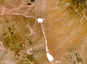
Jackass Flats is a shallow alluvial basin located in the southwest portion of the Nevada National Security Site in Nye County, Nevada. The area lies east of Yucca Mountain, south of the Calico Hills and Shoshone Mountain and northwest of Skull Mountain. The valley drains to the southwest via the Tonopah and Fortymile washes into the Amargosa Valley across US Route 95 at Amargosa Valley. The "flat" covers an area of approximately 120 square miles (310 km2) and ranges in elevation from about 2,800 ft (850 m) just north of US 95 to 4,000 ft (1,200 m) at the mountain bases to the north and east.

Storax Sedan was a shallow underground nuclear test conducted in Area 10 of Yucca Flat at the Nevada National Security Site on July 6, 1962 as part of Operation Plowshare, a program to investigate the use of nuclear weapons for mining, cratering, and other civilian purposes. The radioactive fallout from the test contaminated more US residents than any other nuclear test. The Sedan Crater is the largest human-made crater in the United States, and is listed on the National Register of Historic Places.

Northwye is a former community in Phelps County, Missouri, United States. It lies at the north junction of U.S. Routes 63 and 66, just north of Rolla. The name refers to the Y-intersection of the two roads north of town. Several homes are still in the area.
The Shoshone Mountains, in west central Nevada, make up one of the longest mountain ranges in the state. The range runs in a general north-south direction in Nye and Lander counties. The range has a length of about 66 miles (106 km) and a width of about 6 mi (9.7 km) with an area of approximately 400 sq mi (1,000 km2).

The Kawich Range is a mountain range in Nye County in southern Nevada in the United States, just south of the Hot Creek Range. The southern part of the range lies on the Nellis Air Force Range. The mountains cover an area of about 250 square miles (650 km2) and contain Kawich Peak, at 9,399 feet (2,865 m) above sea level. U.S. Route 6 crosses the pass between The Kawich and the Hot Creek ranges and meets State Route 375 at Warm Springs just north of the range. To the east lies the Reveille and Kawich valleys with the Reveille Range to the east of the northern portion and the Belted Range east of Quartzite Mountain at the southern end. The broad Pahute Mesa and Gold Flat lie to the south with Cactus Flat and the Cactus Range to the southwest. To the northwest across Stone Cabin Valley lies the Monitor Range.

The Monitor Range is located in south-central Nevada in the United States. The range lies west and northwest of the Hot Creek Range and north of U.S. Route 6 in Nye County. It extends into the southwest corner of Eureka County at its northern end ending just south of U.S. Route 50. Tonopah is about 15 miles west of the south end of the range and Eureka lies about 20 miles east of the north end of the range. Its highest point is Table Mountain at 10,649 feet (3,246 m).

The Toquima Range is a mountain range, located primarily in Nye County with a small extension into Lander County, in Nevada, United States. Most of the range is included within the Humboldt-Toiyabe National Forest. The range reaches a maximum elevation of 11,949 feet at the southern summit of Mount Jefferson. From Hickison Summit on U.S. Route 50, the range runs for approximately 71 miles (115 km) to the south-southwest. To its west are Big Smoky Valley, scenic State Route 376, and the large Toiyabe Range. To the east are remote Monitor Valley and the Monitor Range. Lying to the south of the range are U.S. Route 6 (Nevada) and the community of Tonopah, while to the north is U.S. Route 50, leading to the small community of Austin.

The mountains in the McCullough Range lie mostly above the city of Henderson in the U.S. state of Nevada. The range has two distinct areas with the northern portion being primarily volcanic in origin, while the southern part of the range is primarily composed of metamorphic rock.
The Selenite Range is a mountain range in western Pershing County, Nevada. The range is a north–south trending feature approximately 27 miles (43 km) long and 4 miles (6.4 km) wide.

Mica Peak is the name of two separate mountain summits in the United States located approximately 5.49 miles (9 km) apart; one in Spokane County, Washington and the other in Kootenai County, Idaho. The two peaks are located along the same ridge, which separates the Spokane Valley and Rathdrum Prairie from the Palouse. The mountains have an elevation difference of only 31 ft (9.4 m) and are the southernmost peaks of the Selkirk Mountains.
The Halfpint Range is a low arcuate mountain range in eastern Nye County and extending into southwest Lincoln County, Nevada. The western portion of the range lies within the Nevada Test Site. Yucca Flat and Plutonium Valley lie to west and Frenchman Flat to the south. The Buried Hills, the Papoose Range and Papoose Lake lie to the east. French Peak is at the south end and Banded Mountain lies at the north end of the range.
The Hays Canyon Range is a mountain range in northwest Washoe County, Nevada, adjacent the California border. The Surprise Valley with its alkali lakes and the Warner Mountains lie to the west.
The Reveille Range is the Nye County, Nevada mountain range that is the location of the Reveille Range volcanic field. The highest point is Reveille Peak in the southern part of the range with an elevation of 8,812 feet (2,686 m).

The Pahute Mesa (landform) is a large, 60 miles (97 km) long mesa in southern Nye County, Nevada. The mesa's southeast region lies in the Nevada Test Site which is southeast; the region in the test site is called Pahute Mesa, one of the major test site sub-regions.

Sarcobatus Flat is a closed valley in western Nye County, Nevada between Goldfield and Beatty. The Bullfrog Hills form the southern boundary and the Grapevine Mountains along with Bonnie Claire Flat form the western boundary. Pahute Mesa bounds the area to the east and north. To the north the flat is contiguous with Lida Valley and Stonewall Flat.
Mollie's Nipple or Molly's Nipple is the name given to as many as seven peaks, at least one butte, at least one well, and some other geological features in Utah. Some sources claim there are eleven geological features in Utah that bear this name. At least some of those names are attributed to John Kitchen – a pioneer of an early exploration of Utah, who named them to commemorate a nipple of his wife Molly.

The Blackjack Mountains are a mountain range located in Gila County, Arizona. They have a maximum elevation of 6,942 ft (2,116 m) at Apache Peaks and a prominence of 2,580 ft (790 m). The peak has a topographic isolation of 17.88 miles, with the nearest higher peak lying to the south in the Pinal Mountains. The Blackjack mountains are located within the Tonto National Forest and are north of Globe, Arizona. The high point of the range, Apache Peaks, is ranked 36th in prominence for Arizona's most prominent peaks.