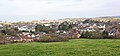
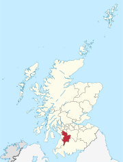
Stewarton is a town in East Ayrshire, Scotland. In comparison to the neighbouring towns of Kilmaurs, Fenwick, Dunlop and Lugton, it is a relatively large town, with a population estimated at over 7,400. It is 300 feet above sea level. The town is served by Stewarton railway station.
Chapeltoun is an estate on the banks of the Annick Water in East Ayrshire, a rural area of Scotland famous for its milk and cheese production and the Ayrshire or Dunlop breed of cattle.
Lambroughton is a village in the old Barony of Kilmaurs, Scotland. This is a rural area famous for its milk and cheese production and the Ayrshire or Dunlop breed of cattle.

Clan Cunningham is a Scottish clan. The traditional origins of the clan are placed in the 12th century. However, the first contemporary record of the clan chiefs is in the thirteenth century. The chiefs of the Clan Cunningham supported Robert the Bruce during the Wars of Scottish Independence. In the 15th and 16th centuries, the Clan Cunningham feuded with the Clan Montgomery. Historically, the chief of Clan Cunningham held the title of Earl of Glencairn. However, in modern times the chief of the clan is Cunningham of Corsehill. On 18 December 2013, Sir John Christopher Foggo Montgomery Cunninghame, Baronet of Corsehill, was recognized by Lord Lyon as Clan Chief after the chiefship had been vacant for over 200 years.

The old Barony and castle of Corsehill lay within the feudal Baillerie of Cunninghame, near Stewarton, now East Ayrshire, Scotland.
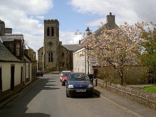
Dunlop is a village and parish in East Ayrshire, Scotland. It lies on the A735, north-east of Stewarton, seven miles from Kilmarnock. The road runs on to Lugton and the B706 enters the village from Beith and Burnhouse.
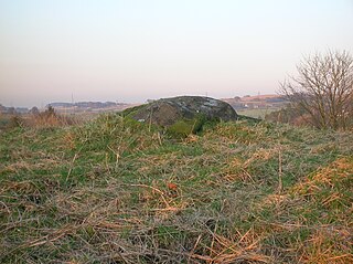
Carlin Stone or Carline Stane is the name given to a number of prehistoric standing stones and natural stone or landscape features in Scotland. The significance of the name is unclear, other than its association with old hags, witches, and the legends of the Cailleach.
The Barony of Peacockbank was in the old feudal Baillerie of Cunninghame, near Stewarton in what is now East Ayrshire, Scotland.

The Lochridge estate was in the old feudal Baillerie of Cunninghame, near Stewarton in what is now East Ayrshire, Scotland.

The Barony of Ladyland was in the old feudal Baillerie of Cunninghame, near Kilbirnie in what is now North Ayrshire, Scotland.
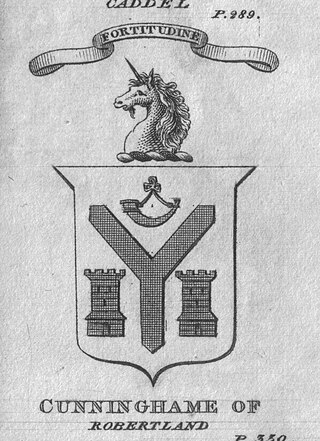
The Castle and Barony of Robertland is located near Stewarton, off the B769 road, in the old district of Cunninghame, Parish of Stewarton, and now part of East Ayrshire, Scotland.

The Lands of Lainshaw lie in Strathannick and were part of the Lordship of Stewarton, in East Ayrshire, Scotland. Lainshaw House is a category B listed mansion, lying in a prominent position above the Annick Water and its holm in the Parish of Stewarton, Scotland. Part of the much older Lainshaw Castle is contained within the several later building phases of the present day Lainshaw House. The names 'Langshaw' or 'Langschaw' were used in historic times. Law Mount near the High and Laigh Castleton farms has been suggested as the site of the original castle, granted in the 12th century to Godfrey de Ross by Hugo de Morville.
The Lands of Cocklebie or Cocklebee formed an estate possessing a common border with the estates of Lainshaw, the Corsehill, and the town of Stewarton, East Ayrshire, Parish of Stewarton, Scotland.

Bloak was a hamlet or clachan in East Ayrshire, Parish of Stewarton, Scotland. The habitation was situated between Auchentiber and Stewarton on the B778. It was originally built as a row of housing for crofters and farm workers. The small school remained open for some years after the hamlet ceased to exist. Robinson gives the Scots word "blout" as meaning "an eruption of fluid", or a place that is soft or wet.

Kingsford is a hamlet or clachan in Strathannick, East Ayrshire, parish of Stewarton, Scotland. The habitation is situated on the B769, two miles north of Stewarton and fourteen miles from Glasgow.
The lands of Broomlands or Broumlands formed a small country estate about a mile to the east of Irvine, North Ayrshire, Scotland situated on the east bank of the Annick Water in the Parishes of Dreghorn and Irvine.

The Murder of Hugh Montgomerie, 4th Earl of Eglinton at the Annick Ford in Stewarton, East Ayrshire, Scotland, took place in 1586 as a consequence of a long running feud between the Montgomeries, Earls of Eglinton and the Cunninghames, Earls of Glencairn, families who were competing for power and influence locally and nationally. The significant repercussions of this act were felt throughout the county of Ayrshire and beyond. The spelling 'Montgomerie' is used throughout for both the family and Montgomery for the clan and clan and district names 'Cunninghame' in the same fashion.
Lainshaw Castle was a 15th century castle about 1.0 mile (1.6 km) south-west of Stewarton, East Ayrshire, Scotland, to the north of Annick Water. The castle was incorporated into Lainshaw House over the course of the 17th and 18th centuries.

Lawthorn is a hamlet near Perceton in Strathannick, Irvine, North Ayrshire, Scotland. The settlement lies on the old Irvine to Stewarton toll road.

Kemp Law Dun is a vitrified fort dating from the Iron Age situated near the town of Dundonald in South Ayrshire, Scotland. The remains of the Iron Age fort or dun lie on the old Auchans Estate in the Dundonald Woods near the site of the old Hallyards Farm and the quarry of that name. The footpath route known as the Smugglers' Trail through the Clavin Hills from Troon to Dundonald runs passed the ruins of the dun. Kemps Law is in the order of two thousand years old.