
Yucatán, officially the Estado Libre y Soberano de Yucatán, is one of the 31 states which, along with Mexico City, constitute the 32 federal entities of Mexico. It comprises 106 separate municipalities, and its capital city is Mérida.

Mérida is the capital of the Mexican state of Yucatán, and the largest city in southeastern Mexico. The city is also the seat of the eponymous municipality. It is located in the northwest corner of the Yucatán Peninsula, about 35 km inland from the coast of the Gulf of Mexico. In 2020 it had a population of 921,770 while its metropolitan area, which also includes the cities of Kanasín and Umán, had a population of 1,316,090.
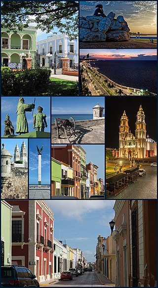
San Francisco de Campeche, 19th c., also known simply as Campeche, is a city in Campeche Municipality in the Mexican state of Campeche, on the shore of the Bay of Campeche in the Gulf of Mexico. Both the seat of the municipality and the state's capital, the city had a population of 220,389 in the 2010 census, while the municipality had a population of 259,005.

Champotón is a small city in Champotón Municipality in the Mexican state of Campeche, located at 19°21′N90°43′W, about 60 km south of the city of Campeche where the small Champotón river meets the coast of the Gulf of Mexico. At the 2010 census it had a population of 30,881.

Progreso is a port city in the Mexican state of Yucatán, located on the Gulf of Mexico in the north-west of the state some 30 minutes north of state capital Mérida by highway. As of the Mexican census of 2010, Progreso had an official population of 37,369 inhabitants, the sixth largest community in the state in population. The city is also the municipal seat of the surrounding municipality of the same name. The municipality's area is 270.10 km2 (104.29 sq mi) and its population at the census was 49,454 inhabitants. It includes Scorpion Reef with its five islets 130 km offshore (north) on the outer edge of Campeche Bank. Its largest other towns are Chicxulub Puerto, Campestre Flamboyanes, and Chelem.

Valladolid is a city located in the eastern region of the Mexican state of Yucatán. It is the seat of Valladolid Municipality. As of the 2020 census the population of the city was 56,494 inhabitants, and that of the municipality was 85,460.

The Caste War of Yucatán or ba'atabil kichkelem Yúum (1847–1915) began with the revolt of native Maya people of the Yucatán Peninsula against Hispanic populations, called Yucatecos. The latter had long held political and economic control of the region. A lengthy war ensued between the Yucateco forces based in the northwest of the Yucatán and the independent Maya in the southeast.

Maní is a small city in Maní Municipality in the central region of the Yucatán Peninsula, in the Mexican state of Yucatán. It is about 100 km to the south south-east of Mérida, Yucatán, some 16 km east of Ticul. The village of Tipikal lies 6 km to the east.

Campeche, officially Estado Libre y Soberano de Campeche, is one of the 31 states which, with Mexico City, make up the 32 Federal Entities of Mexico. Located in southeast Mexico, it is bordered by the states of Tabasco to the southwest, Yucatán to the northeast, Quintana Roo to the east, and by the Petén department of Guatemala to the south. It has a coastline to the west with the Gulf of Mexico. The state capital, also called Campeche, was declared a World Heritage Site in 1997. The formation of the state began with the city, which was founded in 1540 as the Spanish began the conquest of the Yucatán Peninsula. The city was a rich and important port during the colonial period, but it declined after Mexico's independence. Campeche was part of the province of Yucatán but split off in the mid-19th century, mostly due to political friction with the city of Mérida. Much of the state's recent economic revival is due to the discovery of petroleum offshore in the 1970s, which has made the coastal cities of Campeche and Ciudad del Carmen important economic centers. The state has important Mayan and colonial sites; however, these are not as well-known or visited as others in the Yucatán.

Sisal is a seaport town in Hunucmá Municipality in the state of Yucatán, Mexico. It was the principal port of Yucatán during the henequen boom, later overshadowed when the more modern port of Progreso was built to the east. It lent its name to the agave-derived sisal fiber which was shipped through this port.

Mérida Municipality is one of the 106 municipalities in the Mexican state of Yucatán containing (858.41 km2) of land with the head or seat being the city of Mérida. Because the archaeological remains of the Maya reminded the Spaniards of the ancient city of Mérida, Spain, which was marked by Roman archaeological sites, they renamed the site of T-hó after the Spanish city.
The [Book of the] Songs of Dzitbalché, originally titled The Book of the Dances of the Ancients, is a Mayan book containing poetry. It is the source of almost all the ancient Mayan lyric poems that have survived, and is closely connected to the Books of Chilam Balam which are sacred books of the colonial Yucatec Maya. The sole surviving copy of the Songs of Dzitbalché was written in alphabetic Mayan in the 18th century.
The Republic of Yucatán was a sovereign state during two periods of the nineteenth century. The first Republic of Yucatán, founded May 29, 1823, willingly joined the Mexican federation as the Federated Republic of Yucatán on December 23, 1823, less than seven months later. The second Republic of Yucatán began in 1841, with its declaration of independence from the Centralist Republic of Mexico. It remained independent for seven years, after which it rejoined the United Mexican States. The area of the former republic includes the modern Mexican states of Yucatán, Campeche and Quintana Roo. The Republic of Yucatán usually refers to the second republic (1841–1848).

Calkiní is one of the 13 municipalities in the Mexican state of Campeche. It is situated at the northern tip of the state, on the central western coast the Yucatán Peninsula. The municipal seat, and largest settlement, is the city of Calkiní.

The Province of Yucatán, or the Captaincy General, Governorate, Intendancy, or Kingdom of Yucatán, was a first order administrative subdivision of the Viceroyalty of New Spain in the Yucatán Peninsula.

Dzidzantún Municipality is one of the 106 municipalities in the Mexican state of Yucatán containing 198.00 square kilometres (76.45 sq mi) of land and located roughly 75 kilometres (47 mi) northeast of the city of Mérida.

Tekantó Municipality is a small (47.25 km²) municipality in the Mexican state of Yucatán. The municipality was formed in 1900 and its municipal seat is the homonymous locality of Tekantó, at the end of highway 80, 54 km east of Merida.

The Hacienda San José Chactún is a hacienda located in the State of Yucatán in Mexico.

Dzemul Municipality (In the Yucatec Maya Language: “ravaged mound” is one of the 106 municipalities in the Mexican state of Yucatán containing 123.91 square kilometres of land and located roughly 47 kilometres northeast of the city of Mérida. There is a large Mayan archaeological site called Xcambo, which is used as a place of worship as there is a chapel built above the Mayan remains.

The Tren Maya is a 1,525-kilometre (948 mi) intercity railway in Mexico that will traverse the Yucatán Peninsula. Construction began in June 2020 and the railway is scheduled to begin operation on December 15, 2023. The railway begins in Palenque in Chiapas and travels northeast towards Cancún in Quintana Roo via two routes that encircle the peninsula. The project aims to connect tourist destinations in the Caribbean with lesser-known sites inland, including historic Mayan sites from which it derives its name.

