Caluco

Last updated
Caluco
El Salvador location map.svg
Red pog.svg
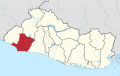
Caluco
Location in El Salvador
Coordinates: 13°43′N89°39′W / 13.717°N 89.650°W / 13.717; -89.650
CountryFlag of El Salvador.svg  El Salvador
Department Sonsonate
Government
  MayorNelson Uvaldo Cornejo Sibrian
Area
  Municipality19.86 sq mi (51.43 km2)
Elevation
1,250 ft (380 m)
Population
 (2020)
  Total
11,056

Caluco is a city and municipality in the Sonsonate department of El Salvador. [1] According to the 2007 Population and Housing Census, it has a population of 9,139.

Contents

History

Caluco was a producer of cocoa.[ citation needed ]

Caluco, which in colonial times was at the peak of Salvadoran cocoa production and export, also holds a treasure of cultural heritage: the ruins of the first church in El Salvador.

Area

The municipality is 51.43 km2 (19.86 mi2) large.

Related Research Articles

<span class="mw-page-title-main">Legislative Assembly of El Salvador</span> Government body of El Salvador

The Legislative Assembly is the legislative branch of the government of El Salvador.

<span class="mw-page-title-main">Ocotepeque</span> Municipality in Honduras

Ocotepeque is a municipality in the Honduran department of Ocotepeque. The town of Nueva Ocotepeque is the municipal seat and the capital of the department.

<span class="mw-page-title-main">Berlín, El Salvador</span> Municipality in Usulután Department, El Salvador

Berlin is a municipality in the Usulután Department, in El Salvador. The municipality is also one of the four capital districts of the department. It is located at the east of El Salvador, 112 kilometers from the capital city San Salvador. The municipality of Berlin is situated in the Tecapa-Chinameca-Alegrìa mountain zone, located in the central-north of Usulután.

Santiago de María is a municipality in the Usulután department of El Salvador. It has one of the strongest economies in El Salvador due to small private businesses and an entrepreneurial culture. It has a population of 20,032.

<span class="mw-page-title-main">Aguilares, El Salvador</span> Salvadoran City

Aguilares is a district in the San Salvador department of El Salvador, located 33 km away from the city of San Salvador. The municipality measures 33.72 km² and as of 2006, had an estimated population of 73,300. Sugar cane cultivation is the major economic activity for the area.

<span class="mw-page-title-main">Guazapa</span> Municipality in San Salvador

Guazapa is a district in San Salvador Norte Municipality in the San Salvador Department of El Salvador.

Tonacatepeque is a district in the San Salvador department of El Salvador. It has a population of 90,896 inhabitants according to the 2007 Census. This makes this municipality twelfth largest in terms of population in El Salvador. It is part of the San Salvador metropolitan area.

<span class="mw-page-title-main">Soyapango</span> District in San Salvador Department, El Salvador

Soyapango is a district in the San Salvador department of El Salvador. Soyapango is the country's largest municipality with 284,700 residents. Soyapango is a satellite city of San Salvador and it is the main thoroughfare between San Salvador and the eastern part of the country, and nearly 70,000 vehicles travel through it every day. The nickname for this satellite city is Soya.

San Juan Tepezontes is a municipality in the La Paz department of El Salvador. Its name is a Hispanicization of a Nawat term meaning "many hills." It was incorporated in 1945. Its population as of 2004 was 3,269.

Armenia is a municipality in the Sonsonate department of El Salvador. It was founded by Spaniards and a small group of Armenians, with a significant number of indigenous people living there when Europeans arrived. According to the official census of 2007, it has a population of 34,912 inhabitants.

Cuisnahuat is a city and municipality in the Sonsonate department of El Salvador.

<span class="mw-page-title-main">Juayúa</span> Municipality in Sonsonate, El Salvador

Juayúa is a city and municipality in the Sonsonate department of El Salvador. It is a small town up in the mountains, founded in 1577. Juayua is located in the western part of El Salvador, about 50 miles from San Salvador.

<span class="mw-page-title-main">Nahuizalco</span>

Nahuizalco is a municipality in the Sonsonate department of El Salvador. It lies on the "flowers route", 9 km from Sonsonate and 74 km from San Salvador, at 540 m above sea level on the southern part of the Apaneca-Ilamatepec mountain range. Per the population and housing census of 2007, Nahuizalco has 49,081 residents.

Nahulingo is a local district in the municipality of Sonsonate Centro in the Sonsonate department of El Salvador. According to the 2007 Housing and Population Census, it has a population of 10,417 people.

San Julián is a district of the municipality of Sonsonate Este in the department of Sonsonate, El Salvador. According to the 2007 Population and Housing Census, it has 18,648 inhabitants. It was used as a battlefield several years ago and is now a beautiful and very populated neighborhood.

<span class="mw-page-title-main">Coatepeque, El Salvador</span> Municipality in Santa Ana, El Salvador

Coatepeque is a city and municipality in the Santa Ana department of El Salvador.

<span class="mw-page-title-main">El Congo</span> Municipality in Santa Ana, El Salvador

El Congo is a city and municipality in the Santa Ana department of El Salvador.

San Jose Villanueva is a small municipality in the Department of La Libertad, El Salvador. San Jose Villanueva has a population of 14,000 inhabitants and 9,896 inhabitants. It is located in the south of the Department, bordered by the cities of Nuevo Cuscatlán to the north, Huizucar to the east, the port of La Libertad to the south and Zaragoza to the west. The town contains a health clinic, six schools, an institute, a Catholic church, and seven Protestant churches. In the last several years, the municipality has seen an influx of the upper middle class, including the introduction of a gated housing development. Principal crops include grains, coffee, and grasses. There are businesses in cattle, pigs, and poultry. Among the successful industries are the Beneficiary of Coffee and the Dairy Elaboration. There are paved access roads. Of note is a local archaeological site, the Piedra Pintada, a rock inscribed with three meters of ancient hieroglyphics.

<span class="mw-page-title-main">Acajutla</span> City in Sonsonate Department, El Salvador

Acajutla is a seaport city in Sonsonate Department, El Salvador. The city is located at 13°35′24″N89°50′01″W on the Pacific coast of Central America and is El Salvador's principal seaport from which a large portion of the nation's exports of coffee, sugar, and Balsam of Peru are shipped. As a city, Acajutla is one of seventeen such districts in Sonsonate. As of 1992, the population of the city was 18,008.

<span class="mw-page-title-main">Lempa River</span> River that flows through Guatemala, El Salvador and Honduras

The Lempa River is a 422-kilometre-long (262 mi) river in Central America. It is a transboundary river shared by El Salvador, Guatemala and Honduras.

References

  1. "Caluco". ISDEM (in Spanish). Retrieved 2020-10-10.

13°43′31″N89°39′41″W / 13.7253°N 89.6615°W / 13.7253; -89.6615