![]() | You can help expand this article with text translated from the corresponding article in Spanish. (June 2023)Click [show] for important translation instructions.
|
Nahulingo Distrito de Nahulingo | |
---|---|
Municipality | |
Coordinates: 13°42′19″N89°42′53″W / 13.70528°N 89.71472°W | |
Country | ![]() |
Department | Sonsonate Department |
Area | |
• Total | 13.68 sq mi (35.42 km2) |
Elevation | 646 ft (197 m) |
Population (2007) | |
• Total | 10,417 |
• Density | 760/sq mi (290/km2) |
Time zone | UTC-6 (Central Standard Time) |
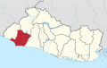
Nahulingo is a local district in the municipality of Sonsonate Centro in the Sonsonate department of El Salvador. [1] According to the 2007 Housing and Population Census, it has a population of 10,417 people.
Until the 30th April 2024, it was a municipality, but with the municipal reorganization approved in June 2023, it became a district. [2]
The population of this town is of Pipil origin; and before the conquest it was one of the two halves of the city-state of Tacuzcalco (both halves being separated by the Ceniza River), the other half being the town (today in ruins) where the battle of Tucuzcalco would take place. [3]
During the colonial period it belonged to the province of Izalcos (later called the mayor's office of Sonsonate) and in 1770 it was a town attached to the parish of Caluco. Between 1821 and 1823, together with the entire mayor's office of Sonsonate, it belonged to the province of Guatemala, and in 1824 it was incorporated into the department of Sonsonate. By 1859 its population was estimated at 495 inhabitants. [3]
On March 21, 1901, the National Legislative Assembly, at the proposal of the Executive Branch, decreed the extinction of the towns of Sonzacate, San Antonio del Monte, and Nahulingo. The Municipality of Sonsonate received through inventory the archives, furniture, accounts and stocks in kind and money of the towns, which would be governed and ruled as neighborhoods of the city, and all the properties of the municipalities of the extinct towns became the property of that of Sonsonate. The decree was approved by President Tomás Regalado on March 23 and published in the Official Gazette on March 28 [4] .On March 28, 1905, the National Legislative Assembly issued a legislative decree that reestablished the neighborhoods of San Antonio del Monte, Nahulingo and Sonzacate as towns; the Municipality of Sonsonate delivered to the respective municipalities the corresponding furniture, archives and documents. The decree was sanctioned by President Pedro José Escalón on the same day, March 28. [5]
The National Anthem of El Salvador was adopted on 15 September 1879 and officially approved on 11 December 1953. The lyrics were written by General Juan José Cañas in 1856, with music composed by the Italian Juan Aberle in 1879.
Coatepec Harinas is one of 125 municipalities in the State of Mexico, Mexico. The municipal seat is the town of Coatepec Harinas. The original name is "Coauhtepetl" which means 'serpent hill' in Náhuatl. Around 1825 because of a boom in flour production, the name "Harinas" was added.
El Salvador is divided into 14 departments for administrative purposes, subdivided into 44 municipalities (municipios) and 262 districts. The country is a unitary state.
Sonsonate is a department of El Salvador in the western part of the country. The capital is Sonsonate.
Carlos Meléndez Ramírez was a Salvadoran politician who served as the president of El Salvador from 1913 to 1914 and again from 1915 to 1918. He also served as the president of the Legislative Assembly from 1912 to 1913.
San Antonio del Monte is also a subdivision of Garafía in the island of La Palma in the Canary Islands
San Julián is a district of the municipality of Sonsonate Este in the department of Sonsonate, El Salvador. According to the 2007 Population and Housing Census, it has 18,648 inhabitants. It was used as a battlefield several years ago and is now a beautiful and very populated neighborhood.
Concepción de Ataco is a district and city within the Ahuachapán Department, El Salvador. It has an area of 61.03 km ² and a population of 18,101 inhabitants.
Sonsonate is a city and district of El Salvador, of which it is also its municipal seat. It has an estimated population of 71,980 inhabitants for the year 2020. Sonsonate is the second most important city in western El Salvador. The town was founded under the name of "Villa del Espíritu Santo" on vacant lots near the town of los Izalcos in 1552. However, this foundation would be extremely ephemeral, because the following year, in 1553, this villa would be transferred to its current location, with the name of "Villa de la Santísima Trinidad de Sonsonate", in a cocoa-producing area. With the passage of time, the town would be known simply by the name of Sonsonate. This name was taken from the Rio Grande or Sonsonate in the Nahuat language, which crosses it from north to south across the entire plain until it flows into the Pacific Ocean. This was the third Spanish population founded in the territories that currently constitute El Salvador, although, it is worth clarifying, during the entire period of Spanish domination of America, Sonsonate was the capital of the Mayor's Office of Sonsonate, a territory apart from the one administered by San Salvador, today the capital of El Salvador.
San Pablo del Monte is a city in the municipality of the same name in the south of the Mexican state of Tlaxcala, It is located at the southernmost point in the state, near the border with the adjoining state of Puebla. It is a suburb of the city of Puebla and a component of its metropolitan area. At the 2005 census the population of the city was 55,760.
The municipalities of El Salvador are the second-level administrative divisions within the Republic of El Salvador. These municipalities divide the country's departments and serve as the fundamental administrative units of local government.
Tala is a town in the north of the Canelones Department of southern Uruguay.
The University of El Salvador (UES) is the oldest and the most prominent university institution in El Salvador. It serves as the national university of the country. The main campus, Ciudad Universitaria, is located in the capital of San Salvador, but there are also branches of the university in other Salvadoran cities such as Santa Ana, San Miguel and San Vicente. The university counts a total of 9 faculties in its main campus and has a student population of more than 50,000.
The vice president of El Salvador is a political position in El Salvador which is elected concurrently with the position of President of El Salvador.
The Municipality of Maldonado is one of the eight municipalities of Maldonado Department, Uruguay. It was created by Law N° 18653 of 15 March 2010.
Ana Mercedes Campos was a Salvadoran athlete recognized for her role in the 7th Central American and Caribbean Games in Mexico in 1954.
Ernesto Alfredo Castro Aldana is a Salvadoran politician and businessman who currently serves as the president of the Legislative Assembly of El Salvador. Castro previously served as a secretary and private advisor to Nayib Bukele from 2012 to 2020 when he was elected as a deputy of the Legislative Assembly from San Salvador in the 2021 legislative election.
The Airport of the Pacific or International Airport of the Pacific is a planned joint-use civilian international airport and military base that will be located in Conchagua, El Salvador. It will serve the city of La Unión and the planned Bitcoin City. The airport was proposed by Salvadoran president Nayib Bukele during his 2019 presidential campaign as a part of his Cuscatlán Plan and construction was approved by the Legislative Assembly on 26 April 2022. Preliminary terraforming began in March 2023 and construction is planned to begin in December 2024.
Fidel Antonio Novoa Meléndez was a Salvadoran politician who was the president of the Legislative Assembly from 1903 to 1904 and again from 1912 to 1913.
13°42′N89°43′W / 13.700°N 89.717°W