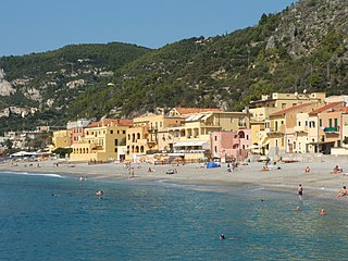
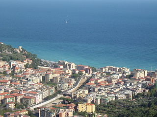
Calvisio | |
---|---|
Panoramic view | |
Coordinates: 44°10′54.4″N8°21′6.87″E / 44.181778°N 8.3519083°E Coordinates: 44°10′54.4″N8°21′6.87″E / 44.181778°N 8.3519083°E | |
Country | |
Region | |
Province | Savona (SV) |
Comune | Finale Ligure |
Elevation | 21 m (69 ft) |
Time zone | UTC+1 (CET) |
• Summer (DST) | UTC+2 (CEST) |
Postal code | 17024 |
Dialing code | (+39) 019 |
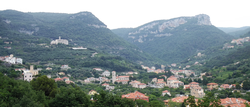
Calvisio is a frazione (and parish) of the municipality of Finale Ligure, in Liguria, northern Italy.
"Frazione" is the Italian name given in administrative law to a type of territorial subdivision of a comune; for other administrative divisions, see municipio, circoscrizione, quartiere. It is cognate to the English word fraction, but in practice is roughly equivalent to "parishes" or "wards" in other countries.
A parish is a territorial entity in many Christian denominations, constituting a division within a diocese. A parish is under the pastoral care and clerical jurisdiction of a parish priest, who might be assisted by one or more curates, and who operates from a parish church. Historically, a parish often covered the same geographical area as a manor. Its association with the parish church remains paramount.
Finale Ligure is a comune on the Gulf of Genoa in the Province of Savona in Liguria, Italy. It is considered part of the Italian Riviera.
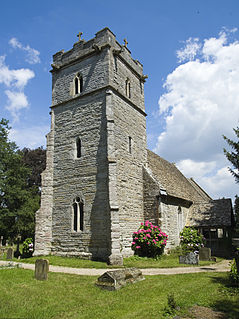
Present-day Calvisio is located near the Sciusa, mainly on the right banks of the stream. There also stands the parish church, built in a neo-Middle Ages style. On monte Tolla slopes, [2] also on the right side of Sciusa Valley but at an elevation of 120 m, is located Lacrêma, the oldest part of the village, also known as Calvisio Vecchio (literally Old Calvisio). [2]
Romanesque Revival is a style of building employed beginning in the mid-19th century inspired by the 11th- and 12th-century Romanesque architecture. Unlike the historic Romanesque style, however, Romanesque Revival buildings tended to feature more simplified arches and windows than their historic counterparts.
The elevation of a geographic location is its height above or below a fixed reference point, most commonly a reference geoid, a mathematical model of the Earth's sea level as an equipotential gravitational surface . The term elevation is mainly used when referring to points on the Earth's surface, while altitude or geopotential height is used for points above the surface, such as an aircraft in flight or a spacecraft in orbit, and depth is used for points below the surface.
Calvisio area was inhabited by Ligures as confirmed by remains as an ellipse-shaped field encircled by menhirs named Pratorotondo (round meadow).
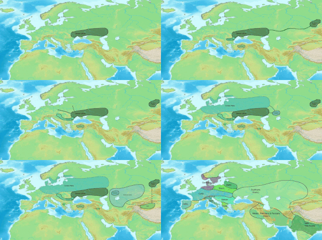
The Ligures were an Indo-European people who appear to have originated in, and gave their name to, Liguria, a region of north-western Italy. Elements of the Ligures appear to have migrated to other areas of western Europe, including the Iberian peninsula.
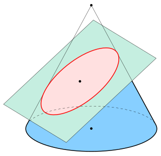
In mathematics, an ellipse is a plane curve surrounding two focal points, such that for all points on the curve, the sum of the two distances to the focal points is a constant. As such, it generalizes a circle, which is the special type of ellipse in which the two focal points are the same. The elongation of an ellipse is measured by its eccentricity e, a number ranging from e = 0 to e = 1.
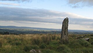
A menhir, standing stone, orthostat, or lith is a large man-made upright stone, typically dating from the European middle Bronze Age. They can be found solely as monoliths, or as part of a group of similar stones. Menhirs' size can vary considerably, but they are generally uneven and squared, often tapering towards the top.
During the Roman Age the Sciusa Valley was crossed by Via Julia Augusta and maybe some of the stones of that ancient highway were recycled in oldest buildings of the village. Saint Cipriano church was promoted to parish church before 1356. [3]
The Via Julia Augusta is the name given to the Roman road formed by the merging of the Via Aemilia Scauri with the Via Postumia. The road runs from Placentia to Arelate, initially westward along the edge of the plain of the River Po to Derthona (Tortona), then southward to the Ligurian coast. There it formed a continuous route westward along the precipitous descent of the Ligurian mountains into the sea. This takes it to Vada Sabatia, Albingaunum (Albenga) and Album Intimilium (Ventimiglia), continuing to La Turbie, where its original terminus was marked by a triumphal arch. Later it was extended, taking a route away from the coast via the valley of the River Laghet, north of Nice and westward to Arles where it joined the Via Domitia.
A parish church in Christianity is the church which acts as the religious centre of a parish. In many parts of the world, especially in rural areas, the parish church may play a significant role in community activities, often allowing its premises to be used for non-religious community events. The church building reflects this status, and there is considerable variety in the size and style of parish churches. Many villages in Europe have churches that date back to the Middle Ages, but all periods of architecture are represented.
Calvisio was a separate comune (municipality) until 1868 when, with Varigotti (which also was an autonomous municipality) requested and obtained to be joined with Final Pia. At the time Calvisio had around 500 inhabitants. [4]
The comune is a basic administrative division in Italy, roughly equivalent to a township or municipality.
Varigotti is a frazione (locality) of the comune of Finale Ligure, in Liguria, northern Italy.
Final Pia or Finale Pia is one of three urban forming the Ligurian town of Finale Ligure, near Savona, northern Italy. An independent municipality until 1927, it was later merged with Finale Marina and Finalborgo to form the modern town of Finale Ligure. The village is situated along the Via Aurelia, however, most of the buildings face the banks of the river Sciusa, especially after the big residential development in the postwar period, expansion that has effectively united the center of the inner Finale Pia Calvisio frazione, at about one kilometer from the coast.
It later followed the destiny of Final Pia, which in 1927 was joined to Finale Marina e Finalborgo giving the present-day municipality of Finale Ligure.
Dolcedo is a comune (municipality) in the Province of Imperia in the Italian region Liguria, located about 100 kilometres (62 mi) southwest of Genoa and about 7 kilometres (4 mi) northwest of Imperia.
Bormida, with a population of 453 spread over an area of 22.4 square kilometres (8.6 sq mi), is a rural municipality of the Province of Savona in the Italian region Liguria. The municipality is a member of the Comunità Montana Alta Val Bormida. On May 11 2017 it was reported that due to a declining population the town's mayor Daniele Galliano recommended a proposal to the Ligurian regional government, and not a confirmed measure, but that it hopes to enact the bonus in 2018 of offering €2,000 ($2,175) and very low rents starting at $50 per month for anyone willing to move there.
Celle Ligure is a comune (municipality) in the Province of Savona in the Italian region Liguria, located about 30 kilometres west of Genoa and about 8 kilometres northeast of Savona.
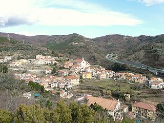
Orco Feglino is a comune (municipality) in the Province of Savona in the Italian region Liguria, located about 50 kilometres (31 mi) southwest of Genoa and about 30 kilometres (19 mi) southwest of Savona in the upper valley of the Aquila stream. It consists of the two villages of Orco and Feglino.
Sassello is a comune (municipality) in the Province of Savona in the Italian region Liguria, located about 58 kilometres (36 mi) west of Genoa and about 26 kilometres (16 mi) north of Savona in the northern side of the Ligurian Apennines. It is the birthplace of Blessed Chiara Badano.
The Genova-Ventimiglia railway runs along the coast of the Liguria region of Italy. It was opened as a single track line between Genova and Savona in 1868, and between Savona and Ventimiglia in 1872, mostly running along a coastal corniche.
Lega Nord Liguria is a regionalist political party in Liguria. It joined Lega Nord in 1991 and, since then, it has functioned as its "national" section in the region.
Calvisia may refer to:
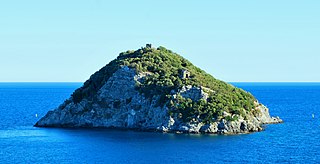
Bergeggi is an island which lies in the Ligurian Sea off the coast near the village of Bergeggi in the Province of Savona, Liguria, Italy.
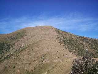
Monte Tobbio is a 1092 metres high mountain of the Apennines, located in the Italian region of Piedmont.
The Capanne di Marcarolo Natural Regional Park is a natural park in the province of Alessandria. It gets the name from a small village in the protected area, Capanne di Marcarolo.
The Stura di Ovada is a 32.9-kilometre (20.4 mi) stream of Liguria and Piedmont (Italy); it is the main tributary of the Orba.
Sasso di Bordighera is a frazione of the municipality of Bordighera, in Liguria, northern Italy.
Borghetto San Nicolò is a frazione of the municipality of Bordighera, in Liguria, northern Italy.
Lavina is a frazione of the municipality of Rezzo, in Liguria, northern Italy. Up to 1928 it was a self-standing comune.
The Brevenna is a 16.138-kilometre (10.028 mi) creek of Liguria, Italy.
Monte Alpesisa is a 989 metres high mountain in the Ligurian Apennines, in Italy.