
Old Goa is a historical city situated on the southern banks of the Mandovi River in the Ilhas sub-district of North Goa in the Indian state of Goa.

Panaji is the capital of the Indian state of Goa and the headquarters of North Goa district. Previously, Panjim was the territorial capital of the former Portuguese possessions of Goa, Daman & Diu. It lies on the banks of the Mandovi River estuary in the Tiswadi sub-district (tehsil). With a population of 114,759 in the metropolitan area, Panaji is Goa's largest urban agglomeration, ahead of Margao and Mormugao.

Ponda, also known as Fondya, is a city and a municipal council in the north Goa district of Goa, India. Located in the central area of Goa, Ponda lies 28 km southeast of Panaji, the capital of Goa and 17 km northeast of Margao, the district headquarters. Ponda is also known as "Antruz Mahal" because of the presence of numerous famous temples and rich cultural heritage.

The Mahadayi/Mandovi River, also known as Mahadayi or Mhadei river, is described as the lifeline of the Indian state of Goa. The Mandovi and the Zuari are the two primary rivers in the state of Goa. Mandovi joins with the Zuari at a common creek at Cabo Aguada, forming the Mormugao harbour. Panaji, the state capital and Old Goa, the former capital of Goa, are both situated on the left bank of the Mandovi.

Ribandar is a town in Ilhas, Goa, located between the cities of Panjim and Old Goa.
Bicholim, pronounced, also known as Divchal and Dicholi, is a town and a municipal council in North Goa district in the state of Goa, India. It is the headquarters of the Concelho (district) of Bicholim, one of seven that make up the Novas Conquistas, territories added to Goa comparatively latter than the first three of the Velhas Conquistas. The town is located about 30 kilometres from the capital Panjim. It is in the mining heartland of Goa.
Porvorim, also known as Parvari, is the De facto legislative and executive capital of the state of Goa, India, as both the Goa Legislative Assembly and Secretariat are functioning from the same complex in the region of Alto Porvorim in porvorim.(Alto - Portuguese word meaning high or upper). Soon it will also become the De facto judicial capital of Goa, when the High Court of Bombay at Goa which is currently functioning from Lyceum complex in Panaji, is transferred to the new building complex which is being constructed in Alto - Betim Porvorim region of Porvorim. The construction of the new building is expected to be completed by December 2020. Porvorim is situated on the right bank of the Mandovi River, as de jure capital of Goa, Panaji is located on the opposite bank. Porvorim is considered an upmarket residential hub as it lies on the Mumbai–Goa highway NH66. Goa's largest shopping centre - Mall De Goa - is situated here.

Pernem is a northmost administrative region or sub-district in North Goa. It acts as the Gateway of Goa from Maharashtra side. It is also the name of the town of Pernem, which is its headquarters. It has a Municipal Council. Geographically, Pernem is surrounded by Sawantwadi sub-district on East, Arabian Sea on West, Bardez and Bicholim sub-district on south and Sawantwadi sub-district on north. The two rivers which decide the boundary of this sub-district are Terekhol River and Chapora River. Terekhol river acts as a border of Maharashtra and Goa while Chapora river acts as a border of Pernem sub-district and Bardez sub-district.

The island of Divar lies in the Mandovi river in the Indian state of Goa. It is one of 6 major islands between the Mandovi and Zuari, the others being:

Reis Magos is a village located on the northern bank of the Mandovi River in Bardez, Goa, opposite to the capital city of Panjim. The village is famous for two of Goa’s famous structures; the Reis Magos Fort, and the Reis Magos Church – the first church in Bardez. Reis Magos is the Portuguese name for the Three Wise Men from the Bible.

Tiswadi or Ilhas de Goa is a Sub-District in North Goa in the state of Goa, Konkan region, India, on which the state capital Panjim is situated, previously it was the territorial capital of both Goa and Daman.
Cumbarjua, is an island and town within the Mandovi River in Goa. It is situated to the east of Goa's capital Panjim at a distance of 20 kilometres. It is one of 6 major islands between the Mandovi and Zuari, he others being:

Pondataluka is a subdivision of the district of North Goa, Goa state, India. Its administrative headquarters is the township of Ponda.

Corjuem Fort is a fortress situated 4 kilometres (2.5 mi) from the village of Aldona on the river island of Corjuem, Goa. It was a military fortress for the defense of Portuguese India. It is smaller than the other forts in Goa, but it gives a good view of the surrounding river and land. It is a protected monument under the Goa, Daman and Diu ancient monuments and archaeological sites and remains act.
Santo Estêvão or St Estevam is an island in Ilhas, Goa, India. St Estevam is known also Jua and in the past was known as Shakecho Juvo – the isle of vegetables – known for its long, seven-ridged, light green ladyfingers. Therefore the people of Jua came to be nicknamed 'bhende'. The island is named after St. Stephen. It is one of Goa's most prosperous villages, often quoted by ex-Chief Minister Pratapsingh Rane for having a high per capita income.

Goa is a state on the southwestern coast of India within the region known as the Konkan, and geographically separated from the Deccan highlands by the Western Ghats. It is surrounded by the Indian states of Maharashtra to the north and Karnataka to the east and south, with the Arabian Sea forming its western coast. It is India's smallest state by area and its fourth-smallest by population. Goa has the highest GDP per capita among all Indian states, two and a half times as high as the GDP per capita of the country as a whole. The Eleventh Finance Commission of India named Goa the best-placed state because of its infrastructure, and India’s National Commission on Population rated it as having the best quality of life in India. It is the third-highest ranking among Indian states in human development index.
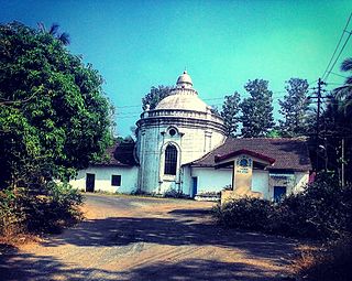
Naroa is a village located on the eastern tip of the island of Divar, in the Indian state of Goa. It has a population of barely a thousand people, with about 80 houses.
Marcel is a village turned census town in the Ponda Sub-District, North Goa in the state of Goa, India. It is located in the Novas Conquistas region of the state.
Ilha de Goa is the largest of the islands of Ilhas de Goa, in the basin of the Zuari and Mandovi Rivers in Goa. This island is the largest and the most populous island in the state of Goa. The present capital - Panjim as well the former capital - The City of Goa, both lie on the island. It is one of 6 major islands between the Mandovi and Zuari, the others being:
The Cumbarjua Canal is a distributary channel formed by the merger of the Mandovi and Zuari rivers in Goa, India. It's flow has led to the formation of river deltas, most prominent of them are - Goa, Cumbarjua and St Estevam.


