
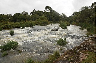
The Pelotas River is a river in southern Brazil, and a tributary of the Uruguay River.
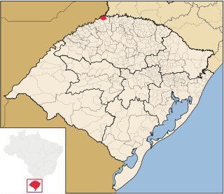
Derrubadas is a municipality of the Brazilian state of Rio Grande do Sul.
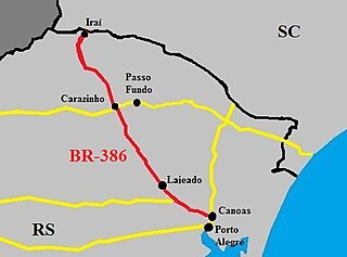
The BR-386 is a Brazilian federal highway running between the southern states of Rio Grande do Sul and Santa Catarina. It has a total length of 525 km (326 mi).
There are several rivers named Canoas River in Brazil:

The Serra Geral is a mountain range in southern Brazil, constituting the southern portion of the Serra do Mar system which runs along Brazil's southeastern coast. The Serra Geral runs parallel to the Atlantic coast in Santa Catarina and northern Rio Grande do Sul states, separating a narrow coastal plain from an interior plateau. The coastal plain is characterized by short rivers and frequent lagoons and bays, and lies within the humid tropical Serra do Mar coastal forests ecoregion.

The Pepiri-Guazu River is a river of Argentina and the Santa Catarina state in southeastern Brazil. For its entire course, it forms a short portion of the international border between Argentina and Brazil. It flows from north to south into the Uruguay River.
The San Antonio River is a tributary of the Iguazu River. The San Antonio River forms the border between Misiones Province in Argentina and Paraná State in Brazil. South of the San Antonio's source near Barracão, the international border continues south along the Pepiri-Guazu River, which forms the border between Misiones Province and Santa Catarina State.
The São José dos Dourados River is a river of São Paulo state in southeastern Brazil. It is a tributary of the Paraná River, which it joins just upriver of Ilha Solteira Dam.

The Tavares River or Rio Tavares is a river of Florianópolis, capital of Santa Catarina state in southeastern Brazil.
The Leão River is a river of Santa Catarina state in southeastern Brazil. It is a tributary of Canoas or Sertão branch river.
The Irani River is a river of Santa Catarina state in southeastern Brazil. It is a tributary of the Uruguay River.
The Rancho Grande River is a river of Santa Catarina state in southeastern Brazil. It is part of the Uruguay River basin.
The São João River is a tributary of the Canoas River in Santa Catarina state, southeastern Brazil. It is a tributary of the Inferno Grande River, part of the Uruguay River basin.
The Inferno Grande River is a river of Santa Catarina state in southeastern Brazil. It is a tributary of the Canoas River, part of the Uruguay River basin.

The Marombas River is a river of Santa Catarina state in southeastern Brazil. It is a tributary of the Canoas River and part of the Uruguay River basin.
Dos Indios River or Rio dos Indios may refer to:
The Canoas River, also known as Sertão River, is a river of Santa Catarina state in southeastern Brazil. It is one of two branches formed by the Praia Grande River, which recombine to form the Mampituba.
