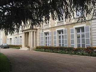
Château-Chinon is a commune in the Nièvre department in France. It is a sub-prefecture of the department.
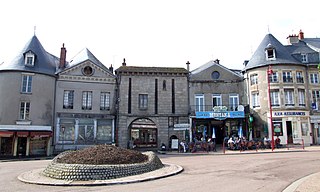
The arrondissement of Chinon is an arrondissement of France in the Indre-et-Loire department in the Centre-Val de Loire region. Since the January 2017 reorganization of the arrondissements of Indre-et-Loire, it has 106 communes.
The arrondissement of Château-Chinon (Ville) is an arrondissement of France in the Nièvre department in the Bourgogne-Franche-Comté region. Since the January 2017 reorganization of the arrondissements of Nièvre, it has 80 communes.
The arrondissement of Clamecy is an arrondissement of France in the Nièvre department in the Bourgogne-Franche-Comté region. Since the January 2017 reorganization of the arrondissements of Nièvre, it has 84 communes.
The following is a list of the 17 cantons of the Nièvre department, in France, following the French canton reorganisation which came into effect in March 2015:
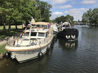
The Canal du Nivernais links the Loire with the Seine following approximately the course of the river Yonne in a south to north direction, first climbing northeast and north to cross the Morvan watershed, then roughly following the course of the river Yonne, south to north. Beginning on the Loire in the village of Saint-Léger-des-Vignes, the canal is situated entirely in the département of Nièvre reaching its half-way point at the town of Clamecy and finishes in the town of Auxerre, situated on the river Yonne.

Morvan Regional Natural Park is a protected area of woodlands, lakes and traditional farmland in the Bourgogne-Franche-Comté region of central France. It covers a total area of 173,000 hectares and extends through four different departments with the majority being in Nièvre. The area was officially designated as a regional natural park in 1970.
The canton of Arnay-le-Duc is an administrative division of the Côte-d'Or department, eastern France. Its borders were modified at the French canton reorganisation which came into effect in March 2015. Its seat is in Arnay-le-Duc.
The canton of Brazey-en-Plaine is an administrative division of the Côte-d'Or department, eastern France. It was created at the French canton reorganisation which came into effect in March 2015. Its seat is in Brazey-en-Plaine.
The canton of Châtillon-sur-Seine is an administrative division of the Côte-d'Or department, eastern France. Its borders were modified at the French canton reorganisation which came into effect in March 2015. Its seat is in Châtillon-sur-Seine.
The canton of Semur-en-Auxois is an administrative division of the Côte-d'Or department, eastern France. Its borders were modified at the French canton reorganisation which came into effect in March 2015. Its seat is in Semur-en-Auxois.
The canton of Château-Renault is an administrative division of the Indre-et-Loire department, central France. Its borders were modified at the French canton reorganisation which came into effect in March 2015. Its seat is in Château-Renault.
The canton of Chinon is an administrative division of the Indre-et-Loire department, central France. Its borders were modified at the French canton reorganisation which came into effect in March 2015. Its seat is in Chinon.
The canton of Argonne Suippe et Vesle is an administrative division of the Marne department, northeastern France. It was created at the French canton reorganisation which came into effect in March 2015. Its seat is in Sainte-Menehould.
The canton of Corbigny is an administrative division of the Nièvre department, central France. Its borders were modified at the French canton reorganisation which came into effect in March 2015. Its seat is in Corbigny.
The canton of Cosne-Cours-sur-Loire is an administrative division of the Nièvre department, central France. It was created at the French canton reorganisation which came into effect in March 2015. Its seat is in Cosne-Cours-sur-Loire.
The canton of Pouilly-sur-Loire is an administrative division of the Nièvre department, central France. Its borders were modified at the French canton reorganisation which came into effect in March 2015. Its seat is in Pouilly-sur-Loire.
The canton of Saint-Pierre-le-Moûtier is an administrative division of the Nièvre department, central France. Its borders were modified at the French canton reorganisation which came into effect in March 2015. Its seat is in Saint-Pierre-le-Moûtier.
The canton of Joux-la-Ville is an administrative division of the Yonne department, central France. It was created at the French canton reorganisation which came into effect in March 2015. Its seat is in Joux-la-Ville.