The arrondissement of Nevers is an arrondissement of France in the Nièvre department in the Bourgogne-Franche-Comté region. Since the January 2017 reorganization of the arrondissements of Nièvre, it has 82 communes.
The following is a list of the 17 cantons of the Nièvre department, in France, following the French canton reorganisation which came into effect in March 2015:

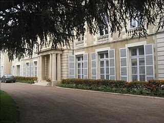
Saint-Pierre-le-Moûtier is a commune in the Nièvre department in central France. It was besieged during the Hundred Years' War.

Toury-Lurcy is a commune in the Nièvre department in central France.
The canton of Voves is an administrative division of the Eure-et-Loir department, northern France. Its borders were modified at the French canton reorganisation which came into effect in March 2015. Its seat is in Les Villages-Vovéens.
The canton of Descartes is an administrative division of the Indre-et-Loire department, central France. Its borders were modified at the French canton reorganisation which came into effect in March 2015. Its seat is in Descartes.
The canton of Pornic is an administrative division of the Loire-Atlantique department, western France. Its borders were modified at the French canton reorganisation which came into effect in March 2015. Its seat is in Pornic.
The canton of La Charité-sur-Loire is an administrative division of the Nièvre department, central France. Its borders were modified at the French canton reorganisation which came into effect in March 2015. Its seat is in La Charité-sur-Loire.
The canton of Clamecy is an administrative division of the Nièvre department, central France. Its borders were modified at the French canton reorganisation which came into effect in March 2015. Its seat is in Clamecy.
The canton of Cosne-Cours-sur-Loire is an administrative division of the Nièvre department, central France. It was created at the French canton reorganisation which came into effect in March 2015. Its seat is in Cosne-Cours-sur-Loire.
The canton of Decize is an administrative division of the Nièvre department, central France. Its borders were modified at the French canton reorganisation which came into effect in March 2015. Its seat is in Decize.
The canton of Fourchambault is an administrative division of the Nièvre department, central France. It was created at the French canton reorganisation which came into effect in March 2015. Its seat is in Fourchambault.
The canton of Imphy is an administrative division of the Nièvre department, central France. Its borders were modified at the French canton reorganisation which came into effect in March 2015. Its seat is in Imphy.
The canton of Luzy is an administrative division of the Nièvre department, central France. Its borders were modified at the French canton reorganisation which came into effect in March 2015. Its seat is in Luzy.
The canton of Nevers-2 is an administrative division of the Nièvre department, central France. It was created at the French canton reorganisation which came into effect in March 2015. Its seat is in Nevers.
The canton of Pouilly-sur-Loire is an administrative division of the Nièvre department, central France. Its borders were modified at the French canton reorganisation which came into effect in March 2015. Its seat is in Pouilly-sur-Loire.
The canton of La Chapelle-de-Guinchay is an administrative division of the Saône-et-Loire department, eastern France. Its borders were modified at the French canton reorganisation which came into effect in March 2015. Its seat is in La Chapelle-de-Guinchay.
The canton of Digoin is an administrative division of the Saône-et-Loire department, eastern France. Its borders were modified at the French canton reorganisation which came into effect in March 2015. Its seat is in Digoin.
The canton of Pierre-de-Bresse is an administrative division of the Saône-et-Loire department, eastern France. Its borders were modified at the French canton reorganisation which came into effect in March 2015. Its seat is in Pierre-de-Bresse.
The canton of Mareuil-sur-Lay-Dissais is an administrative division of the Vendée department, western France. Its borders were modified at the French canton reorganisation which came into effect in March 2015. Its seat is in Mareuil-sur-Lay-Dissais.