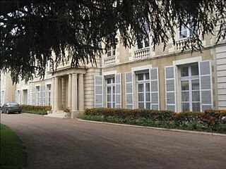
Imphy is a commune in the Nièvre department in Bourgogne, France.

Fourchambault is a commune in the Nièvre department in central France.
The arrondissement of Nevers is an arrondissement of France in the Nièvre department in the Bourgogne-Franche-Comté region. Since the January 2017 reorganization of the arrondissements of Nièvre, it has 82 communes.
The following is a list of the 17 cantons of the Nièvre department, in France, following the French canton reorganisation which came into effect in March 2015:
The canton of Corbigny is an administrative division of the Nièvre department, central France. Its borders were modified at the French canton reorganisation which came into effect in March 2015. Its seat is in Corbigny.
The canton of Guérigny is an administrative division of the Nièvre department, central France. Its borders were modified at the French canton reorganisation which came into effect in March 2015. Its seat is in Guérigny.
The canton of La Charité-sur-Loire is an administrative division of the Nièvre department, central France. Its borders were modified at the French canton reorganisation which came into effect in March 2015. Its seat is in La Charité-sur-Loire.
The canton of Château-Chinon is an administrative division of the Nièvre department, central France. Its borders were modified at the French canton reorganisation which came into effect in March 2015. Its seat is in Château-Chinon (Ville).
The canton of Clamecy is an administrative division of the Nièvre department, central France. Its borders were modified at the French canton reorganisation which came into effect in March 2015. Its seat is in Clamecy.
The canton of Cosne-Cours-sur-Loire is an administrative division of the Nièvre department, central France. It was created at the French canton reorganisation which came into effect in March 2015. Its seat is in Cosne-Cours-sur-Loire.
The canton of Luzy is an administrative division of the Nièvre department, central France. Its borders were modified at the French canton reorganisation which came into effect in March 2015. Its seat is in Luzy.
The canton of Nevers-1 is an administrative division of the Nièvre department, central France. It was created at the French canton reorganisation which came into effect in March 2015. Its seat is in Nevers.
The canton of Nevers-2 is an administrative division of the Nièvre department, central France. It was created at the French canton reorganisation which came into effect in March 2015. Its seat is in Nevers.
The canton of Nevers-3 is an administrative division of the Nièvre department, central France. It was created at the French canton reorganisation which came into effect in March 2015. Its seat is in Nevers.
The canton of Nevers-4 is an administrative division of the Nièvre department, central France. It was created at the French canton reorganisation which came into effect in March 2015. Its seat is in Nevers.
The canton of Pouilly-sur-Loire is an administrative division of the Nièvre department, central France. Its borders were modified at the French canton reorganisation which came into effect in March 2015. Its seat is in Pouilly-sur-Loire.
The canton of Saint-Pierre-le-Moûtier is an administrative division of the Nièvre department, central France. Its borders were modified at the French canton reorganisation which came into effect in March 2015. Its seat is in Saint-Pierre-le-Moûtier.
The canton of Varennes-Vauzelles is an administrative division of the Nièvre department, central France. It was created at the French canton reorganisation which came into effect in March 2015. Its seat is in Varennes-Vauzelles.
Jean Louis Boigues was a French industrialist and politician.

The Société Boigues & Cie was a French ironmaking company based in Fourchambault, Nièvre, founded by a Parisian metal trader. Boigues et fils built a foundry at Fourchambault, Nièvre in 1821–22, the first in France to use the modern English technique of making iron using coal (coke) rather than charcoal. The company became a limited partnership, Société Boigues & Cie, in 1839 after the death of the co-founder Jean Louis Boigues. In 1853 it merged with other companies to form what would be later named the Société de Commentry, Fourchambault et Decazeville