The canton of Trévières is an administrative division of the Calvados département, in northwestern France. Its chief town is Trévières. Its borders were modified at the French canton reorganisation which came into effect in March 2015

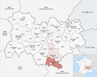
The arrondissement of Die is an arrondissement in the Drôme department in the Auvergne-Rhône-Alpes region of France. Since the January 2017 reorganization of the arrondissements of Drôme, it has 113 communes.

The arrondissement of Nyons is an arrondissement of France in the Drôme department in the Auvergne-Rhône-Alpes region. In 2006 it absorbed the four cantons of Dieulefit, Marsanne, Montélimar-1 and Montélimar-2 from the arrondissement of Valence. Since the January 2017 reorganization of the arrondissements of Drôme, it has 149 communes.

The arrondissement of Valence is an arrondissement of France in the Drôme department in the Auvergne-Rhône-Alpes region. In 2006 the four of its cantons of Dieulefit, Marsanne, Montélimar-1 and Montélimar-2 that previously belonged to the arrondissement of Valence were assigned to the arrondissement of Nyons. Since the January 2017 reorganization of the arrondissements of Drôme, it has 105 communes.
The following is a list of the 19 cantons of the Drôme department, in France, following the French canton reorganisation which came into effect in March 2015:

The A7 Autoroute, also known as l'autoroute du Soleil is a French motorway. It continues the A6 and links Lyon to Marseille. The autoroute du Soleil is 302.5 km (188.0 mi) long and forms part of European routes E15, E80, and E714.
The Canton of Rémuzat is a former canton located in the Department of Drôme, in the Arrondissement of Nyons. The Canton had 1372 inhabitants. It was disbanded following the French canton reorganisation which came into effect in March 2015. It consisted of 16 communes, which joined the canton of Nyons et Baronnies in 2015.
The canton of Tourrette-Levens is an administrative division of the Alpes-Maritimes department, southeastern France. It was created at the French canton reorganisation which came into effect in March 2015. Its seat is in Tourrette-Levens.
The canton of Le Diois is an administrative division of the Drôme department, southeastern France. It was created at the French canton reorganisation which came into effect in March 2015. Its seat is in Die.
The canton of Vercors-Monts du Matin is an administrative division of the Drôme department, southeastern France. It was created at the French canton reorganisation which came into effect in March 2015. Its seat is in Chatuzange-le-Goubet.
The canton of Crest is an administrative division of the Drôme department, southeastern France. It was created at the French canton reorganisation which came into effect in March 2015. Its seat is in Crest.
The canton of Drôme des collines is an administrative division of the Drôme department, southeastern France. It was created at the French canton reorganisation which came into effect in March 2015. Its seat is in Saint-Donat-sur-l'Herbasse.
The canton of Romans-sur-Isère is an administrative division of the Drôme department, southeastern France. It was created at the French canton reorganisation which came into effect in March 2015. Its seat is in Romans-sur-Isère.
The canton of Grignan is an administrative division of the Drôme department, southeastern France. Its borders were modified at the French canton reorganisation which came into effect in March 2015. Its seat is in Grignan.
The canton of Loriol-sur-Drôme is an administrative division of the Drôme department, southeastern France. Its borders were modified at the French canton reorganisation which came into effect in March 2015. Its seat is in Loriol-sur-Drôme.
The canton of Nyons et Baronnies is an administrative division of the Drôme department, southeastern France. It was created at the French canton reorganisation which came into effect in March 2015. Its seat is in Nyons.
The canton of Chartreuse-Guiers is an administrative division of the Isère department, eastern France. It was created at the French canton reorganisation which came into effect in March 2015. Its seat is in Saint-Laurent-du-Pont.
The canton of Luzech is an administrative division of the Lot department, southern France. Its borders were modified at the French canton reorganisation which came into effect in March 2015. Its seat is in Luzech.
The canton of Joinville is an administrative division of the Haute-Marne department, northeastern France. Its borders were modified at the French canton reorganisation which came into effect in March 2015. Its seat is in Joinville.
The canton of Montmédy is an administrative division of the Meuse department, northeastern France. Its borders were modified at the French canton reorganisation which came into effect in March 2015. Its seat is in Montmédy.


