The arrondissement of Nyons is an arrondissement of France in the Drôme department in the Auvergne-Rhône-Alpes region. In 2006 it absorbed the four cantons of Dieulefit, Marsanne, Montélimar-1 and Montélimar-2 from the arrondissement of Valence. Since the January 2017 reorganization of the arrondissements of Drôme, it has 149 communes.

The arrondissement of Valence is an arrondissement of France in the Drôme department in the Auvergne-Rhône-Alpes region. In 2006 the four of its cantons of Dieulefit, Marsanne, Montélimar-1 and Montélimar-2 that previously belonged to the arrondissement of Valence were assigned to the arrondissement of Nyons. Since the January 2017 reorganization of the arrondissements of Drôme, it has 105 communes.
The following is a list of the 19 cantons of the Drôme department, in France, following the French canton reorganisation which came into effect in March 2015:

The canton of Valréas, sometimes called the enclave des Papes, is a canton of the Vaucluse département, a part of the Provence-Alpes-Côte d'Azur (PACA) région in southern France. It consists of 4 communes: Grillon, Richerenches, Valréas and Visan.
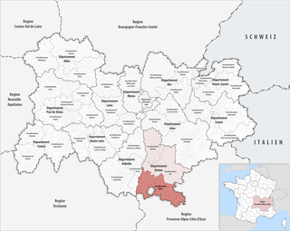
The Canton of Rémuzat is a former canton located in the Department of Drôme, in the Arrondissement of Nyons. The Canton had 1372 inhabitants. It was disbanded following the French canton reorganisation which came into effect in March 2015. It consisted of 16 communes, which joined the canton of Nyons et Baronnies in 2015.
The canton of Tain-l'Hermitage is an administrative division of the Drôme department, southeastern France. Its borders were modified at the French canton reorganisation which came into effect in March 2015. Its seat is in Tain-l'Hermitage.
The canton of Le Diois is an administrative division of the Drôme department, southeastern France. It was created at the French canton reorganisation which came into effect in March 2015. Its seat is in Die.
The canton of Crest is an administrative division of the Drôme department, southeastern France. It was created at the French canton reorganisation which came into effect in March 2015. Its seat is in Crest.
The canton of Dieulefit is an administrative division of the Drôme department, southeastern France. Its borders were modified at the French canton reorganisation which came into effect in March 2015. Its seat is in Dieulefit.
The canton of Grignan is an administrative division of the Drôme department, southeastern France. Its borders were modified at the French canton reorganisation which came into effect in March 2015. Its seat is in Grignan.
The canton of Loriol-sur-Drôme is an administrative division of the Drôme department, southeastern France. Its borders were modified at the French canton reorganisation which came into effect in March 2015. Its seat is in Loriol-sur-Drôme.
The canton of Le Tricastin is an administrative division of the Drôme department, southeastern France. It was created at the French canton reorganisation which came into effect in March 2015. Its seat is in Pierrelatte.
The canton of Montélimar-1 is an administrative division of the Drôme department, southeastern France. Its borders were modified at the French canton reorganisation which came into effect in March 2015. Its seat is in Montélimar.
The canton of Valence-1 is an administrative division of the Drôme department, southeastern France. Its borders were modified at the French canton reorganisation which came into effect in March 2015. Its seat is in Valence.
The canton of Valence-2 is an administrative division of the Drôme department, southeastern France. Its borders were modified at the French canton reorganisation which came into effect in March 2015. Its seat is in Valence.
The canton of Valence-3 is an administrative division of the Drôme department, southeastern France. Its borders were modified at the French canton reorganisation which came into effect in March 2015. Its seat is in Valence.
The canton of Valence-4 is an administrative division of the Drôme department, southeastern France. Its borders were modified at the French canton reorganisation which came into effect in March 2015. Its seat is in Valence.
The canton of Nyons et Baronnies is an administrative division of the Drôme department, southeastern France. It was created at the French canton reorganisation which came into effect in March 2015. Its seat is in Nyons.
The canton of Saint-Vallier is an administrative division of the Drôme department, southeastern France. Its borders were modified at the French canton reorganisation which came into effect in March 2015. Its seat is in Saint-Vallier.

