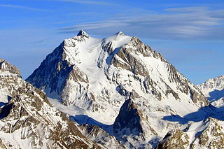
Mont-Blanc[mɔ̃ blɑ̃] was a department of the First French Empire. It was named after Mont Blanc, the highest mountain in Western Europe, which marks the border between France and Piedmont. It was formed in 1792, when the Savoy region, was occupied by the French. The department ceased to exist following Napoleon's defeat at Waterloo; the territory was restored to its former rulers.

The arrondissement of Annecy is an arrondissement of France in the Haute-Savoie department in the Auvergne-Rhône-Alpes region. It has 79 communes. Its population is 282,319 (2016), and its area is 1,261.6 km2 (487.1 sq mi).

The arrondissement of Bonneville is an arrondissement of France in the Haute-Savoie department in the Auvergne-Rhône-Alpes region. It has 60 communes. Its population is 186,945 (2016), and its area is 1,558.2 km2 (601.6 sq mi).

The arrondissement of Thonon-les-Bains is an arrondissement of France in the Haute-Savoie department in the Auvergne-Rhône-Alpes region. It has 68 communes. Its population is 145,809 (2016), and its area is 907.7 km2 (350.5 sq mi).
The following is a list of the 17 cantons of the Haute-Savoie department, in France, following the French canton reorganisation which came into effect in March 2015:

Maurienne is one of the provinces of Savoy, corresponding to the arrondissement of Saint-Jean-de-Maurienne in France. It is also the original name of the capital of the province, now Saint-Jean-de-Maurienne.

The canton of Castellane is an administrative division in southeastern France. At the French canton reorganisation which came into effect in March 2015, the canton was expanded from 7 to 32 communes. Its seat is in Castellane.

The Fier is a 72.2 km (44.9 mi) long river in the Haute-Savoie and Savoie départements, southeastern France. Its source is at Manigod, in the Aravis Range. It flows generally west. It is a left tributary of the Rhône into which it flows at Seyssel.
The Bornes Massif is a mountainous massif in the north French Prealps in the département of Haute-Savoie. It has 20 peaks higher than 2000 m and is a popular destination for winter sports. The Massif is the source of the celebrated cheese Reblochon.
The canton of Annecy-4 is an administrative division in Eastern France. Since the French canton reorganisation which came into effect in March 2015, the communes of the canton of Annecy-4 are:
The canton of Bourg-Saint-Maurice is an administrative division of the Savoie department, southeastern France. Its borders were modified at the French canton reorganisation which came into effect in March 2015. Its seat is in Bourg-Saint-Maurice.
The canton of Modane is an administrative division of the Savoie department, southeastern France. Its borders were modified at the French canton reorganisation which came into effect in March 2015. Its seat is in Modane.
The canton of Saint-Pierre-d'Albigny is an administrative division of the Savoie department, southeastern France. Its borders were modified at the French canton reorganisation which came into effect in March 2015. Its seat is in Saint-Pierre-d'Albigny.
The canton of Annecy-3 is an administrative division of the Haute-Savoie department, southeastern France. Its borders were modified at the French canton reorganisation which came into effect in March 2015. Its seat is in Annecy.
The canton of Bonneville is an administrative division of the Haute-Savoie department, southeastern France. Its borders were modified at the French canton reorganisation which came into effect in March 2015. Its seat is in Bonneville.
The canton of Cluses is an administrative division of the Haute-Savoie department, southeastern France. Its borders were modified at the French canton reorganisation which came into effect in March 2015. Its seat is in Cluses.
The canton of Évian-les-Bains is an administrative division of the Haute-Savoie department, southeastern France. Its borders were modified at the French canton reorganisation which came into effect in March 2015. Its seat is in Évian-les-Bains.
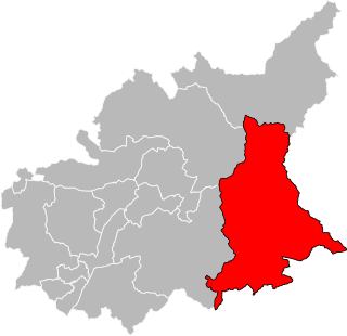
The canton of Le Mont-Blanc is an administrative division of the Haute-Savoie department, southeastern France. It was created at the French canton reorganisation which came into effect in March 2015. Its seat is in Passy.
The canton of La Roche-sur-Foron is an administrative division of the Haute-Savoie department, southeastern France. Its borders were modified at the French canton reorganisation which came into effect in March 2015. Its seat is in La Roche-sur-Foron.
The canton of Rumilly is an administrative division of the Haute-Savoie department, southeastern France. Its borders were modified at the French canton reorganisation which came into effect in March 2015. Its seat is in Rumilly.


