The Vercors Massif is a range in France consisting of rugged plateaux and mountains straddling the départements of Isère and Drôme in the French Prealps. It lies west of the Dauphiné Alps, from which it is separated by the rivers Drac and Isère. The cliffs at the massif's eastern limit face the city of Grenoble.

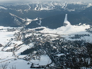
Villard-de-Lans is a commune in the Isère department of the Auvergne-Rhones-Alpes region in southeastern France. The town is also situated in the Vercors Massif. It was the administrative centre of the eponymous canton until the departmental elections of 2015. After the elections, Villard-de-Lans and the communes of its former canton were all incorporated into the new canton of Fontaine-Vercors. The town remains the seat of the Community of Communes in the Vercors Massif (CCMV).

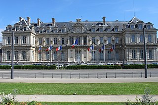
The arrondissement of Grenoble is an arrondissement of France in the Isère department in the Auvergne-Rhône-Alpes region. Since the January 2017 reorganization of the arrondissements of Isère, it has 267 communes.
The following is a list of the 19 cantons of the Drôme department, in France, following the French canton reorganisation which came into effect in March 2015:
The following is a list of the 29 cantons of the Isère department, in France, following the French canton reorganisation which came into effect in March 2015:
Canton of Matheysine-Trièves is a canton of the Isère département, in south-eastern part of France. It was created at the French canton reorganisation which came into effect in March 2015. The seat of the canton is in La Mure. It takes its name from the regions Matheysine and Trièves.

Pont-en-Royans is a commune in the Isère department in southeastern France.
Lans-en-Vercors is a commune in the Isère department in southeastern France.

Autrans is a former commune in the Isère department in the Rhône-Alpes region of south-eastern France. On 1 January 2016, it was merged into the new commune of Autrans-Méaudre-en-Vercors.

Sainte-Eulalie-en-Royans is a French commune in the Drôme department in southeastern the region Auvergne-Rhone-Alpes.
The canton of Moûtiers is an administrative division of the Savoie department, southeastern France. Its borders were modified at the French canton reorganisation which came into effect in March 2015. Its seat is in Moûtiers.
The canton of Vercors-Monts du Matin is an administrative division of the Drôme department, southeastern France. It was created at the French canton reorganisation which came into effect in March 2015. Its seat is in Chatuzange-le-Goubet.
The canton of Chartreuse-Guiers is an administrative division of the Isère department, eastern France. It was created at the French canton reorganisation which came into effect in March 2015. Its seat is in Saint-Laurent-du-Pont.
The canton of Fontaine-Seyssinet is an administrative division of the Isère department, eastern France. Its borders were modified at the French canton reorganisation which came into effect in March 2015. Its seat is in Fontaine.
The canton of Morestel is an administrative division of the Isère department, eastern France. Its borders were modified at the French canton reorganisation which came into effect in March 2015. Its seat is in Morestel.
The canton of Oisans-Romanche is an administrative division of the Isère department, eastern France. It was created at the French canton reorganisation which came into effect in March 2015. Its seat is in Vizille.
The canton of Le Sud Grésivaudan is an administrative division of the Isère department, eastern France. It was created at the French canton reorganisation which came into effect in March 2015. Its seat is in Saint-Marcellin.
The canton of Grenoble-2 is an administrative division of the Isère department, eastern France. Its borders were modified at the French canton reorganisation which came into effect in March 2015. Its seat is in Grenoble.
The canton of Meylan is an administrative division of the Isère department, eastern France. Its borders were modified at the French canton reorganisation which came into effect in March 2015. Its seat is in Meylan.