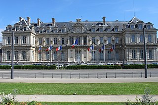
Voiron is a commune in the ninth district of the Isère department in southeastern France. It is the capital of the canton of Voiron and has been part of the Grenoble-Alpes Métropole since 2010. Voiron is located 25 km (16 mi) northwest of Grenoble and 85 km (53 mi) southeast of Lyon. Its roughly 20,000 inhabitants are the Voironnais.
The following is a list of the 29 cantons of the Isère department, in France, following the French canton reorganisation which came into effect in March 2015:
The Communauté d'agglomération du Pays Voironnais is the communauté d'agglomération, an intercommunal structure, centred on the town of Voiron. It is located in the Isère department, in the Auvergne-Rhône-Alpes region, eastern France. It was created in 2000. Its population was 95,268 in 2014, of which 20,775 in Voiron proper.
Canton of Matheysine-Trièves is a canton of the Isère département, in south-eastern part of France. It was created at the French canton reorganisation which came into effect in March 2015. The seat of the canton is in La Mure. It takes its name from the regions Matheysine and Trièves.
The canton of Bourg-Saint-Maurice is an administrative division of the Savoie department, southeastern France. Its borders were modified at the French canton reorganisation which came into effect in March 2015. Its seat is in Bourg-Saint-Maurice.
The canton of Romans-sur-Isère is an administrative division of the Drôme department, southeastern France. It was created at the French canton reorganisation which came into effect in March 2015. Its seat is in Romans-sur-Isère.
The canton of Bièvre is an administrative division of the Isère department, eastern France. It was created at the French canton reorganisation which came into effect in March 2015. Its seat is in La Côte-Saint-André.
The canton of Bourgoin-Jallieu is an administrative division of the Isère department, eastern France. It was created at the French canton reorganisation which came into effect in March 2015. Its seat is in Bourgoin-Jallieu.
The canton of Morestel is an administrative division of the Isère department, eastern France. Its borders were modified at the French canton reorganisation which came into effect in March 2015. Its seat is in Morestel.
The canton of Oisans-Romanche is an administrative division of the Isère department, eastern France. It was created at the French canton reorganisation which came into effect in March 2015. Its seat is in Vizille.
The canton of Le Sud Grésivaudan is an administrative division of the Isère department, eastern France. It was created at the French canton reorganisation which came into effect in March 2015. Its seat is in Saint-Marcellin.
The canton of Charvieu-Chavagneux is an administrative division of the Isère department, eastern France. It was created at the French canton reorganisation which came into effect in March 2015. Its seat is in Charvieu-Chavagneux.
The canton of L'Isle-d'Abeau is an administrative division of the Isère department, eastern France. Its borders were modified at the French canton reorganisation which came into effect in March 2015. Its seat is in L'Isle-d'Abeau.
The canton of Meylan is an administrative division of the Isère department, eastern France. Its borders were modified at the French canton reorganisation which came into effect in March 2015. Its seat is in Meylan.
The canton of Le Moyen Grésivaudan is an administrative division of the Isère department, eastern France. It was created at the French canton reorganisation which came into effect in March 2015. Its seat is in Crolles.
The canton of Roussillon is an administrative division of the Isère department, eastern France. Its borders were modified at the French canton reorganisation which came into effect in March 2015. Its seat is in Roussillon.
The canton of Saint-Martin-d'Hères is an administrative division of the Isère department, eastern France. It was created at the French canton reorganisation which came into effect in March 2015. Its seat is in Saint-Martin-d'Hères.
The canton of La Tour-du-Pin is an administrative division of the Isère department, eastern France. Its borders were modified at the French canton reorganisation which came into effect in March 2015. Its seat is in La Tour-du-Pin.
The canton of Tullins is an administrative division of the Isère department, eastern France. Its borders were modified at the French canton reorganisation which came into effect in March 2015. Its seat is in Tullins.
The canton of La Verpillière is an administrative division of the Isère department, eastern France. Its borders were modified at the French canton reorganisation which came into effect in March 2015. Its seat is in La Verpillière.