The French Alps are the portions of the Alps mountain range that stand within France, located in the Auvergne-Rhône-Alpes and Provence-Alpes-Côte d'Azur regions. While some of the ranges of the French Alps are entirely in France, others, such as the Mont Blanc massif, are shared with Switzerland and Italy.

Écrins National Park is one of the ten French national parks. It is located in the south-eastern part of France in the Dauphiné Alps south of Grenoble and north of Gap, shared between the départements of Isère and Hautes-Alpes.

The arrondissement of Grenoble is an arrondissement of France in the Isère department in the Auvergne-Rhône-Alpes region. Since the January 2017 reorganization of the arrondissements of Isère, it has 267 communes.
The arrondissement of Albertville is an arrondissement of France in the Savoie department in the Auvergne-Rhône-Alpes region. It has 74 communes.
The following is a list of the 29 cantons of the Isère department, in France, following the French canton reorganisation which came into effect in March 2015:
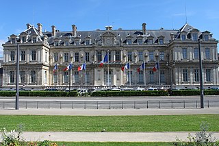
Grenoble-Alpes Métropole is the métropole, an intercommunal structure, centred on the city of Grenoble. It is located in the Isère department, in the Auvergne-Rhône-Alpes region, eastern France. It was created in January 2015, replacing the previous Communauté d'agglomération de Grenoble. Its population was 451,752 in 2014, of which 163,625 in Grenoble proper.
Canton of Matheysine-Trièves is a canton of the Isère département, in south-eastern part of France. It was created at the French canton reorganisation which came into effect in March 2015. The seat of the canton is in La Mure. It takes its name from the regions Matheysine and Trièves.

The Rampe de Laffrey is a section of France's Route nationale 85, today called the Route Napoléon, located in the department of Isère between the communes of Laffrey and Vizille, about fifteen kilometers southeast of Grenoble. It is a steep and mostly relatively straight section of road which ends in a sharp turn, and known for the high number of fatal automobile accidents which have occurred along its route. Four of these, in 1946, 1973, 1975, and 2007, and all affecting buses of pilgrims returning from Notre Dame de la Salette, are counted among the deadliest in French history.

L'Oisans is a region in the French Alps, located in the départements of l'Isère and Hautes-Alpes, and corresponding to the drainage basin of the River Romanche and its tributaries. Between Livet-et-Gavet and Le Bourg-d'Oisans, the Romanche forms a deep gorge.
The Isère-Drac-Romanche Departmental Association is a public administrative establishment in France formed by the Conseil d'État in 1936. Its purpose is to maintain the system of flood-risk protection in the plains of the Isère, Drac, and Romanche rivers by preserving the integrity of embankments and their associated works. The organization performs all research and labor necessary for their preservation and keeps the system under constant surveillance in order to guarantee its efficiency in protecting the land and property at stake behind the embankments.
The canton of Moûtiers is an administrative division of the Savoie department, southeastern France. Its borders were modified at the French canton reorganisation which came into effect in March 2015. Its seat is in Moûtiers.
The canton of Saint-Jean-de-Maurienne is an administrative division of the Savoie department, southeastern France. Its borders were modified at the French canton reorganisation which came into effect in March 2015. Its seat is in Saint-Jean-de-Maurienne.
The canton of Albertville-2 is an administrative division of the Savoie department, southeastern France. It was created at the French canton reorganisation which came into effect in March 2015. Its seat is in Albertville.

The canton of Ugine is an administrative division of the Savoie department, southeastern France. Its borders were modified at the French canton reorganisation which came into effect in March 2015. Its seat is in Ugine.
The canton of Rai is an administrative division of the Orne department, northwestern France. It was created at the French canton reorganisation which came into effect in March 2015. Its seat is in Rai.
The canton of Fontaine-Vercors is an administrative division of the Isère department, eastern France. It was created at the French canton reorganisation which came into effect in March 2015. Its seat is in Fontaine.
The canton of Le Haut-Grésivaudan is an administrative division of the Isère department, eastern France. It was created at the French canton reorganisation which came into effect in March 2015. Its seat is in Pontcharra.
The canton of Le Sud Grésivaudan is an administrative division of the Isère department, eastern France. It was created at the French canton reorganisation which came into effect in March 2015. Its seat is in Saint-Marcellin.
The canton of Le Moyen Grésivaudan is an administrative division of the Isère department, eastern France. It was created at the French canton reorganisation which came into effect in March 2015. Its seat is in Crolles.
The canton of Le Pont-de-Claix is an administrative division of the Isère department, eastern France. It was created at the French canton reorganisation which came into effect in March 2015. Its seat is in Le Pont-de-Claix.