Related Research Articles

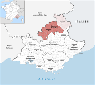
The arrondissement of Gap is an arrondissement of France in the Hautes-Alpes department in the Provence-Alpes-Côte d'Azur region. It has 126 communes. Its population is 105,841 (2016), and its area is 3,410.5 km2 (1,316.8 sq mi).
The following is a list of the 15 cantons of the Hautes-Alpes department, in France, following the French canton reorganisation which came into effect in March 2015:
The Canton of Savines-le-Lac is a former canton in the Arrondissement of Gap in the department of Hautes-Alpes in the region Provence-Alpes-Côte d'Azur in France. It was disbanded following the French canton reorganisation which came into effect in March 2015. It consisted of 6 communes, which joined the canton of Chorges in 2015. It had 1,943 inhabitants (2012). Its main town and commune was Savines-le-Lac and its last representative in the conseil général was Victor Berengue.
The canton of Le Lauzet-Ubaye is a former administrative division in southeastern France. It was disbanded following the French canton reorganisation which came into effect in March 2015. It consisted of 5 communes, which joined the canton of Barcelonnette in 2015. It had 1,335 inhabitants (2012).
The canton of Allos-Colmars is a former administrative division in southeastern France. It was disbanded following the French canton reorganisation which came into effect in March 2015. It consisted of 6 communes, which joined the canton of Castellane in 2015. It had 2,097 inhabitants (2012).
The canton of Digne-les-Bains-Ouest is a former administrative division in southeastern France. It was disbanded following the French canton reorganisation which came into effect in March 2015. It had 12,820 inhabitants (2012).
The canton of La Javie is a former administrative division in southeastern France. It was disbanded following the French canton reorganisation which came into effect in March 2015. It consisted of 6 communes, which joined the canton of Seyne in 2015. It had 1,805 inhabitants (2012).
The canton of Turriers is a former administrative division in southeastern France. It was disbanded following the French canton reorganisation which came into effect in March 2015. It consisted of 7 communes, which joined the canton of Seyne in 2015. It had 1,265 inhabitants (2012).
The canton of Aiguilles is a former administrative division in southeastern France. It was disbanded following the French canton reorganisation which came into effect in March 2015. It consisted of 7 communes, which joined the canton of Guillestre in 2015. It had 2,145 inhabitants (2012).
The canton of Le Monêtier-les-Bains is a former administrative division in southeastern France. It was disbanded following the French canton reorganisation which came into effect in March 2015. It consisted of 3 communes, which joined the new canton of Briançon-1 in 2015. It had 3,606 inhabitants (2012).
The canton of Gap-Campagne is a former administrative division in southeastern France. It was disbanded following the French canton reorganisation which came into effect in March 2015. It had 5,054 inhabitants (2012).
The canton of Gap-Centre is a former administrative division in southeastern France. It was disbanded following the French canton reorganisation which came into effect in March 2015. It had 8,998 inhabitants (2012). The canton comprised part of the commune of Gap.
The canton of Gap-Nord-Est is a former administrative division in southeastern France. It was disbanded following the French canton reorganisation which came into effect in March 2015. It had 7,224 inhabitants (2012). The canton comprised part of the commune of Gap.
The canton of Gap-Sud-Est is a former administrative division in southeastern France. It was disbanded following the French canton reorganisation which came into effect in March 2015. It had 8,806 inhabitants (2012). The canton comprised part of the commune of Gap.
The canton of Gap-Sud-Ouest is a former administrative division in southeastern France. It was disbanded following the French canton reorganisation which came into effect in March 2015. It had 10,096 inhabitants (2012). The canton comprised part of the commune of Gap.
The canton of Orcières is a former administrative division in southeastern France. It was disbanded following the French canton reorganisation which came into effect in March 2015. It consisted of 3 communes, which joined the canton of Saint-Bonnet-en-Champsaur in 2015. It had 1,853 inhabitants (2012).
The canton of Ribiers is a former administrative division in southeastern France. It was disbanded following the French canton reorganisation which came into effect in March 2015. It consisted of 7 communes, which joined the canton of Laragne-Montéglin in 2015. It had 1,795 inhabitants (2012).
The canton of Saint-Firmin is a former administrative division in southeastern France. It was disbanded following the French canton reorganisation which came into effect in March 2015. It consisted of 8 communes, which joined the canton of Saint-Bonnet-en-Champsaur in 2015. It had 1,625 inhabitants (2012).
The canton of Briançon-1 is an administrative division of the Hautes-Alpes department, in southeastern France. It was created at the French canton reorganisation which came into effect in March 2015. Its seat is in Briançon.
The cantons of Gap are administrative divisions of the Hautes-Alpes department, in southeastern France. Since the French canton reorganisation which came into effect in March 2015, the town of Gap is subdivided into 4 cantons. Their seat is in Gap.
References
Coordinates: 44°33′34″N6°04′43″E / 44.55944°N 6.07861°E