Related Research Articles

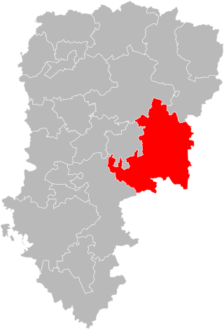
La Grand-Combe is a commune in the Gard department in southern France.

The arrondissement of Alès is an arrondissement of France in the Gard department in the Occitanie region. It has 95 communes. Its population is 153,189 (2021), and its area is 1,273.9 km2 (491.9 sq mi).

The arrondissement of Nîmes is an arrondissement of France in the Gard department in the Occitanie region. It has 181 communes. Its population is 564,024 (2021), and its area is 3,188.3 km2 (1,231.0 sq mi).

The arrondissement of Florac is an arrondissement of France in the Lozère department in the Occitanie région. Its INSEE code is 481 and its capital city is Florac-Trois-Rivières. Its population is 13,028 (2021), and its area is 1,687.5 km2 (651.5 sq mi).
The following is a list of the 23 cantons of the Gard department, in France, following the French canton reorganisation which came into effect in March 2015:

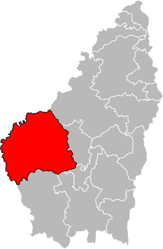
The canton of Le Pilat is a French administrative division located in the department of Loire and the Auvergne-Rhône-Alpes region. At the French canton reorganisation which came into effect in March 2015, the canton was renamed and expanded from 14 to 35 communes:
The canton of Villeneuve-sur-Aisne is an administrative division of the Aisne department, in northern France. It was created at the French canton reorganisation which came into effect in March 2015. Its seat is in Villeneuve-sur-Aisne.
The canton of Lalinde is an administrative division of the Dordogne department, southwestern France. Its borders were modified at the French canton reorganisation which came into effect in March 2015. Its seat is in Lalinde.
The canton of Vallée Dordogne is an administrative division of the Dordogne department, southwestern France. It was created at the French canton reorganisation which came into effect in March 2015. Its seat is in Saint-Cyprien.
The canton of Pays de Montaigne et Gurson is an administrative division of the Dordogne department, southwestern France. It was created at the French canton reorganisation which came into effect in March 2015. Its seat is in Port-Sainte-Foy-et-Ponchapt.
The canton of Haute-Ardèche is an administrative division of the Ardèche department, southern France. Its borders were modified at the French canton reorganisation which came into effect in March 2015. Its seat is in Thueyts.

The canton of Causses-Rougiers is an administrative division of the Aveyron department, southern France. It was created at the French canton reorganisation which came into effect in March 2015. Its seat is in La Cavalerie.

The canton of Monts du Réquistanais is an administrative division of the Aveyron department, southern France. It was created at the French canton reorganisation which came into effect in March 2015. Its seat is in Réquista.

The canton of Villeneuvois et Villefranchois is an administrative division of the Aveyron department, southern France. It was created at the French canton reorganisation which came into effect in March 2015. Its seat is in Villeneuve.
The canton of Roquemaure is an administrative division of the Gard department, southern France. Its borders were modified at the French canton reorganisation which came into effect in March 2015. Its seat is in Roquemaure.
The canton of Uzès is an administrative division of the Gard department, southern France. Its borders were modified at the French canton reorganisation which came into effect in March 2015. Its seat is in Uzès.
The canton of Le Réolais et Les Bastides is an administrative division of the Gironde department, southwestern France. It was created at the French canton reorganisation which came into effect in March 2015. Its seat is in Pineuilh.

The canton of Les Coteaux de Dordogne is a canton of the Gironde department, Southwestern France. It was created at the canton reorganisation that came into effect in March 2015. Its seat is Castillon-la-Bataille. It elects two members of the Departmental Council of Gironde.
The canton of Argonne Suippe et Vesle is an administrative division of the Marne department, northeastern France. It was created at the French canton reorganisation which came into effect in March 2015. Its seat is in Sainte-Menehould.

Alès Agglomération is the communauté d'agglomération, an intercommunal structure, centred on the city of Alès. It is located in the Gard department, in the Occitanie region, southern France. It was created in January 2013 by the merger of the former Communauté d'agglomération du Grand Alès with 3 former communautés de communes and 5 other communes. It was further expanded with 3 other communautés de communes in January 2017. Its seat is in Alès. Its population was 129,157 in 2017, of which 40,219 in Alès proper.
References
| International | |
|---|---|
| National | |
44°13′N4°02′E / 44.21°N 4.03°E
| | This Gard geographical article is a stub. You can help Wikipedia by expanding it. |