[[Le Vigan, Gard|Le Vigan]]"},"government_footnotes":{"wt":""},"leader_party":{"wt":"[[Socialist Party (France)|PS]]"},"leader_title":{"wt":"[[List of presidents of departmental councils (France)|President of the Departmental Council]]"},"leader_name":{"wt":"Françoise Laurent-Perrigot{{cite web|title=Répertoire national des élus: les conseillers départementaux|url=https://www.data.gouv.fr/fr/datasets/r/601ef073-d986-4582-8e1a-ed14dc857fba|website=data.gouv.fr, Plateforme ouverte des données publiques françaises|date=4 May 2022|language=fr}}"},"unit_pref":{"wt":"Metric"},"area_magnitude":{"wt":""},"area_footnotes":{"wt":"{{ref|area|1}}"},"area_total_km2":{"wt":"5853"},"area_note":{"wt":""},"elevation_footnotes":{"wt":""},"elevation_m":{"wt":""},"elevation_min_m":{"wt":""},"elevation_max_m":{"wt":""},"population_total":{"wt":"{{France metadata Wikidata|population_total}}"},"population_as_of":{"wt":"{{France metadata Wikidata|population_as_of}}"},"population_footnotes":{"wt":"{{France metadata Wikidata|population_footnotes2}}"},"population_rank":{"wt":"[[List of French departments by population|32nd]]"},"population_density_km2":{"wt":"auto"},"population_demonym":{"wt":""},"population_note":{"wt":""},"blank_name_sec1":{"wt":"[[Departments of France|Department number]]"},"blank_info_sec1":{"wt":"30"},"blank_name_sec2":{"wt":"[[Arrondissements of France|Arrondissements]]"},"blank_info_sec2":{"wt":"[[arrondissements of the Gard department|3]]"},"blank1_name_sec2":{"wt":"[[Cantons in France|Cantons]]"},"blank1_info_sec2":{"wt":"[[cantons of the Gard department|23]]"},"blank2_name_sec2":{"wt":"[[Communes in France|Communes]]"},"blank2_info_sec2":{"wt":"[[communes of the Gard department|351]]"},"timezone1":{"wt":"[[Central European Time|CET]]"},"utc_offset1":{"wt":"+1"},"timezone1_DST":{"wt":"[[Central European Summer Time|CEST]]"},"utc_offset1_DST":{"wt":"+2"},"postal_code_type":{"wt":""},"postal_code":{"wt":""},"area_code_type":{"wt":""},"area_code":{"wt":""},"iso_code":{"wt":""},"website":{"wt":""},"footnotes":{"wt":"{{note|area|1}} French Land Register data, which exclude [[estuary|estuaries]], and lakes, ponds, and glaciers larger than 1 km2"}},"i":0}}]}" id="mwBg">Department of France in Occitanie
Gard | |
---|---|
From top down, left to right: Pont du Gard, prefecture building in Nîmes, Cévennes and Arena of Nîmes | |
![]() Location of Gard in France | |
Coordinates: 44°7′41″N4°4′54″E / 44.12806°N 4.08167°E | |
Country | France |
Region | Occitanie |
Prefecture | Nîmes |
Subprefectures | Alès Le Vigan |
Government | |
• President of the Departmental Council | Françoise Laurent-Perrigot [1] (PS) |
Area | |
• Total | 5,853 km2 (2,260 sq mi) |
Population (2022) [2] | |
• Total | 764,010 |
• Rank | 32nd |
• Density | 130/km2 (340/sq mi) |
Time zone | UTC+1 (CET) |
• Summer (DST) | UTC+2 (CEST) |
Department number | 30 |
Arrondissements | 3 |
Cantons | 23 |
Communes | 351 |
^1 French Land Register data, which exclude estuaries, and lakes, ponds, and glaciers larger than 1 km2 |
Gard (French pronunciation: [ɡaʁ] ⓘ ) is a department in Southern France, located in the region of Occitanie. It had a population of 748,437 as of 2019; [3] its prefecture is Nîmes.
The department is named after the river Gardon. In recent decades of the 21st century, local administration and French speakers have returned to the original Occitan name of the river, Gard (Occitan pronunciation: [gaɾ] ). It is part of a revival of Occitan culture.
In classical times the Gard area was settled by Romans and their allies. They built the Via Domitia across the region in 118 BC. Centuries later, on 4 March 1790, Gard was one of the original 83 departments created during the French Revolution. It comprised the ancient province of Languedoc.
Originally this department was to include the canton of Ganges, but Ganges was transferred to the neighbouring department of Hérault. In return, Gard was assigned the fishing port of Aigues Mortes, which gave the department its own outlet to the Gulf of Lion on the Mediterranean Sea.
During the middle of the nineteenth century the prefecture, traditionally a centre of commerce with a manufacturing sector focused on textiles, was an early beneficiary of railway development, becoming an important railway junction. Several luxurious hotels were built, and the improved market access provided by the railways also encouraged, initially, a rapid growth in wine growing. But many winegrowers were ruined when the vineyards were infected with phylloxera in 1872.
Gard is part of the region of Occitanie and is surrounded by the departments of Hérault, Lozère, Aveyron, Bouches-du-Rhône, Vaucluse and Ardèche. It has a short coastline to the south on the Mediterranean Sea. The highest point in the department is Mont Aigoual.
In the first quarter of the 21st century, the department has suffered serious flooding. The region has also been subject to some of the highest recorded temperatures in France's history as climate change alters summer heat. [4]
Population development since 1791:
|
| |||||||||||||||||||||||||||||||||||||||||||||||||||||||||||||||||||||||||||||||||||||||
| ||||||||||||||||||||||||||||||||||||||||||||||||||||||||||||||||||||||||||||||||||||||||
source: [5] [6] |
The inhabitants of Gard are called "Gardois". The most populous commune is Nîmes, the prefecture. As of 2019, there are eight communes that have more than 10,000 inhabitants each: [3]
Commune | Population (2019) |
---|---|
Nîmes | 148,561 |
Alès | 41,837 |
Bagnols-sur-Cèze | 18,091 |
Beaucaire | 15,906 |
Saint-Gilles | 13,931 |
Villeneuve-lès-Avignon | 12,216 |
Vauvert | 11,492 |
Pont-Saint-Esprit | 10,369 |
In the closely contested first round of the 2012 presidential election, Gard was the only department to vote for the National Front candidate Marine Le Pen by a slim plurality, with 25.51% of the vote. The incumbent President Nicolas Sarkozy of the Union for a Popular Movement party received 24.86% of the vote, while Socialist candidate François Hollande received 24.11% of the vote share. [7]
The President of the Departmental Council has been Françoise Laurent-Perrigot of the Socialist Party (PS) since 2021.
Party | Seats | |
---|---|---|
The Republicans (LR) | 12 | |
• | Socialist Party (PS) | 10 |
Union of Democrats and Independents (UDI) | 7 | |
• | French Communist Party (PCF) | 6 |
• | Miscellaneous left (DVG) | 4 |
National Rally (FN) | 4 | |
• | Europe Ecology – The Greens (EELV) | 2 |
Miscellaneous right (DVD) | 1 |
In the 2022 legislative election, Gard elected the following representatives to the National Assembly:
Gard contains a part of the Cévennes National Park. There are important Roman architectural remains in Nîmes, as well as the famous Roman aqueduct, the Pont du Gard.
Gard is also home to the source of Perrier, a carbonated mineral water sold both in France and internationally on a large scale. The spring and facility are located just south-east of the commune of Vergèze.
Lozère is a landlocked department in the region of Occitanie in Southern France, located near the Massif Central, bounded to the northeast by Haute-Loire, to the east by Ardèche, to the south by Gard, to the west by Aveyron, and the northwest by Cantal. It is named after Mont Lozère. With 76,604 inhabitants as of 2019, Lozère is the least populous French department.
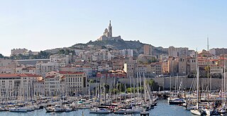
Bouches-du-Rhône is a department in southern France. It borders Vaucluse to the north, Gard to the west and Var to the east. The Mediterranean Sea lies to the south. Its prefecture and largest city is Marseille; other important cities include Aix-en-Provence, Arles, Martigues and Aubagne.
Aude is a department in Southern France, located in the Occitanie region and named after the river Aude. The departmental council also calls it "Cathar Country" after a group of religious dissidents active in the 12th to 14th centuries.
Tarn is a department in the Occitania region in Southern France. Named after the river Tarn, it had a population of 389,844 as of 2019. Its prefecture and largest city is Albi; it has a single subprefecture, Castres. In French, the inhabitants of Tarn are known as Tarnais (masculine) and Tarnaises (feminine). Its INSEE and postcode number is 81.
Hérault is a department of the region of Occitania, Southern France. Named after the Hérault River, its prefecture is Montpellier. It had a population of 1,175,623 in 2019.
Lot is a department in the Occitanie region of France. Named after the Lot River, it lies in the southwestern part of the country and had a population of 174,094 in 2019. Its prefecture is Cahors; its subprefectures are Figeac and Gourdon.
Nîmes is the prefecture of the Gard department in the Occitanie region of Southern France. Located between the Mediterranean Sea and the Cévennes, the commune of Nîmes had an estimated population of 148,561 in 2019.
Beaucaire is a commune in the Gard department in the Occitanie region of Southern France.
Villeneuve-lès-Maguelone is a commune in the Hérault department in the Occitanie region in Southern France. Villeneuve-lès-Maguelone station has rail connections to Narbonne, Montpellier and Avignon.
The arrondissement of Nîmes is an arrondissement of France in the Gard department in the Occitanie region. It has 181 communes. Its population is 564,024 (2021), and its area is 3,188.3 km2 (1,231.0 sq mi).
The arrondissement of Le Vigan is an arrondissement of France in the Gard department in the Occitanie region. It has 74 communes. Its population is 39,330 (2021), and its area is 1,390.6 km2 (536.9 sq mi).
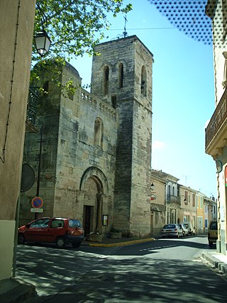
Villetelle is a commune in the Hérault department in the Occitanie region in southern France.
Aniane is a commune in the Hérault department in the Occitanie region in southern France.
Saint-Thibéry is a commune in the Hérault département in the Occitanie region in southern France.
Le Grau-du-Roi is a commune in the Gard department in southern France. It is the only commune in Gard to have a frontage on the Mediterranean. To the west is the Herault department and La Grande-Motte village, and to the east is the Bouches-du-Rhone department. Using the sea as a vantage point, the commune has four distinct sections: the right beach, the Village, the left beach, Port-Camargue and L'Espiguette. Immediately landwards are the large shallow étangs, saline marshes, which separate it from Aigues Mortes, a neighboring mediaeval walled city that used to be a port. The étangs are home to numerous flamingoes.
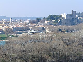
Le Cailar is a commune in the Gard department in southern France. It is located at the confluence of the River Vistre and the River Rhôny. It was an important port during the Iron Age at a time when lagoons connected to the Mediterranean Sea covered the adjoining low-lying land.
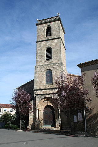
Alignan-du-Vent is a commune in the Hérault department in the Occitanie region in southern France.
Saint-Bauzille-de-la-Sylve is a commune in the Hérault department in the Occitanie region in southern France.
Quarante is a commune in the Hérault department in the Occitanie region in southern France. Quarante is a hilltop medieval village from the Gallo-Roman era, just 1 km from the famous 17th century Canal du Midi, 8 km from Capestang, 25 km from Béziers, and 35 km from the Mediterranean Sea. The closest train station and regional airport is in Béziers, and 59 km to the north is the city of Carcassonne, famous for its medieval walled citadel. International airports within an hour are; Carcassonne, Perpignan, Montpellier, and with Toulouse being two hours away.
Lattes is a commune in the Hérault département in the Occitanie region in southern France, located just on the outskirts of Montpellier.