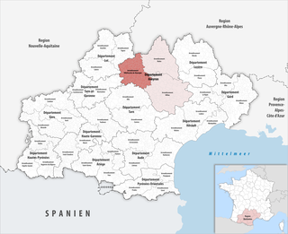
The arrondissement of Villefranche-de-Rouergue is an arrondissement of France in the Aveyron department in the Occitanie region. It has 96 communes. Its population is 88,171 (2016), and its area is 2,123.7 km2 (820.0 sq mi).

The arrondissement of Figeac is an arrondissement of France in the Lot department in the Occitanie region. It has 118 communes. Its population is 54,566 (2016), and its area is 1,593.3 km2 (615.2 sq mi).

Capdenac-Gare is a commune in the Aveyron department in southern France. The old village of Capdenac is directly west of Capdenac-Gare, across the river Lot. In the southern outskirts of Capdenac-Gare is the area of Massip.

The canton of Gramat is a canton in France. Since the French canton reorganisation which came into effect in March 2015, the communes of the canton of Gramat are:

Asprières is a commune in the Aveyron department in the Occitanie region of southern France.
Balaguier-d'Olt is a commune in the Aveyron department in the Occitanie region of southern France.
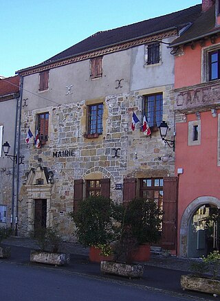
Capdenac is a commune in the Lot department in south-western France.
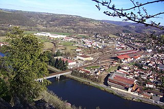
Capdenac is a railway station in Capdenac-Gare, Occitanie, France. The station opened in 1858 and is on the Brive–Toulouse, Capdenac–Rodez and Cahors–Capdenac railway lines. The station is served by Intercités de nuit and TER (local) services operated by SNCF.
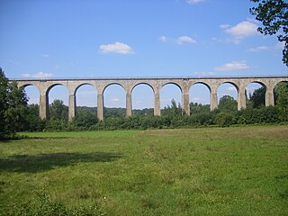
The Brive-la-Gaillarde - Toulouse railway is a 248-kilometre French railway line that connects the rural areas between Brive-la-Gaillarde and the large southern city of Toulouse via Figeac and Capdenac. The railway was opened in several stages between 1858 and 1864.

Lexos is a railway station in Varen, Tarn-et-Garonne, Occitanie, France. It is on the Brive-Toulouse line and is served by TER (local) services operated by SNCF. A former Montauban branch line also terminated here.

The canton of Les Cévennes ardéchoises is an administrative division of the Ardèche department, southern France. Its borders were modified at the French canton reorganisation which came into effect in March 2015. Its seat is in Les Vans.

The canton of Aubrac et Carladez is an administrative division of the Aveyron department, southern France. It was created at the French canton reorganisation which came into effect in March 2015. Its seat is in Laguiole.

The canton of Aveyron et Tarn is an administrative division of the Aveyron department, southern France. It was created at the French canton reorganisation which came into effect in March 2015. Its seat is in Rieupeyroux.

The canton of Lot et Dourdou is an administrative division of the Aveyron department, southern France. It was created at the French canton reorganisation which came into effect in March 2015. Its seat is in Decazeville.

The canton of Lot et Palanges is an administrative division of the Aveyron department, southern France. It was created at the French canton reorganisation which came into effect in March 2015. Its seat is in Saint-Geniez-d'Olt-et-d'Aubrac.

The canton of Causses-Rougiers is an administrative division of the Aveyron department, southern France. It was created at the French canton reorganisation which came into effect in March 2015. Its seat is in La Cavalerie.

The canton of Enne et Alzou is an administrative division of the Aveyron department, southern France. It was created at the French canton reorganisation which came into effect in March 2015. Its seat is in Aubin.
The canton of Alès-1 is an administrative division of the Gard department, southern France. It was created at the French canton reorganisation which came into effect in March 2015. Its seat is in Alès.
The canton of Alès-2 is an administrative division of the Gard department, southern France. It was created at the French canton reorganisation which came into effect in March 2015. Its seat is in Alès.
The canton of Figeac-1 is an administrative division of the Lot department, southern France. It was created at the French canton reorganisation which came into effect in March 2015. Its seat is in Figeac.
