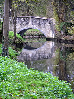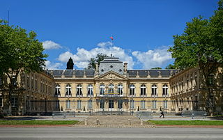
Mantes-la-Jolie is a commune based in the Yvelines department in the Île-de-France region in north-central France. It is located to the west of Paris, 48.4 km (30.1 mi) from the centre of the capital. Mantes-la-Jolie is a subprefecture of the department.

Mantes-la-Ville is a commune in the Yvelines department in the Île-de-France region in north-central France. It is located in the western suburbs of Paris 48.6 km (30.2 mi) from the center.

The arrondissement of Mantes-la-Jolie is an arrondissement of France in the Yvelines department in the Île-de-France region. Since the January 2017 reorganization of the arrondissements of Yvelines, it has 110 communes.
The following is a list of the 21 cantons of the Yvelines department, in France, following the French canton reorganisation which came into effect in March 2015:
GR 11 is a long-distance footpath in the Île-de-France region of France. It is part of an extensive national network of rural hiking trails. It follows a circular route around Paris, going through the départements of Val d'Oise, Seine-et-Marne, Essonne and Yvelines. Towns passed through include Chantilly, Senlis, Fontainebleau, Provins, Mantes-la-Jolie and Chevreuse. The circle is much wider than that followed by the GR 1, which also rings Paris.

Mantes-la-Jolie is a railway station serving the town Mantes-la-Jolie, Yvelines department, northwestern France. It is situated on the Paris–Le Havre railway at the point where the line to Caen and Cherbourg diverges.
The Communauté d'agglomération de Mantes-en-Yvelines is a former administrative entity in the Yvelines département, near Paris. Administrative center: Magnanville. It was merged into the Communauté urbaine Grand Paris Seine et Oise in January 2016.

The 8th constituency of Yvelines is a French legislative constituency in the Yvelines département.
The University Institute of Technology of Mantes en Yvelines is one of the French University Institutes of Technology.
The canton of Aubergenville is an administrative division of the Yvelines department, northern France. Its borders were modified at the French canton reorganisation which came into effect in March 2015. Its seat is in Aubergenville.
The canton of Bonnières-sur-Seine is an administrative division of the Yvelines department, northern France. Its borders were modified at the French canton reorganisation which came into effect in March 2015. Its seat is in Bonnières-sur-Seine.
The canton of Le Chesnay is an administrative division of the Yvelines department, northern France. Its borders were modified at the French canton reorganisation which came into effect in March 2015. Its seat is in Le Chesnay.
The canton of Limay is an administrative division of the Yvelines department, northern France. Its borders were modified at the French canton reorganisation which came into effect in March 2015. Its seat is in Limay.
The canton of Maurepas is an administrative division of the Yvelines department, northern France. Its borders were modified at the French canton reorganisation which came into effect in March 2015. Its seat is in Maurepas.
The canton of Les Mureaux is an administrative division of the Yvelines department, northern France. It was created at the French canton reorganisation which came into effect in March 2015. Its seat is in Les Mureaux.
The canton of Rambouillet is an administrative division of the Yvelines department, northern France. Its borders were modified at the French canton reorganisation which came into effect in March 2015. Its seat is in Rambouillet.
The canton of Trappes is an administrative division of the Yvelines department, northern France. Its borders were modified at the French canton reorganisation which came into effect in March 2015. Its seat is in Trappes.
The canton of Verneuil-sur-Seine is an administrative division of the Yvelines department, northern France. It was created at the French canton reorganisation which came into effect in March 2015. Its seat is in Verneuil-sur-Seine.
The Communauté urbaine Grand Paris Seine et Oise is the communauté urbaine, an intercommunal structure, covering the western suburbs of Paris. It is located in the Yvelines department, in the Île-de-France region, northern France. It was created in January 2016 by the merger of the previous communautés d'agglomération Mantes-en-Yvelines, Deux Rives de la Seine, Poissy-Achères-Conflans-Sainte-Honorine, Seine & Vexin and the communautés de communes Coteaux du Vexin and Seine-Mauldre. Its population was 411,100 in 2014. Its seat is in Aubergenville.


