
The Aluku are a Bushinengue ethnic group living mainly on the riverbank in Maripasoula in southwest French Guiana. The group are sometimes called Boni, referring to the 18th-century leader, Bokilifu Boni.

The arrondissement of Cayenne is an arrondissement of France in French Guiana department in French Guiana region. It has 10 communes. Its population is 181,520 (2020), and its area is 17,029 km2 (6,575 sq mi). It is the smallest of the three arrondissements in French Guiana, but also its most populated.
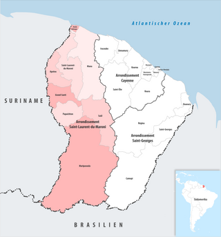
The arrondissement of Saint-Laurent-du-Maroni is an arrondissement of France in French Guiana department in French Guiana region. It has eight communes. Its population is 100,954 (2022), and its area is 40,945 km2 (15,809 sq mi).

Apatou is a commune in French Guiana, an overseas region and department of France in South America. Apatou is home to Maroons of the Aluku, Paramacca, Ndyuka, and Saramaka tribes.

Maripasoula, previously named Upper Maroni, is a commune of French Guiana, an overseas region and department of France located in South America. With a land area of 18,360 km2 (7,090 sq mi), Maripasoula is the largest commune of France. The commune is slightly larger than the country of Kuwait or the U.S. state of New Jersey.

Papaichton is a commune in the overseas region and department of French Guiana. The village lies on the shores of the Lawa River. Papaichton is served by the Maripasoula Airport.

French Guiana is an overseas department of France located on the northern coast of South America in the Guianas. Bordered by Suriname to the west and Brazil to the east and south, French Guiana covers a land area of 83,534 km2 (32,253 sq mi), and is inhabited by 301,099 people.

Guiana Amazonian Park is the largest national park of France, aiming at protecting part of the Amazonian forest located in French Guiana which covers 41% of the region. It is the largest park in France as well as the largest park in the European Union and one of the largest national parks in the world.

Maripasoula Airport is an airport 3.5 km (1.9 NM) north of Maripasoula, a commune in the arrondissement of Saint-Laurent-du-Maroni in French Guiana. It is near the Lawa River, which forms the border between French Guiana and Suriname.

The canton of Sinnamary is one of the former cantons of the Guyane department in French Guiana. It was located in the arrondissement of Cayenne. The canton consisted of two communes and its seat was located in Sinnamary. Its population was 3,373 in 2012.

The canton of Saint-Laurent-du-Maroni is one of the former cantons of the Guyane department in French Guiana. It was located in the arrondissement of Saint-Laurent-du-Maroni. Its administrative seat was located in Saint-Laurent-du-Maroni, the canton's sole commune. Its population was 40,597 in 2012.
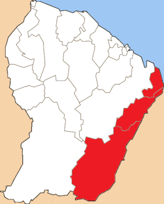
The canton of Saint-Georges-de-l'Oyapock is one of the former cantons of the Guyane department in French Guiana. It was located in the arrondissement of Cayenne, and consisted of three communes. Its administrative seat was located in Saint-Georges. Its population was 5,644 in 2012.
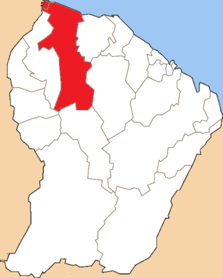
The canton of Mana is one of the former cantons of the Guyane department in French Guiana. It was located in the arrondissement of Saint-Laurent-du-Maroni, and consisted of two communes. Its administrative seat was located in Mana. Its population was 10,661 in 2012.

The canton of Matoury is one of the former cantons of the Guyane department in French Guiana. It was located in the arrondissement of Cayenne. Its administrative seat was located in Matoury, the canton's sole commune. Its population was 29,712 in 2012.
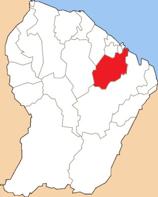
The canton of Roura is one of the former cantons of the Guyane department in French Guiana. It was located in the arrondissement of Cayenne. Its administrative seat was located in Roura, the canton's sole commune. Its population was 3,050 in 2012.

The canton of Macouria is one of the former cantons of the Guyane department in French Guiana. It was located in the arrondissement of Cayenne. Its administrative seat was located in Macouria, the canton's sole commune. Its population was 10,358 in 2012.
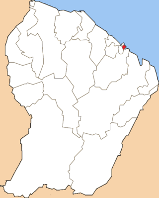
The canton of Remire-Montjoly is one of the former cantons of the Guyane department in French Guiana. It was located in the arrondissement of Cayenne. Its administrative seat was located in Remire-Montjoly, the canton's sole commune. Its population was 20,689 in 2012.
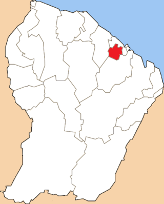
The canton of Montsinéry-Tonnegrande is one of the former cantons of the Guyane department in French Guiana. It was located in the arrondissement of Cayenne. Its administrative seat was located in Montsinéry-Tonnegrande, the canton's sole commune. Its population was 2,483 in 2012.
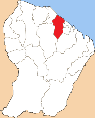
The canton of Kourou is one of the former cantons of the Guyane department in French Guiana. It was located in the arrondissement of Cayenne. Its administrative seat was located in Kourou, the canton's sole commune. Its population was 25,490 in 2012.

The Communauté de communes de l'Ouest guyanais (CCOG) is a communauté de communes, an intercommunal structure in the French département d'outre-mer of French Guiana. It was created in 1995, and its seat is Mana. Its area is 40,945 km2, and its population was 94,677 in 2018.


