Cayenne is the prefecture of French Guiana, an overseas region and department of France located in South America. The city stands on a former island at the mouth of the Cayenne River on the Atlantic coast. The city's motto is "fert aurum industria", which means "work brings wealth". Cayenne is the largest Francophone city of the South American continent.

The Aluku are a Bushinengue ethnic group living mainly on the riverbank in Maripasoula in southwest French Guiana. The group are sometimes called Boni, referring to the 18th-century leader, Bokilifu Boni.
The Music of French Guiana is a very rich and varied music of several styles and cultures coming from Europe, Africa and the Americas by the Amerindians due to its history and its multi-ethnic diversity.

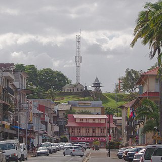
Saint-Laurent-du-Maroni is a commune of French Guiana, an overseas region and department of France located in South America. Saint-Laurent-du-Maroni is one of the three sub-prefectures of French Guiana and the seat of the Arrondissement of Saint-Laurent-du-Maroni. It is the second most populous city of French Guiana, with 50,250 inhabitants at the January 2021 census.

Saint-Georges is a commune of French Guiana, an overseas region and department of France located in South America. It lies on the Oyapock River, opposite the Brazilian town of Oiapoque. The town contains a town hall, a French Foreign Legion detachment, and some hotels. Saint-Georges has been one of the three sub-prefectures of French Guiana and the seat of the Arrondissement of Saint-Georges since October 2022.

Régina is a commune of French Guiana, an overseas region and department of France located in South America. With a land area of 12,130 km2 (4,680 sq mi), it is the second-largest commune of France. The town is named after the first merchant who settled in the area.

Iracoubo is a commune on the coast of French Guiana, an overseas region and department of France, located in South America.
The Guianese Socialist Party is a socialist political party in the French overseas région of French Guiana, in South America.
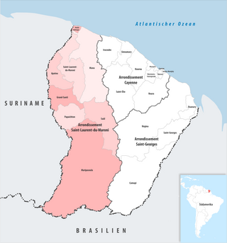
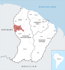
The arrondissement of Saint-Laurent-du-Maroni is an arrondissement of France in French Guiana department in French Guiana region. It has eight communes. Its population is 100,954 (2022), and its area is 40,945 km2 (15,809 sq mi).

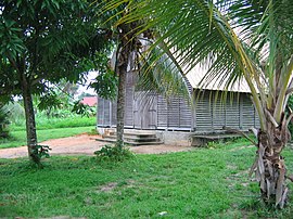
Apatou is a commune in French Guiana, an overseas region and department of France in South America. Apatou is home to Maroons of the Aluku, Paramacca, Ndyuka, and Saramaka tribes.

Mana is a commune and town in French Guiana. It was founded on 16 August 1828 by Sister Anne-Marie Javouhey. It borders the river Mana, from where it gets its name; and is nearby the river Maroni. Mana is the primary producer of rice in French Guiana, which it exports to Suriname.

Maripasoula, previously named Upper Maroni, is a commune of French Guiana, an overseas region and department of France located in South America. With a land area of 18,360 km2 (7,090 sq mi), Maripasoula is the largest commune of France. The commune is slightly larger than the country of Kuwait or the U.S. state of New Jersey.

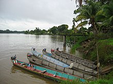
Papaichton is a commune in the overseas region and department of French Guiana. The village lies on the shores of the Lawa River. Papaichton is served by the Maripasoula Airport.
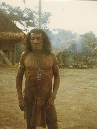
The Wayana are a Carib-speaking people located in the southeastern part of the Guiana highlands, a region divided between Brazil, Suriname, and French Guiana. In 1980, when the last census took place, the Wayana numbered some 1,500 individuals, of which 150 in Brazil, among the Apalai, 400 in Suriname, and 1,000 in French Guiana, along the Maroni River. About half of them still speak their original language.

Articles related to the French overseas department of Guiana(Région Guyane) include:

French Guiana is an overseas department and region of France located on the northern coast of South America in the Guianas and the West Indies. Bordered by Suriname to the west and Brazil to the east and south, French Guiana covers a total area of 84,000 km2 (32,000 sq mi) and a land area of 83,534 km2 (32,253 sq mi), and is inhabited by 295,385 people.

Guiana Amazonian Park is the largest national park of France, aiming at protecting part of the Amazonian forest located in French Guiana which covers 41% of the region. It is the largest park in France as well as the largest park in the European Union and one of the largest national parks in the world.
The COVID-19 pandemic was confirmed to have reached the French overseas department and region of French Guiana. The first five cases were found on 4 March and the first death was announced on 20 April 2020. On 30 April, the territory was green listed, because the pandemic appeared to be under control except for Saint-Georges. In June, the virus started circulating all over the territory.

The canton of Maripasoula is one of the former cantons of the Guyane department in French Guiana. It was located in the arrondissement of Saint-Laurent-du-Maroni and consisted of five communes. Its administrative seat was located in Maripasoula. Its population was 29,504 in 2012.

The Communauté de communes de l'Ouest guyanais (CCOG) is a communauté de communes, an intercommunal structure in the French département d'outre-mer of French Guiana. It was created in 1995, and its seat is Mana. Its area is 40,945 km2, and its population was 94,677 in 2018.